Webster Tornado: How It Happened
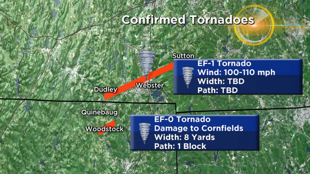
BOSTON (CBS) - The third confirmed tornado in Worcester County in just the past couple of weeks touched down Saturday morning in Webster. The National Weather Service has determined two tornadoes touched down in southern New England, including one that tracked from Dudley to Webster. This tornado has been rated an EF-1 tornado with winds up to 110 miles per hour. A smaller, shorter-lived tornado touched down in the northeastern Connecticut town of Woodstock. This was rated an EF-0 tornado.
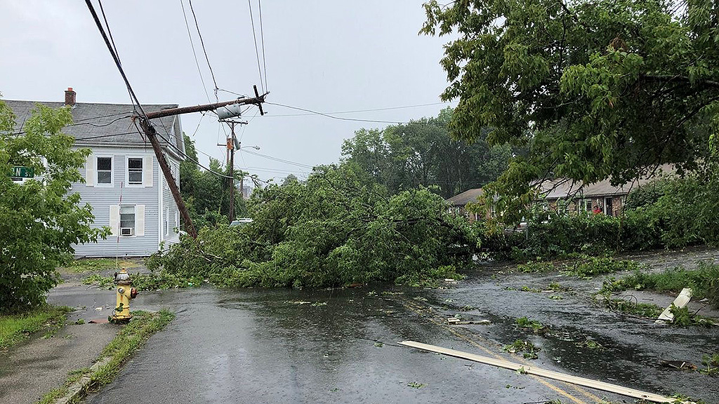
Photos: Webster Tornado Damage
The tornado formed from a storm that quickly spun up in northeastern Connecticut just after 9 a.m. Saturday. In the vicinity of Quinebaug, rotation began to clearly show up on radar. At that time, the NWS issued a Severe Thunderstorm Warning that included southern Worcester County. Shortly thereafter, at around 9:40 a.m., rotation increased and the warning was upgraded to a Tornado Warning which included the towns of Dudley and Webster.
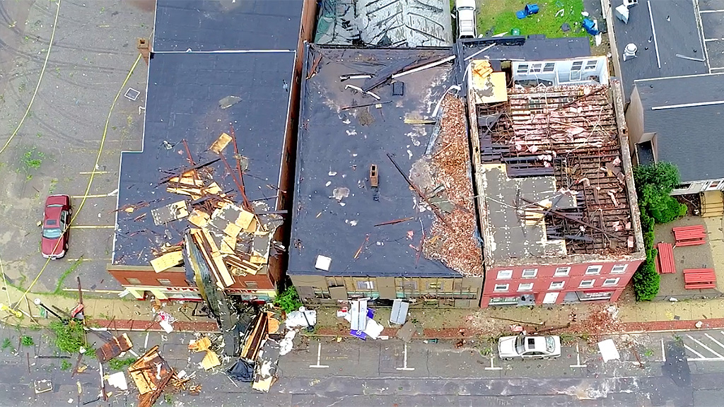
As the storm tracked northeast, it's possible that there were several tornado touchdowns or a 'skipping' tornado as the rotation increased and decreased over time. The NWS will be deciding where exactly it was on the ground and how continuous the path was. Damage has been reported in the towns of Woodstock, Connecticut, Dudley, and Webster where structural damage was most significant. It's also possible that there was more damage in the forested areas of northeast Connecticut, which could take a little more time to get to.
The storm weakened after leaving Webster and tracked toward Sutton.
The setup on Saturday was very similar to the Douglas and Upton tornadoes just a week ago. The risk was highlighted on WBZ-TV News the day before, as spin-up tornadoes were a concern. A 'mesolow' formed and tracked across the area, which is a small scale area of low pressure (as opposed to a large storm, like a nor'easter). These small waves of low pressure can increase wind shear, which is a key tornado ingredient. So even without the heating of the day or a typical thunderstorm setup, you can tap that shear and spin-up a quick but potent tornado. We saw it last week, and now again in almost the exact same area!

The risk for tornadic storms is decreasing now and calmer weather is expected for Sunday into the start of next week.
WATCH: Raw Aerial Drone Video Of Tornado Damage


