Biggest Snow Storm Of Season Will Affect Several Commutes
BOSTON (CBS) - This is the real deal.
For the first time this winter, on the last day of February and first day of March, we are in for a legitimate snow storm here in southern New England.
Check: Current Conditions | Weather Map Center | Interactive Radar | Traffic | Closings
You didn't actually think we were going to make it through the entire winter without one did you?
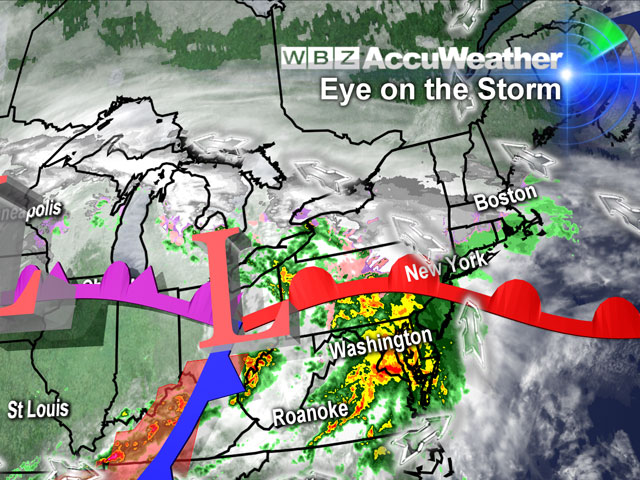
This will be a long duration event, unlike anything we have seen in New England for well over a year.
It will come in waves, three of them to be exact.
Just when you think it is safe to go out and clean your driveway, another wave of snow will come.
In the end, we are looking at more than 30 hours of snow in many areas.
Now, of course, if it were going to snow steady and hard for the entire time we would be talking about an historic snowstorm for our area.
Thankfully, that is not the case.
There will be times of lighter precipitation in between waves and also a rain-snow line to contend with.
So now for the details:
WAVE #1
This will arrive this afternoon, around 1-2 p.m. in Worcester and to the Coast by 3-4 p.m.
This will be a steady, light to moderate snow for just about every location in southern New England.
It could start briefly as rain or a mix along the immediate coastline, but as the precipitation gets heavier it will change to all snow everywhere.
This first wave will taper to light snow flurries and snow showers before midnight after having dropped a widespread 1-3 inches.
A few spots of higher amounts may be found in elevated areas in central Massachusetts.
The rain-snow line will also start to edge northward this evening.
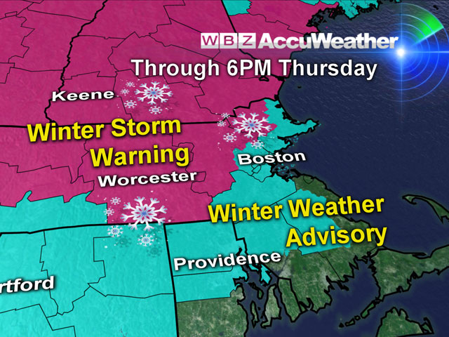
How far north this line gets is crucial to final snowfall totals. Right now, it looks like it may get just about to the Rhode Island-Massachusetts border and as far north as Boston's immediate South Shore.
That would leave all locations from Boston north and west in the snow belt for the entire duration of the event.
WAVE #2
This will arrive after midnight and last through the morning commute on Thursday.
This could wind up being the most significant and troublesome portion of this storm.
Heavy snow will fall from Boston to Worcester and all points north and west, potentially at rates of up to an inch an hour.
This will make commuting in the morning treacherous and likely cause numerous school delays and cancellations.
This wave of snow will likely be the heaviest snow maker of the three, dropping 3-6 inches over the entire area by mid-to-late Thursday morning.
WAVE #3
This comes as a final burst of snow late Thursday afternoon and evening; just when you thought it was over.
An additional 1-3 inches is possible with this burst, not completely tapering until just before midnight.
The areas in southeastern Massachusetts that were seeing rain will likely change back over to snow as colder air is drawn in with this final burst.
Watch Todd Gutner's forecast:
FINAL SNOW TOTAL FORECAST:
0 – 1 inch of slush over most of Cape Cod and the Islands
1 – 3 inches of wet snow along the South Shore, Plymouth and Bristol Counties
3 – 6 inches for most of Norfolk County and areas just south of Boston, also along the coastline in Boston and immediate North Shore
6 – 10 inches for most of Boston's nearby northern and western suburbs, and all communities through 128 and 495.
The higher end of these totals are likely in northern Worcester County and southern New Hampshire.
It is possible that some of these areas could reach a foot or a bit higher.
You can follow Terry on Twitter at @TerryWBZ.


