Heat Wave Temperatures Could Approach 100 Degrees Tuesday, Wednesday
BOSTON (CBS) - So how you feelin' about this summer? Had enough? Ready for fall? Or maybe you are one of those that can never get enough heat and humidity? Well, the kids may be going back to school and the pumpkin beer and pumpkin spice lattes may be arriving BUT I am here to spread the news that summer is FAR from over.
Yet another scorching hot and oppressively humid week is on the way for our last week of meteorological summer (June-July-August).
This has been one VERY hot and humid summer for the record books.
Here is just a smattering of stats currently in Boston:
-
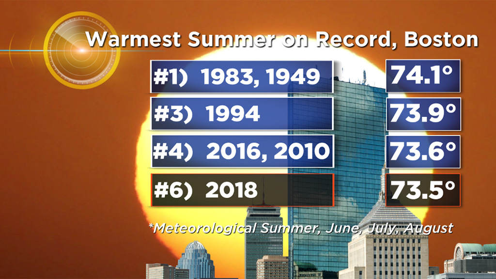
- This is currently the 6th hottest meteorological summer on record (73.5), only 0.6 degrees below the all-time record (74.1) set in 1983 and 1949. And given the forecast for the next several days, there is no doubt we will make a run up the charts.
-
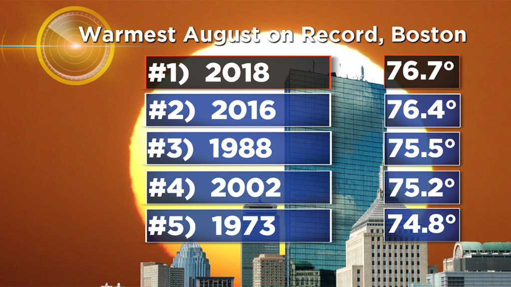
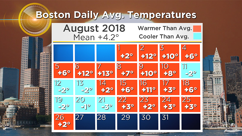
- This is currently the warmest August ever recorded in Boston (76.7), and that comes after a top-ten warmest July ever recorded.
-
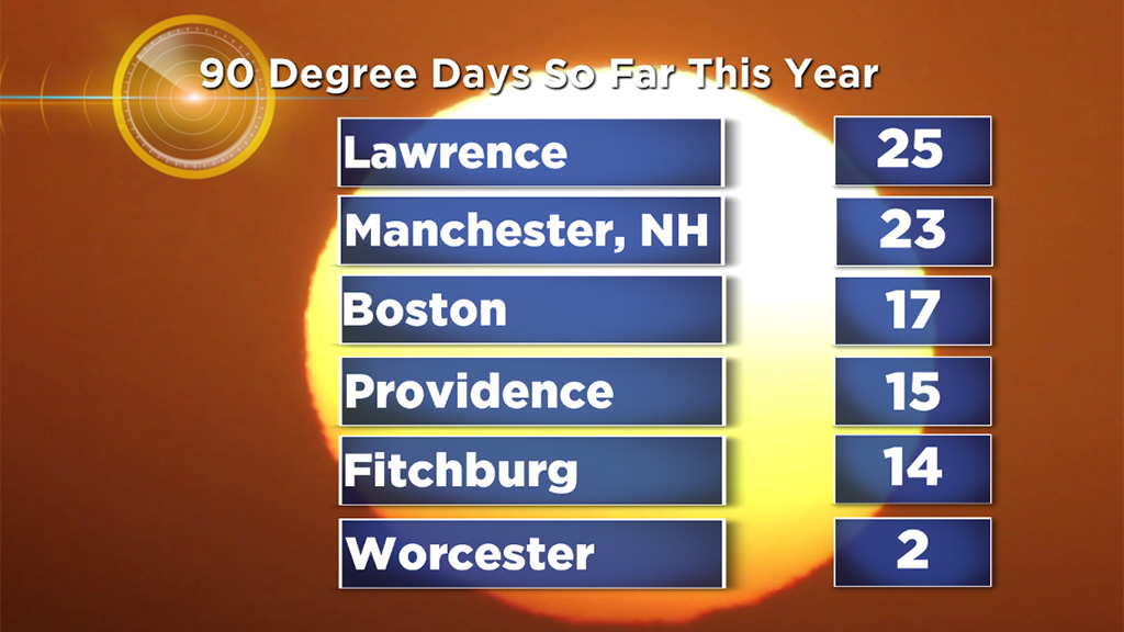
- Boston has had 17 days thus far of 90+ this year (some interior towns have had well over 20 including Lawrence (25) and Manchester, NH (23)). Boston averages 14 90-degree days per year and given the forecast, we may eclipse the scorching hot summer of 2016 when we had 22.
-
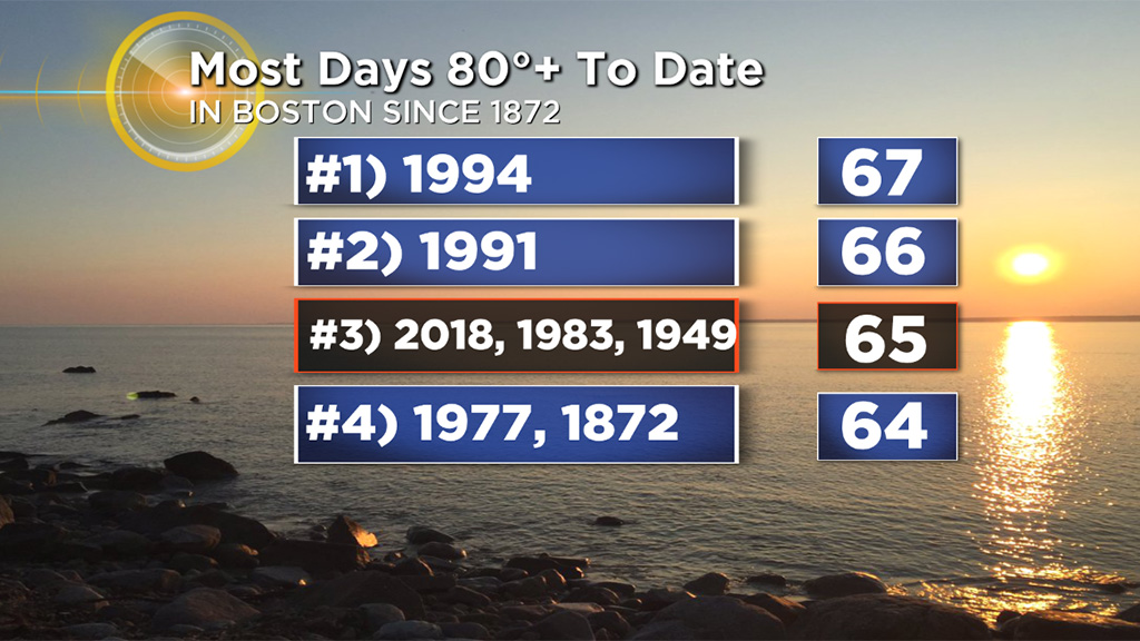
- We are also nearing the record for most days of 80+ temperatures. Currently we are at 65 days, just 2 shy of the record 67 days back in 1994.
-
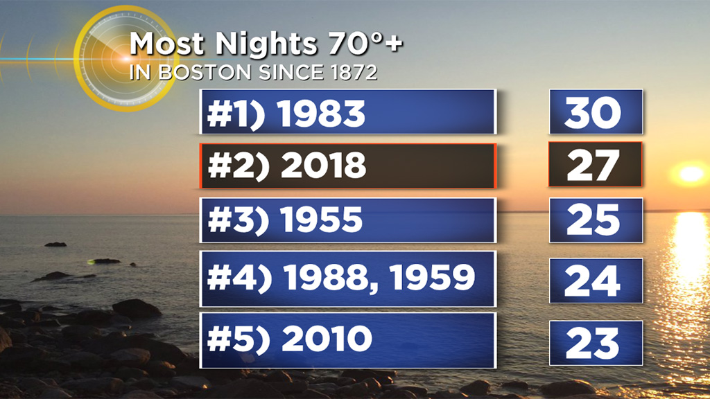
- Last but not least, even the nights have been warm! We have had 27 nights in Boston that haven't dropped below 70 degrees, just 3 shy of the record of 30 set back in 1983.
All of this and we aren't done yet! We are almost certain to have our second official heat wave of the season in Boston this week (A heat wave is 3 consecutive days of 90+ degress) AND the first few weeks of September also look to be much warmer than average. The beat and the HEAT goes on.
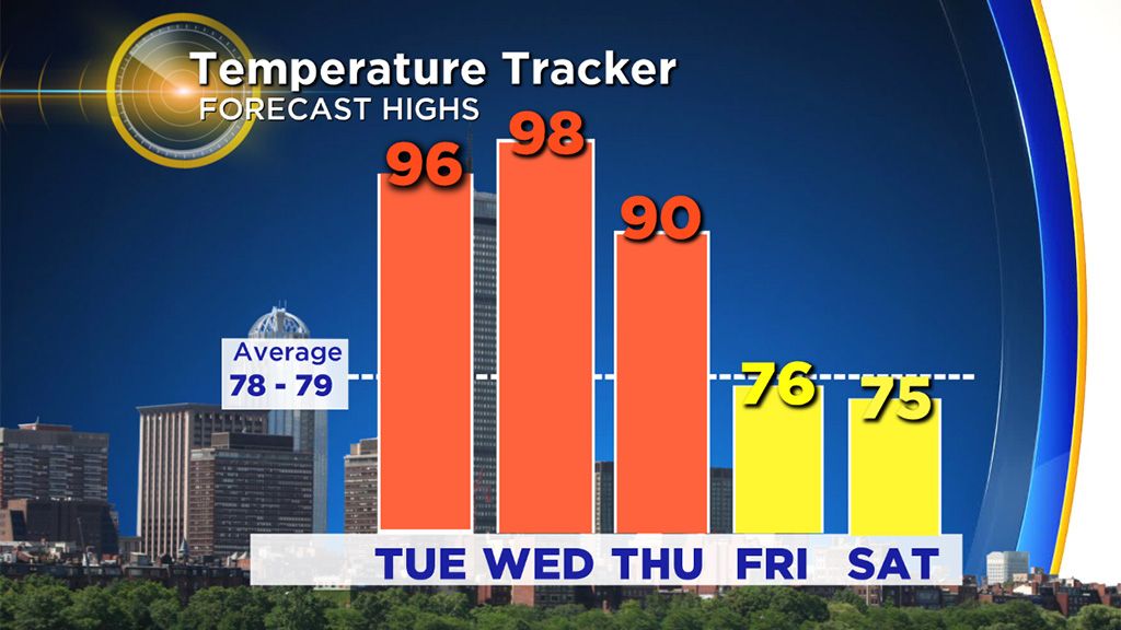
Focusing in a bit more on this week, the heat will peak on Tuesday and Wednesday when temperatures will range between 95-100 degrees. We have a very good shot at tying or breaking a record on Wednesday, the current record is 96 degrees, set back in 1953.
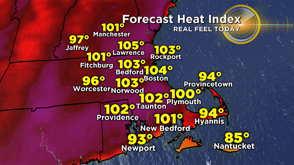
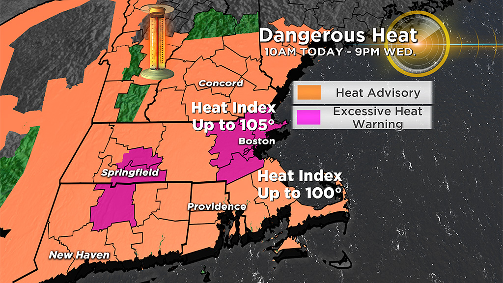
And as typical with the heat this summer, it will also be very humid. Combine the temperatures and humidity and it will "feel like" 100-105 on Tuesday and Wednesday afternoon prompting the National Weather Service to issue an "excessive heat warning" for parts of eastern Massachusetts.
On days like these you should limit your time outdoors working or playing in the sunshine. And of course many schools are back in session this week, talk about bad timing! Several schools have already announced early releases and I would expect that list to grow.
This round of heat will break with the arrival of a cold front (and likely some thunderstorms) on Thursday afternoon and evening. Temperatures will drop back to seasonal levels Friday and Saturday and the humidity will also come down quite a bit as well.
I would be surprised if this were our last hot and oppressive stretch though. The overall pattern heading into September looks to remain hot in the East, for at least the first few weeks, if not longer. So, keep the AC units ready and the summer clothes handy, those crisp and cool fall days and nights are nowhere in sight.