CBS News Live
CBS News Boston: Local News, Weather & More
CBS News Boston is your streaming home for breaking news, weather, traffic and sports for the Boston area and beyond. Watch 24/7.
Watch CBS News
A greater Boston starts here
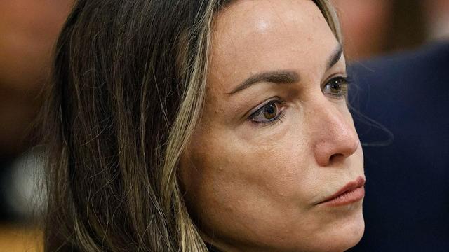
Testimony resumed Thursday in the high-profile Karen Read murder case.

Police moved in and were seen forcibly removing some of the demonstrators who were blocking the entrance to a parking garage.

Spirit Airlines says passengers involved in a fight on a plane that landed in Boston can no longer fly with them.
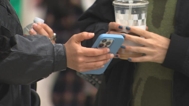
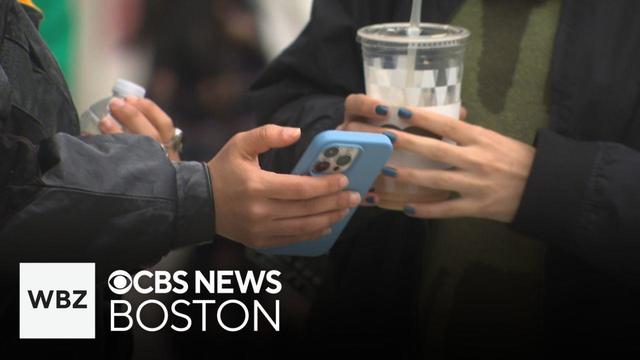
More researchers are sounding the alarm about giving young children smartphones, and there is a growing parent movement to keep phones away until they are older.
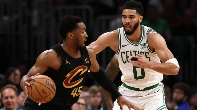
The Cleveland Cavaliers beat the top-seeded Boston Celtics 118-94 on Thursday night to tie their second-round playoff series at one game apiece.
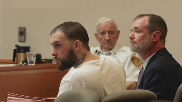
Adam Montgomery is expected to be in a New Hampshire courthouse Thursday when he is sentenced for the murder of his daughter, 5-year-old Harmony Montgomery.
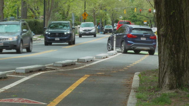
Residents of one neighborhood in Cambridge said a newly designed intersection with bike lanes is making traffic more dangerous than before.
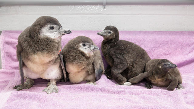
The New England Aquarium announced the arrival of four new African penguin chicks who hatched recently.

Mother's Day is this weekend there's lots of events to celebrate and enjoy with mom!
A look at the timeline of events in Karen Read's high-profile murder trial.
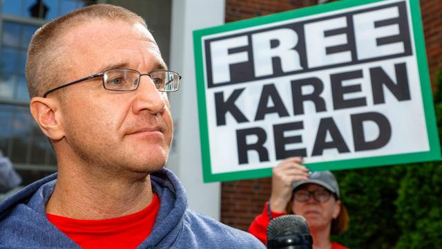
Aidan Kearney, the blogger known as "Turtleboy," is a key figure in the Karen Read trial.

Karen Read is charged with killing her boyfriend, Boston police officer John O'Keefe.
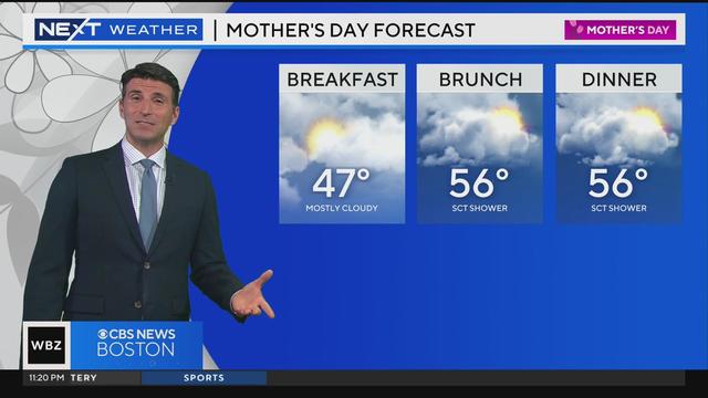
Eric Fisher has an updated weather forecast.
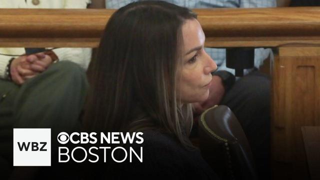
Two members of the Albert family testified about the hours before John O'Keefe was found dead in Canton. WBZ-TV's Tammy Mutasa reports.

MIT police made several arrests during a protest in front of a parking garage. WBZ-TV's Brandon Truitt reports.
The debate about what to do has become one of the biggest issues of our time. WBZ-TV's Paula Ebben reports.
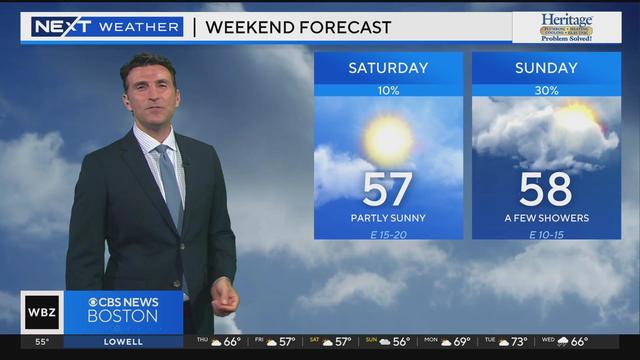
Eric Fisher has an updated weather forecast.

Massachusetts is paying millions to vendors in the migrant crisis with little oversight on how taxpayer money is being spent
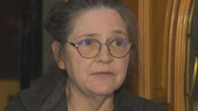
A Townsend woman was scammed into believing a famous actor was in love with her. Then the case took on a potentially more sinister turn.
The Cleveland Cavaliers beat the top-seeded Boston Celtics 118-94 on Thursday night to tie their second-round playoff series at one game apiece.
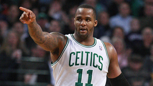
Glen Davis, better known as "Big Baby" during his basketball career, was sentenced to 40 months in prison on Thursday for defrauding the NBA's healthcare plan.
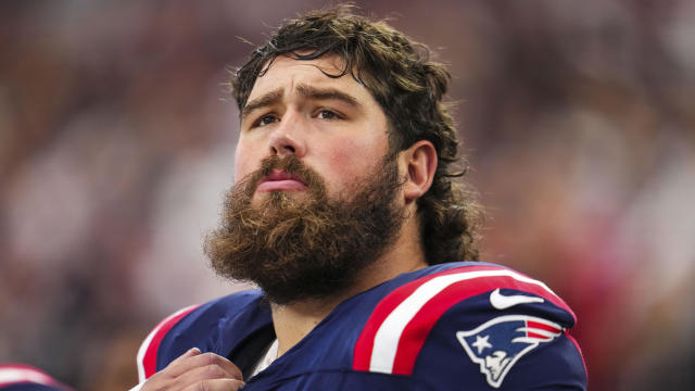
David Andrews said he'll always love football, so that wasn't part of his reason for returning to the Patriots for another season.
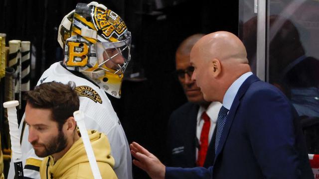
"Swayman was terrific," Montgomery said.

Julian Edelman felt awkward when Robert Kraft entered the same room as Bill Belichick.
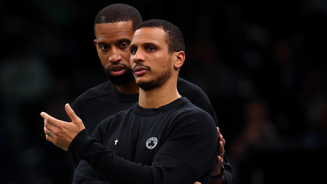
Charles Lee will finish out the postseason with the Celtics, but will then be off to take over the Charlotte Hornets.

Despite getting walloped on the scoreboard by the Florida Panthers, David Pastrnak and the Boston Bruins were not going down without a fight on Wednesday night. Quite literally.

The Florida Panthers beat the Boston Bruins 6-1 on Wednesday night to tie the second-round series at a game apiece.
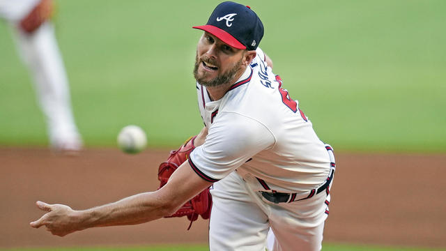
Marcell Ozuna kept up his torrid start with two more homers and Chris Sale pitched six innings against his former team, leading the Atlanta Braves to a 5-0 victory over the Boston Red Sox and a sweep of their two-game interleague series Wednesday night.
More researchers are sounding the alarm about giving young children smartphones, and there is a growing parent movement to keep phones away until they are older.

There are big plans to change the Mass Pike in Allston where the highway takes a dramatic sweeping turn.
Massachusetts lawmakers are considering a bill that proposes prosecuting 18, 19, and 20-year-olds as juveniles.

Not far off Route 495 in Westford, there's a place that will make you forget all about the hustle and bustle of life.

The Old Schwamb Mill is the oldest continuously operated mill in the United States.
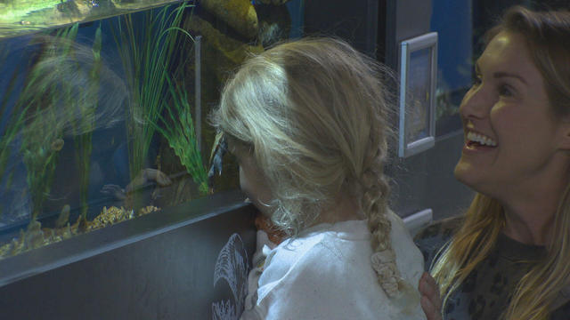
In Falmouth, just down the road from the ferry that heads to Martha's Vineyard, is an aquarium that happens to be a piece of history on Cape Cod.

Dr. Mallika Marshall answers a viewer's question on how to treat a Baker's cyst that's causing her lots of pain.

The next time you hit the gym, you may want to think about the air you're breathing.

Working a night shift for even a short time could negatively impact your health and scientists are researching why.

Trying to be a "perfect" parent could be detrimental to both parents and children.

Alzheimer's disease may be passed down in families more than previously thought.
Massachusetts is paying millions to vendors in the migrant crisis with little oversight on how taxpayer money is being spent
A Townsend woman was scammed into believing a famous actor was in love with her. Then the case took on a potentially more sinister turn.

State contracts obtained by the I-Team show taxpayers are paying tens of millions of dollars to hotels for rooms and food.
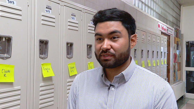
A fourth-grade teacher at an elementary school in Cambridge is facing child rape charges.
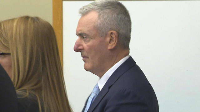
William Foley Jr., a five-time drunk driver who lost his license after a fatal crash in 2001, is back behind bars after an I-Team investigation.
Many residents say they really like Boston, but say the cost of living and high housing prices are taking a toll.
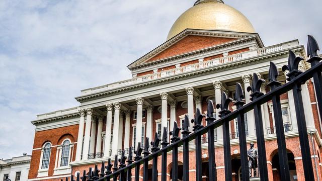
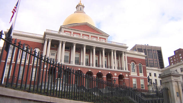
Despite an April revenue haul that exceeded forecasts, there is still anxiety on Beacon Hill about overall revenue shortfalls and economic uncertainty.

Surveys have found that support for Israel is "fairly consistent," regardless of campus protests.
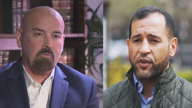
Quincy City Council President Ian Cain and Swansea attorney John Deaton are seeking the Republican nomination to run against Sen. Elizabeth Warren.

Pro-Palestinian students have accelerated their protests of the Israel-Hamas war. But are the they helping or hurting their cause?

You can once again grab a cocktail to go in Massachusetts.
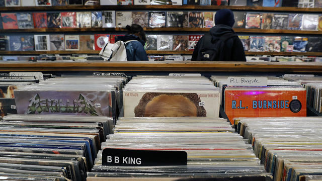
April 20, 2024 is Record Store Day. See which record shops in Massachusetts are participating.

Boston Dynamics' latest robot is ready to "exceed human capabilities," the company says.

Rising costs are forcing small businesses located on Boston's Massachusetts Avenue to close.

Boston-based box wine brand Alileo teamed up with Caffe Nero to launch a coffee and wine experience in Massachusetts.

Researchers spotted a 37-year-old right whale mother named Wolf and her calf off the coast of Massachusetts.

The 2024 cicada broods will not be emerging in Massachusetts - but the buzzing bugs are set to appear here in 2025.
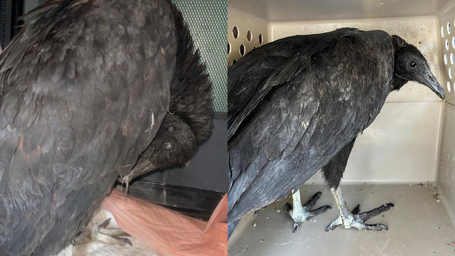
A pair of vultures thought to be "actively dying" actually had too much to drink, wildlife rescuers in Connecticut say.

A fluffy pile of golden retrievers took over the Boston Common in memory of Spencer the marathon dog.

The thick fog made for an eerie sight as the Mayflower II crossed the Cape Cod Canal.

The Coastal Maine Botanical Gardens in Boothbay, Maine offers more than 300 acres of the largest public garden space in New England.

French-inspired home and garden shop Les Fleurs brings the look and feel of Europe to Andover.

John Francis Designs in North Chelmsford is part woodshop and part test kitchen, where one-of-a-kind ravioli molds are made.
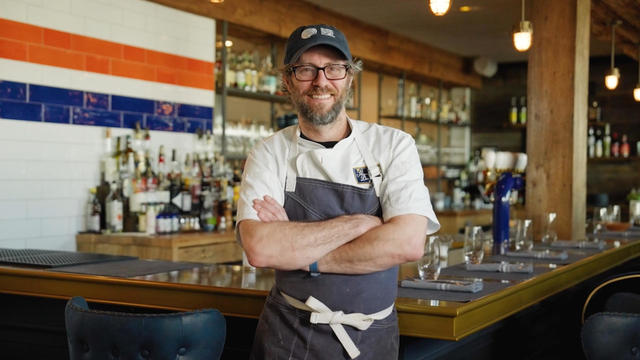
David Standridge is the award-winning executive chef of The Shipwright's Daughter in Mystic, Connecticut, a sea-to-table restaurant focusing on sustainable local seafood.

The Strawbery Banke Museum in Portsmouth offers visitors the chance to explore more than 350 years of New Hampshire's history.
Mother's Day is this weekend there's lots of events to celebrate and enjoy with mom!
More researchers are sounding the alarm about giving young children smartphones, and there is a growing parent movement to keep phones away until they are older.
Residents of one neighborhood in Cambridge said a newly designed intersection with bike lanes is making traffic more dangerous than before.
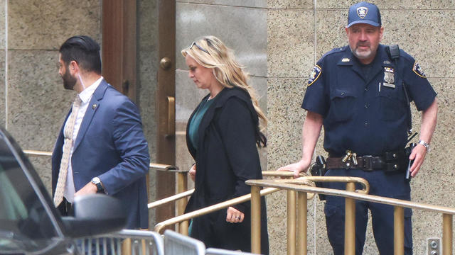
Stormy Daniels gave defiant testimony Thursday as the defense accused her of fabricating details of the alleged sexual encounter between her and former President Donald Trump.
Police moved in and were seen forcibly removing some of the demonstrators who were blocking the entrance to a parking garage.
The Cleveland Cavaliers beat the top-seeded Boston Celtics 118-94 on Thursday night to tie their second-round playoff series at one game apiece.
Glen Davis, better known as "Big Baby" during his basketball career, was sentenced to 40 months in prison on Thursday for defrauding the NBA's healthcare plan.
David Andrews said he'll always love football, so that wasn't part of his reason for returning to the Patriots for another season.
"Swayman was terrific," Montgomery said.
Julian Edelman felt awkward when Robert Kraft entered the same room as Bill Belichick.