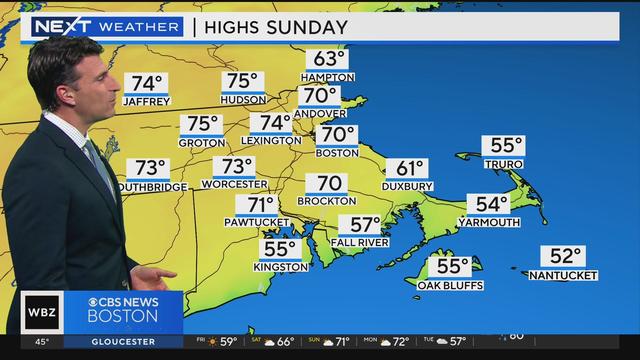
Freeze to 80 degrees? Dramatic temperature swing in the forecast for Boston
What could be more "April" than this in Boston. Freeze warnings and 80 degrees in the same 7-day forecast!
Watch CBS News
What could be more "April" than this in Boston. Freeze warnings and 80 degrees in the same 7-day forecast!

Keep an eye out for Lyrid meteor shower "leftovers," plus an International Space Station flyby over Massachusetts.

Our WBZ NEXT Weather team is excited to once again team up with the New England Revolution for a special Weather Education Day on Friday, May 3 at Gillette Stadium.
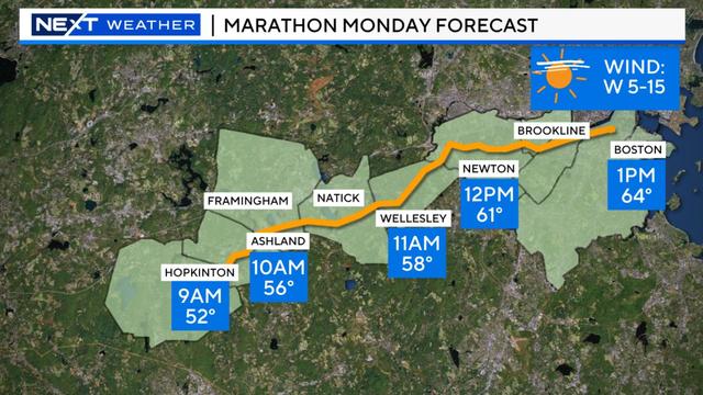
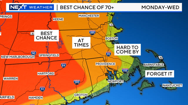
Monday is the 128th Boston Marathon and runners will have a mild, mostly clear day ahead of them.
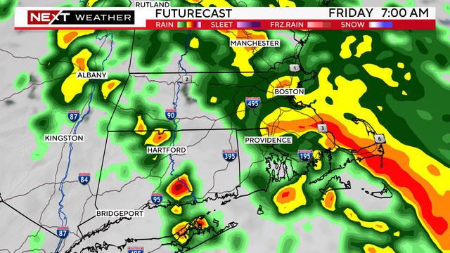
A storm will bring heavy rain and gusty wind to Massachusetts Friday, with effects lingering into the weekend.
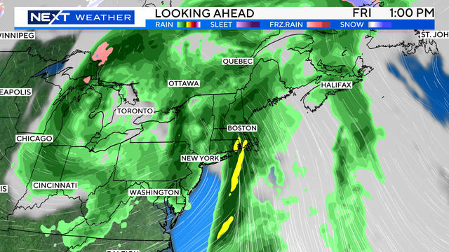
The heaviest rain looks to fall between Thursday night and during the day Friday.
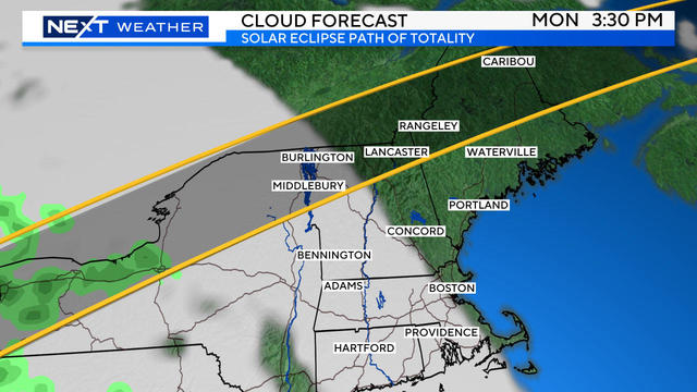
New England may end up being one of the few places in the path of totality in the United States with favorable viewing conditions!
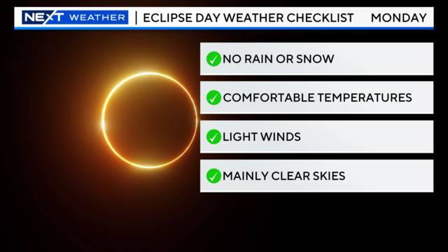
For the last time for more than 50 years, this Monday, we will have the chance to see a total solar eclipse here in New England.

Massachusetts and New Hampshire are going to feel the lingering impacts of this storm for the next several days.
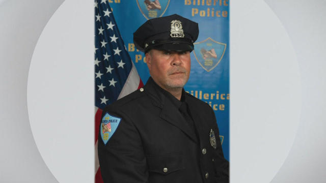
Sgt. Ian Taylor died after he was struck by an excavator on Boston Road.
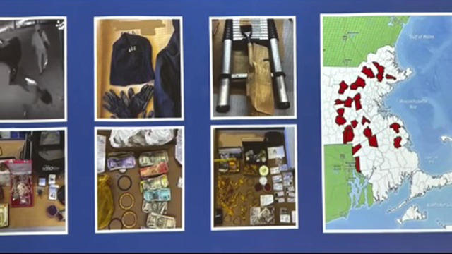
Four men are accused of stealing expensive jewelry from Indian and South Asian families in Massachusetts for years.

Gillette Stadium was already buzzing ahead of the New England Revolution match against Lionel Messi and Inter Miami CF.
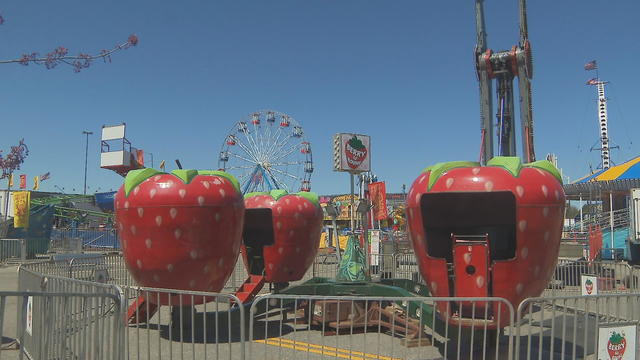
Fiesta Shows is making some changes to its entry policy following a fight that broke out among teens at its carnival in Weymouth last Friday night.

The town of Sharon has confirmed a case of the rare Powassan virus, which is spread by ticks.
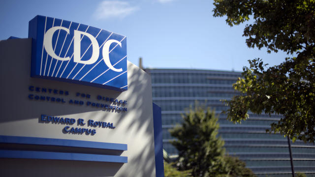
The discovery of drug-resistant bacteria in two dogs prompted a probe by the CDC and New Jersey health authorities.

A new study finds that people with breast cancer are more likely to develop a second cancer over time.
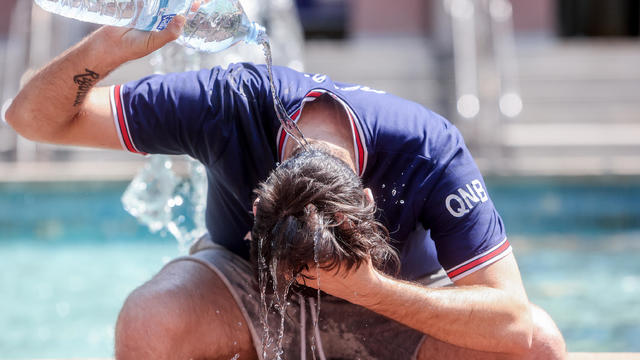
The CDC is keeping a close eye on the impact that rising heat is having on o

The CDC has issued an advisory about the risks of safely injecting Botox after some people have gotten so sick they had to be hospitalized.

Federal officials say they're double checking whether pasteurization has eradicated the danger from possible bird virus particles in milk.
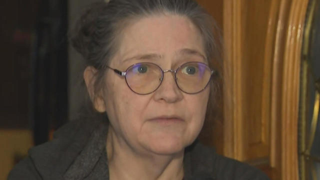
A Townsend woman was scammed into believing a famous actor was in love with her. Then the case took on a potentially more sinister turn.

State contracts obtained by the I-Team show taxpayers are paying tens of millions of dollars to hotels for rooms and food.
A fourth-grade teacher at an elementary school in Cambridge is facing child rape charges.

William Foley Jr., a five-time drunk driver who lost his license after a fatal crash in 2001, is back behind bars after an I-Team investigation.
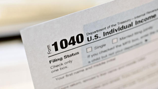
The IRS Criminal Investigation unit helps go after violent criminals, including some right here in Boston.
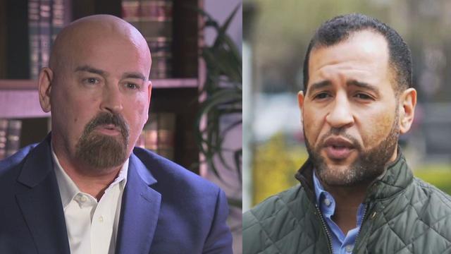
Quincy City Council President Ian Cain and Swansea attorney John Deaton are seeking the Republican nomination to run against Sen. Elizabeth Warren.

Pro-Palestinian students have accelerated their protests of the Israel-Hamas war. But are the they helping or hurting their cause?

Massachusetts State Sen. Peter Durant weighed in on budget concerns in Massachusetts.
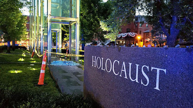
According to ADL's annual Audit of Antisemitic Incidents, Massachusetts had the fifth most incidents in the country last year, up a shocking 189 percent over 2022.
"It's the golden goose," said Rooney of Boston's commercial property taxes, which provides a large percentage of the city's annual revenue.
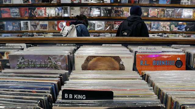
April 20, 2024 is Record Store Day. See which record shops in Massachusetts are participating.

Boston Dynamics' latest robot is ready to "exceed human capabilities," the company says.
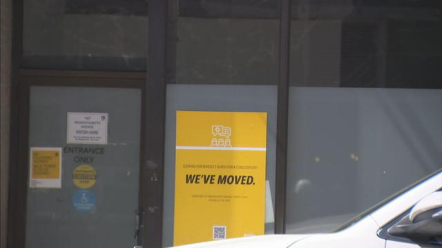
Rising costs are forcing small businesses located on Boston's Massachusetts Avenue to close.

Boston-based box wine brand Alileo teamed up with Caffe Nero to launch a coffee and wine experience in Massachusetts.
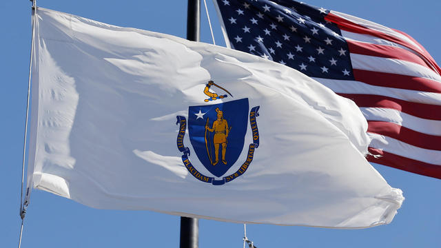
Today is Patriots' Day in Massachusetts. Here's what to know about the celebrations and what's open and closed for the holiday.
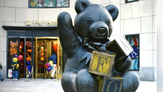
Robert Shure is the talented sculptor behind the FAO Schwartz teddy bear, the Cy Young memorial and the Massachusetts Fallen Firefighters Memorial.

Ming Tsai demonstrates how to cook a traditional Chinese street food - Ming's bings.
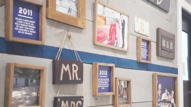
Founded out of love, Rustic Marlin is a home décor and lifestyle brand with a unique origin story in Massachusetts.
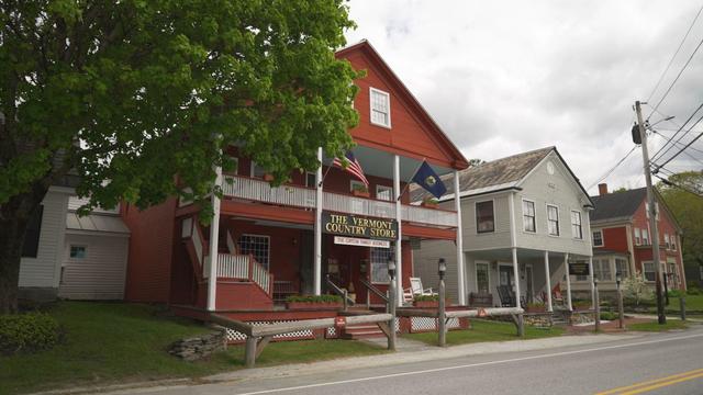
The Vermont Country Store has since become an iconic destination for locals and tourists alike.

Creating an inviting environment for the community to meet, enjoy and participate in the arts
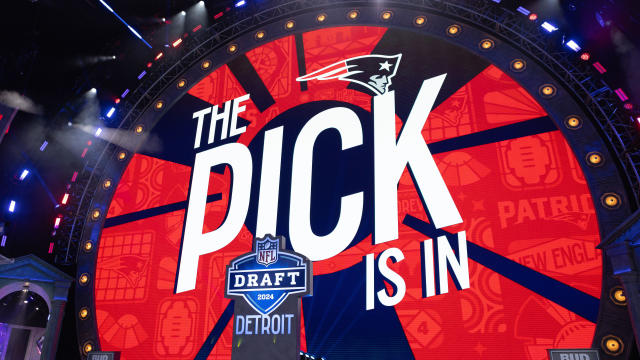
The Patriots checked off three big boxes over the first two days of the 2024 NFL Draft, and have five more picks to make on Saturday.
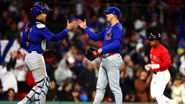
Shota Imanaga continued an impressive start to his major league career by pitching one-run ball into the seventh inning to lead the Chicago Cubs to a 7-1 victory over the Boston Red Sox on Friday night.
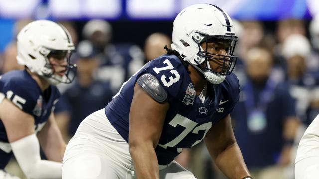
The Patriots addressed another big need on Friday night, drafting tackle Caedan Wallace with their third-round pick.
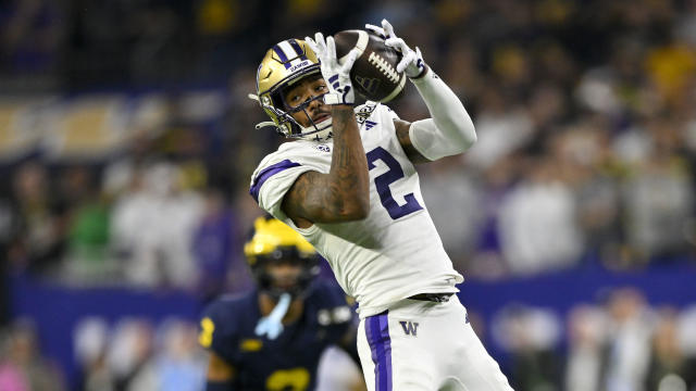
After drafting quarterback Drake Maye with their first pick in the 2024 NFL Draft, the Patriots gave him a weapon with their second selection: Washington receiver Ja'Lynn Polk.
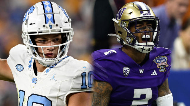
On Thursday night, Drake Maye became a member of the Patriots. On Friday night, the young QB was given a new weapon.

Researchers spotted a 37-year-old right whale mother named Wolf and her calf off the coast of Massachusetts.

The 2024 cicada broods will not be emerging in Massachusetts - but the buzzing bugs are set to appear here in 2025.
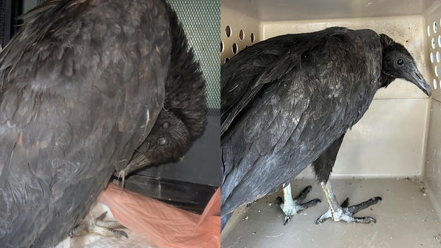
A pair of vultures thought to be "actively dying" actually had too much to drink, wildlife rescuers in Connecticut say.

A fluffy pile of golden retrievers took over the Boston Common in memory of Spencer the marathon dog.

The thick fog made for an eerie sight as the Mayflower II crossed the Cape Cod Canal.