Snow Will Make Roads Slippery Into Monday
BOSTON (CBS) --The National Weather Service has posted a Winter Storm Warning for Plymouth and Bristol counties and a Winter Weather Advisory for the rest of the state late Sunday through Monday afternoon.
IMPACTS & TRACK
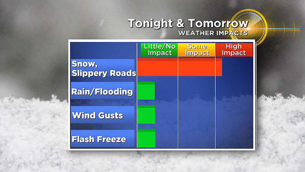
Like its predecessors, this storm will also be a minor event but it will create a period of slippery roads late Sunday night into early Monday. That will be the main impact as rain, flooding, strong winds, and any flash freeze will not be an issue in this latest bout of wintry weather.
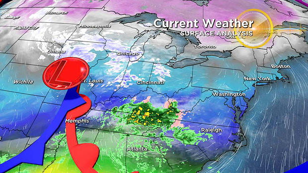
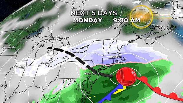
The storm will approach from the west, and it is not destined to strengthen much as it closes in on the region, but a swath of moisture will cross the area and linger well into Monday. By 10 a.m., the center of the storm will be south of New England and heading out to sea rather quickly. Light to moderate snow will taper to scattered showers by the afternoon, with dry conditions developing from west to east Monday night.
TIMELINE
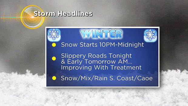
The snow is extrapolated to start around 10 p.m. Sunday evening over western New England with a shift eastward into Worcester County by 11 p.m. to midnight.
The coastal plain will receive its first flakes between midnight and 2 a.m., then steadier snow will fall through the early morning hours.
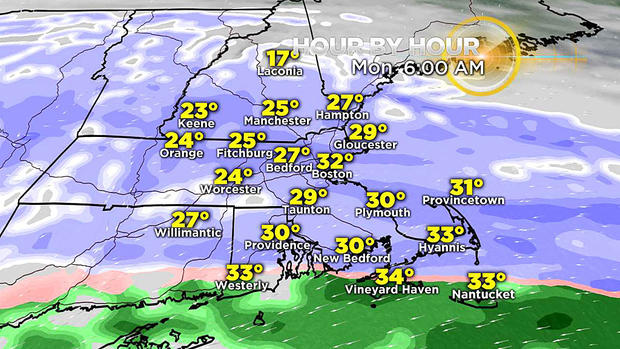
Snow may become moderate at times and most of the accumulation will occur up to 10 a.m. or so. Sufficient warming is anticipated to approach from the south and probably change the snow to a mix and even plain rain close to the New England South Coast including Cape Cod and the Islands from 6 a.m. to 8 a.m.
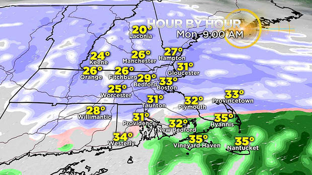
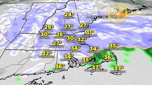
At this time, the changeover line is not expected to advance north of the Cape Cod Canal. I anticipate occasional snow to fall much of the day and taper to snow showers later in the afternoon followed by clearing coming down from the northwest later in the evening. Only a minor additional accumulation is projected after 8 a.m. over most locations despite snow in the air.
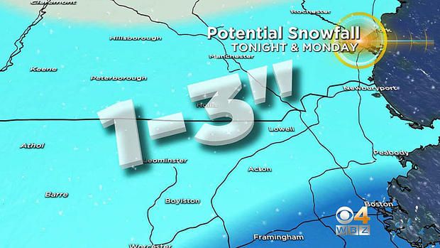
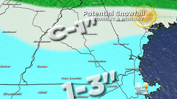
POTENTIAL SNOWFALL
This will be another minor event but there will be enough to prompt removal by shovel, plows, and blowers.
The swath of highest amounts in the 3 to 5 inches range with a few spot totals to 6 inches will occur in a ribbon along the Mass. Pike extending south to within a few miles of the New England South Coast over to the Cape Cod Canal. I am predicting about 3 to 4 inches in Boston.
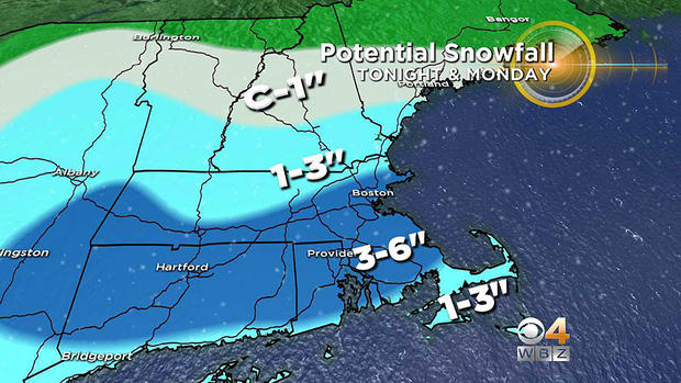
Amounts will taper off from 3 inches down to 2-plus inches over most of northern Mass. to just under 2 inches just across the border into southern N.H. and decreasing to an inch near Concord, N.H. and less than that to just coatings from parts of the Lakes Region Of N.H. north to the mountains.
ROAD CONDITIONS
It is inevitable that roads will become slippery not long after the snow commences late Sunday night. Toughest travel will likely be through mid-morning on Monday, when the steadiest snow falls. Visibility may be limited at times. Steady snow will taper to showers, so improvements on the roads are likely, as crews should be able to keep up with any additional accumulation on the roads.
If you are planning to travel late Sunday to early Monday, allow extra time to reach your destination and proceed with caution, please. Since it is a holiday for many, the traffic should be light Monday morning. Despite the occasional snow falling through the day, I expect that most of the main and secondary roads will become just wet after treatment. Country roads and town streets that are untreated may be slippery deeper into the morning.
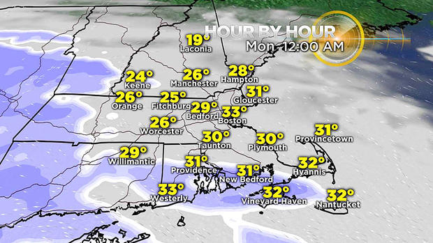
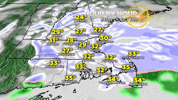
Watch out for icy areas developing again late in the day and especially Monday evening as all snow showers end, clearing begins and temperatures drop through the 20s then later at night down to the lower teens to near 10 degrees by dawn on Tuesday!
REVIEW & COMPARISON
Check out the review of this minor storm and compare it to the Presidents Day Blizzard of 2003 on the same dates of February 17-18 that turned out to be Boston's top snowstorm on record at 27.5" eclipsing the 27.1" in the Blizzard of 1978.

Check the WBZ Weather Team updates here online and on WBZ-TV.


