When Is It Going To Warm Up?
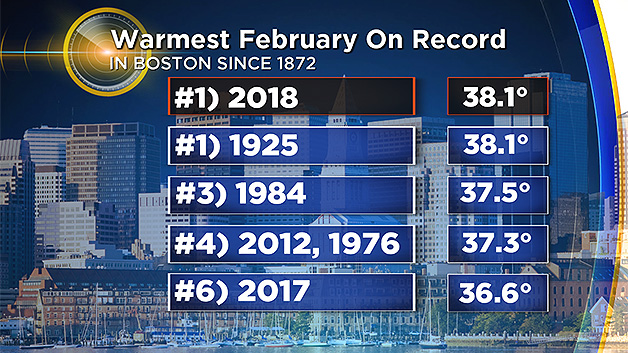
BOSTON (CBS) - Everyone is wondering when it will finally warm up. I think that most people become desperate for warm weather especially after a long and hard, cold winter but that really wasn't the case this year. Instead, in my 42+ years of weathercasting, I think that we endured the most fickle, zig-zagging weather ever during the winter and that is now extending into spring. There was a brutal stretch in late December into the first week of January which yielded the coldest 10-day period in 100 years. After that, there was a January thaw followed by the warmest February on record tied with the year 1925.
Then winter part 2 arrived about 2-3 weeks late and delivered several nor'easters which produced widespread coastal and tree damage. So expectations are high now for warmer weather but that doesn't always happen in April either.
The two snow events this week have been minor but they have caused more disappointment and consternation around southern New England. Social media revealed that many people were stating that it is not supposed to snow in April. Well, the reality is that data proves it snows in April almost every year.
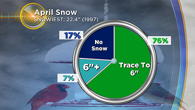
In fact, the pie chart reveals that 76% of the Aprils since 1872 produce a trace to 6 inches of snow in the Boston area with more than that in areas farther north and west of the city. There are extreme cases such as this 36th anniversary of a whopping powder blizzard on April 6-7, 1982.
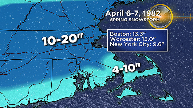
That beast produced 13.3 inches of wind-drifted fluffy snow, the lowest minimum temperature so late in the season and the lowest maximum temperature of any April day in the record books! So, it could be worse but it could be better.
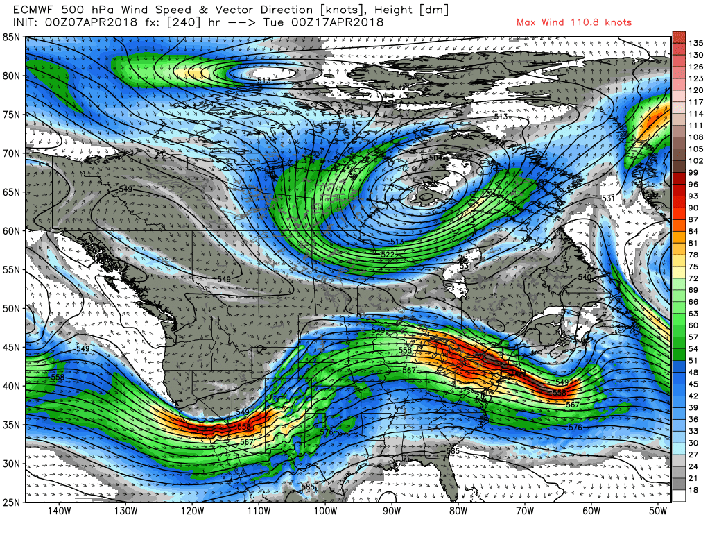
So is the end in sight? Yes, it is but I believe that more patience is required. There are some global factors that are changing but there is a lag time before that is reflected in a shifting weather pattern. The latest upper air profile depicts an active jet stream across the nation. At the same time, the northern stream remains active and as long as some blocking exists over the North Atlantic up into Greenland, masses of cold air will continue to spill southeastward across Canada and occasionally into our country.
Presently, much colder than usual air is streaming down the Plains states. With a strong southern stream, later this upcoming week, a blizzard is possible in the northern Plains states as a swath of severe weather containing some tornadoes roars eastward across the southern Plains, Mississippi Valley to the southeastern states.
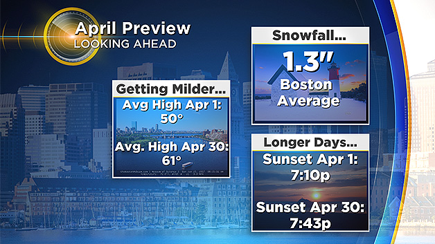
While some milder days should materialize this month here in New England, I do not see any long-lasting stretch of above to much above normal temperatures. A key factor in longer range weather prediction stems from the MJO which is the Madden-Julian Oscillation which is a complex tropical climate pattern that circles the equator and its massive system of air currents can alter the steering currents north and south of it so it is a gargantuan global player.
As it circumnavigates the globe, its various phases tend to produce certain atmospheric results in various locations. Presently, the MJO is in Phase 3 which supports a continuation of a colder than average regime over much of the northern and northeastern portion of the United States.
Eventually, the MJO will transition into a new phase and with the weakening La Nina and other associated factors, a flip to much warmer weather will occur. Exactly when that happens is tricky to determine.
Most indicators are leaning toward warmer weather in May leading to a warmer than average summer. We shall see!