Flash Freeze To Follow Disruptive Winter Storm
BOSTON (CBS) - A highly disruptive winter storm is on the way and this storm will also be very different from town to town.
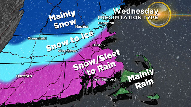
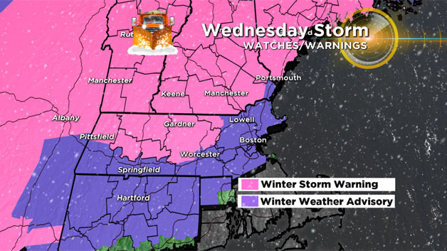
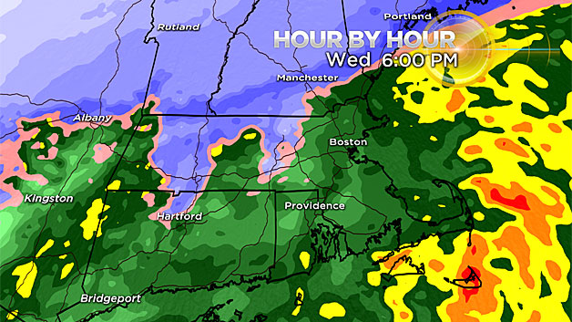
This storm will also be very different from town to town. Take New Bedford or Fall River for example, where they will see an early coating to an inch washed away with a change to rain. Travel about 70 miles to the north to say, Fitchburg, where the storm will be mainly snow with a brief period of ice mixing in and you have a MUCH different story and higher impact.
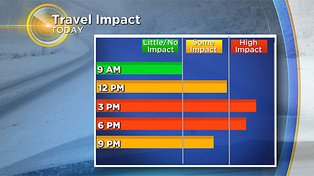
Thankfully, this is another fast moving storm (as most have been this year)…the snow burst lasts for 3-6 hours depending again on where you are, and then the sleet and rain takes over for another 3-6 hours and then it's done.
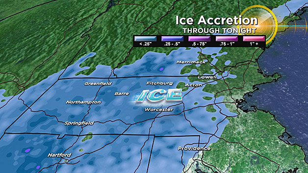
Also, there will be very little wind (gets a bit gusty on the Cape and Islands) and no coastal flooding. So, it's a messy afternoon and PM commute and certainly by Thursday morning it is long gone. One last thing to remember, temperatures will drop below freezing Wednesday night so whether you got rain, snow or a mix of the two, everything ices back up.
TIMELINE
Front End Snow Thump:
Snow arrives around 9 a.m. in western Mass., 10 a.m. in Worcester, 11 a.m. in Boston.
It will ramp up quickly, falling between a half-an-inch to an inch per hour at the onset. Schools and businesses that decided on early release will want to use extreme caution going home as road conditions will deteriorate rapidly around midday.
Change to Sleet and Rain:
The snow will change to rain and ice from south to north during the afternoon.
Approximate changeover times:
1 p.m: South Coast, Cape
2 p.m: Plymouth, Providence
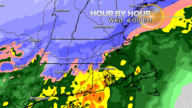
4 p.m: Boston, Worcester (Pike)
5 p.m: 128/495 area northwest of Boston to Cape Ann
6 p.m: Fitchburg to Lowell and Lawrence
7 p.m: About as far north as it gets, perhaps to Nashua NH area, southern NH
Areas inland of I-495 and south of the Pike will change to plain rain.
Outside of 495, any changeover would likely be to sleet as temperatures at the ground level will remain near or slightly below 32 degrees.
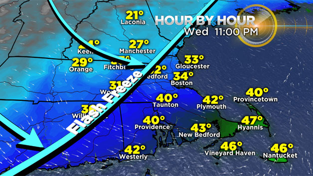
End of Storm, Flash Freeze:
The precipitation will taper off from west to east between 9 p.m. and midnight on Wednesday. It will likely to change back to a brief period of snow before ending. Then the temperatures will crash, dropping below freezing in all of Southern New England, causing any untreated surfaces to ice up.
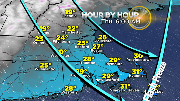
Flash Freeze (Approximate time of drop below 32 degrees):
10pm: 495 area (northwest of Boston) including Lowell, Lawrence, Haverhill
Midnight: 128 area and all towns north of Pike
2am: Boston and immediate suburbs to the west and south
4am: Plymouth to Providence and all areas north
6am: All of southern New England now below 32 including Cape Cod, islands
Snow Amounts:
6-12": Northern Worcester county (Fitchburg area) to Manchester NH and all points north including Central and Northern New England ski areas
4-6": 128 to 495 area…Burlington to Worcester to Lowell, Lawrence and Haverhill…also all of Cape Ann
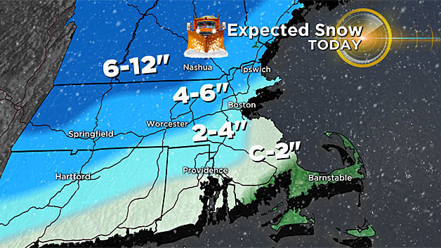
2-4": Boston to Providence and most of Norfolk county and northern Bristol county
Coating to 2": Most of Plymouth county and Southern Bristol county and parts of the upper Cape.
Nothing: Outer Cape Cod, Islands (all rain)
As always we urge that you stay tuned to updated forecasts throughout the storm on WBZ-TV and CBSBoston.com


