What To Expect From First Significant Snowfall Of The Season
BOSTON (CBS) – I have been receiving numerous emails and tweets from thrilled snow lovers this morning. Is your game face on yet? Are you excited about facing the festive flakes again or are you depressed about the real beginning of winter?
The first snowfall of the season is always a challenging one - especially for drivers. Tricky traveling conditions will develop this afternoon as the snow tempo increases. The crews will be dispatched to commence treatment of the roads and eventually the plows will go into action.
TIMING
The snow will become moderate at times this afternoon through much of the evening. Briefly, the snow could even be heavier than that in some spots. The snowfall rate should be in the range of 0.5 to 1" per hour the second half of the afternoon into the first half of the evening.
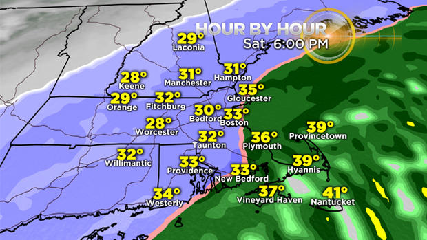
There would be nothing more than a coating to perhaps an inch of wet snow on the outer Cape through midday before a switch to all rain and a brief end as snow showers at dawn tomorrow. Outer Cape Ann, the coastal communities of Plymouth County to just beyond the Cape Cod Canal could receive one to perhaps two or three inches before a mixing with and changing to rain this afternoon.
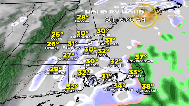
Those areas will likely have a transition back to snow sometime this evening yielding nothing more than a fresh coating to an inch overnight. Snow will taper off to flurries from west to east late this evening extending into the predawn hours.
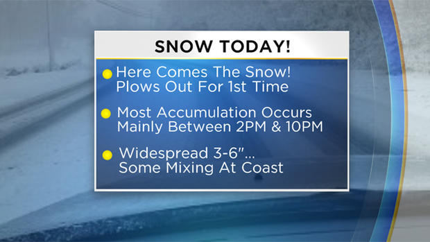
TOTALS
The previous predictions since late Thursday of a widespread 3-6 inches remain valid. It looks like 4-5 inch amounts will be most widespread with scattered totals exceeding 6 inches possible in some areas near and just northwest to southwest of Boston.
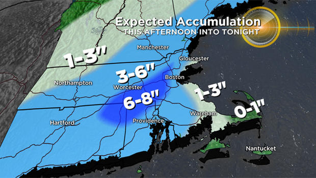
The wettest snow will be falling along and inside of the I-95 corridor. A few inches of pasty snow on some of the trees that still remain foliated might result in some damage to limbs and branches. As noted above, lower totals ranging down to practically nothing will occur from some immediate coastal communities and especially on much of Cape Cod.
OTHER IMPACTS
The main concern is the eventual hazardous travel and the accumulating snow. Get the shovels and snow blowers ready for the first test of the season.
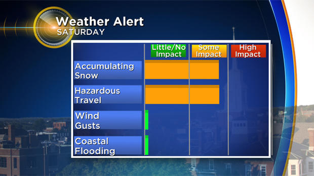
Thankfully, wind will not be a factor as gusts are projected to reach only 10-20 mph near the coastline and perhaps 20-30 mph on outer Cape Cod so coastal flooding will not be an issue either with this one.
LOOKING AHEAD
The next weather maker emanating from a clipper system will produce a period of light to perhaps moderate snow late Monday night into Tuesday morning. Presently, it looks like the potential exists for 1-4 inches from that one and maybe just rain again over southeastern Massachusetts.
That feature will intensify in the Canadian Maritimes and drag in some frigid air Wednesday and Thursday. High temperatures then will be in the range of 20-25 degrees and that is about 20 degrees below the average for mid-December!