Summer Takes A Vacation With Near-Record Chill
Find Eric Fisher on Twitter and Facebook
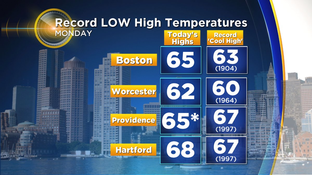
For anyone wishing the hazy hot and humid weather away last week - consider the request granted! From a stretch of 90s to a feel of October. It's the beauty and beast of New England which is always ready to switch patterns on a dime. Anytime you combine onshore winds and steady rain (even during summer) it's a recipe for a chilly day, because the North Atlantic isn't the Bahamas. Monday threatened some record cool readings across the region, and notched a 'coldest high temp' for the date in Providence, RI. If timing had been a little different we would have had a shot at more records, with most of the highs coming in the early morning hours.
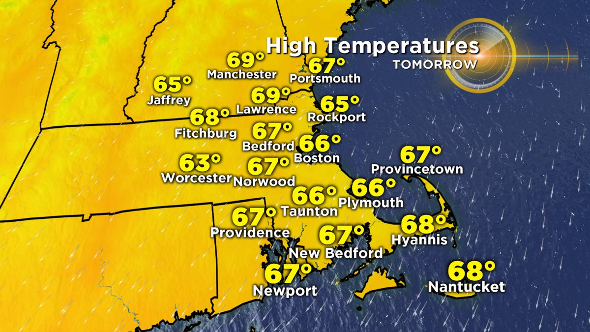
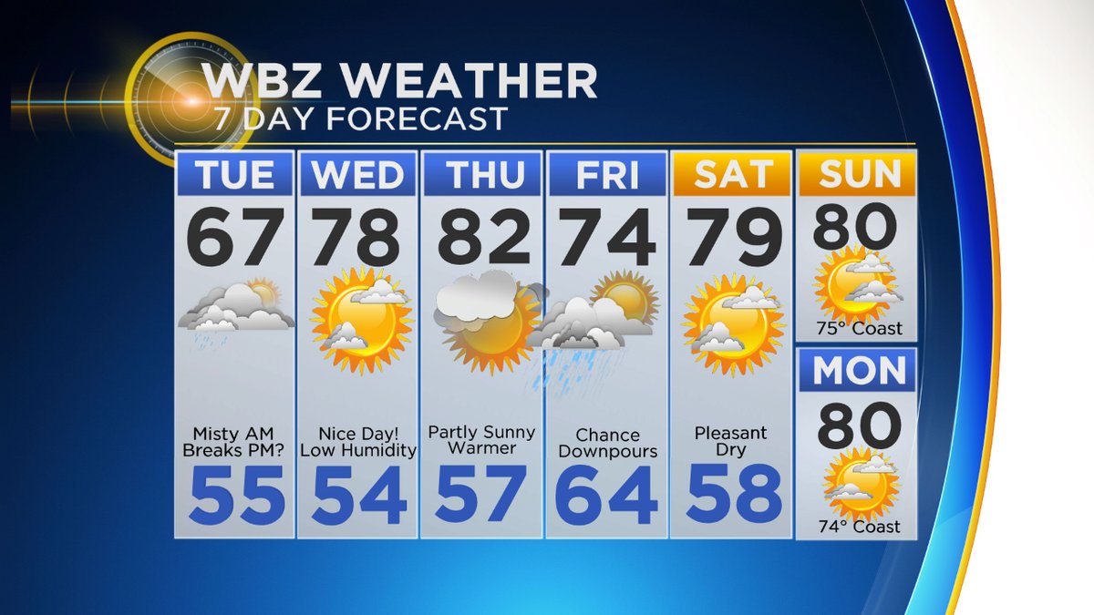
Tuesday brings less rainfall, but similar temperatures. With a lot of low-level moisture trapped across the region, it'll be tough to break apart the clouds. A misty morning should eventually give way to a brightening overcast by midday and some breaks of sunshine for the late afternoon and evening. We won't escape the autumn feel though with highs in the 60s. At least this time the highs will be during the day and not before we go to work! No records are expected to be threatened on Tuesday, but those readings are certainly unusually cool for midsummer.
When's the last time we had such a stretch? You have to go all the way back to....last year. Several days in a row were stuck in the 50s and 60s last July. Remember them? Probably not. A little break in the summer action isn't the worst thing, unless perhaps you're on vacation with a bunch of young kiddos in the house going crazy. We'll pull out of this pattern on Wednesday with perhaps a 'Top 10' New England weather day. High pressure overhead will provide abundant sunshine and highs 75-80 with low humidity. About as good as it gets! Most will get over the 80 degree hump again on Thursday. It's pretty difficult to stay as dreary and cool as we just saw for long in July.
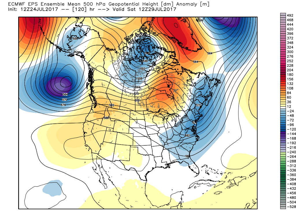
If you're looking for the Triple H conditions to come back, you're out of luck. The Northeast trough should keep reloading for the foreseeable future, meaning 90s and high humidity are not in the cards anytime soon. After another potent system brings a chance of heavy rain Friday, another dry and cool-ish air mass will settle in for the weekend and early next week. It looks like 70s and 80s are in charge for a while. Good news for your AC bill and your garden.