WBZ-TV Storm Watch Weather Alert: Heavy Downpours, Damaging Wind Gusts
BOSTON (CBS) - Get ready for a raw and rainy Monday.
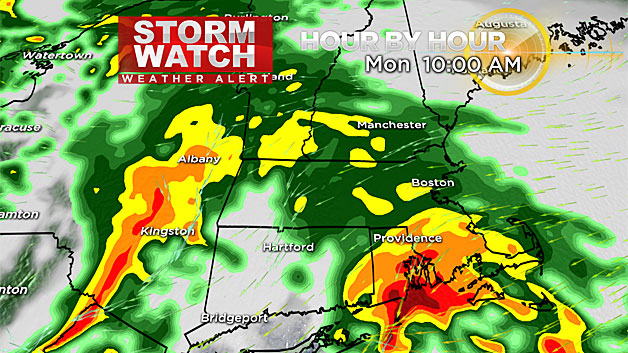
An area of low pressure will approach New England this morning and move across Cape Cod later this evening. This system will bring us heavy rain, an onshore wind and even some coastal flood concerns tonight.
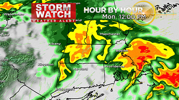
The main impacts from this storm will be the torrential rainfall through the morning and afternoon. There may be some localized urban flooding, especially in southeastern Massachusetts, where the heaviest rain is expected to fall.
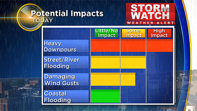
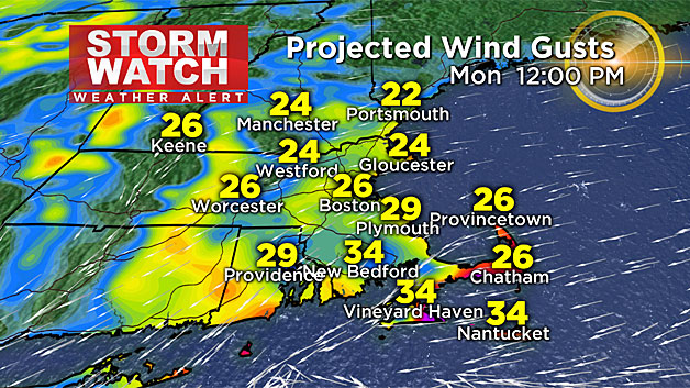
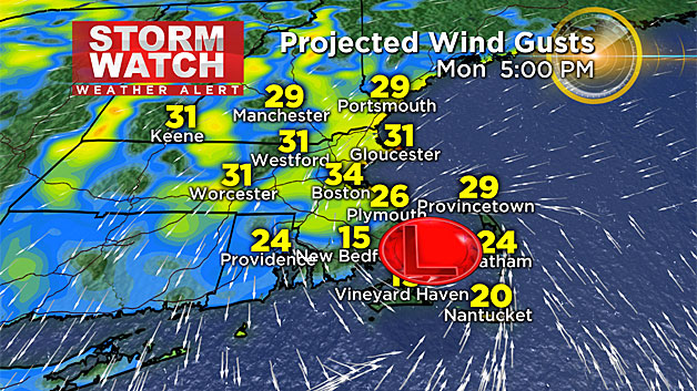
The wind will pick up from the east in the morning and afternoon. Gusts may reach 35 mph, and it will make it downright raw. Temperatures will stay in the low 60s to upper 50s all day.
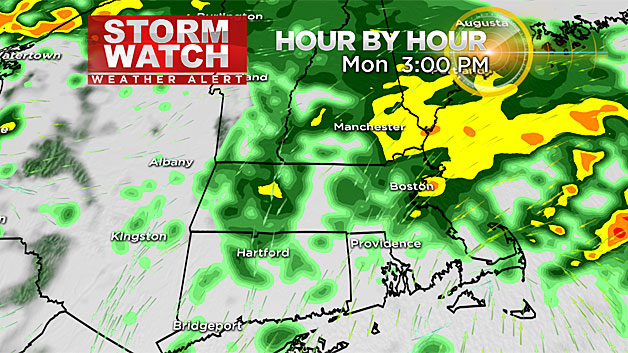
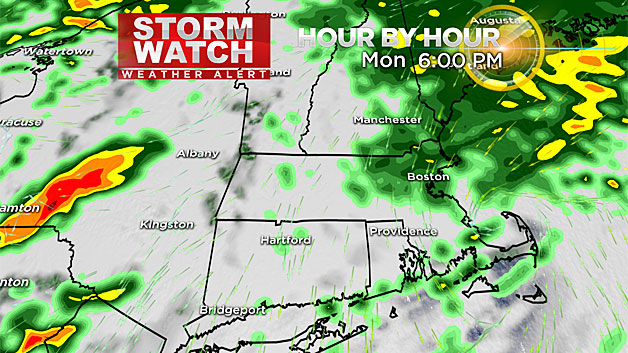
The rain continues to pick up in intensity this morning, especially across southeastern Massachusetts. An isolated thunderstorm may also be embedded within the heavy surge of rain along the South Coast and islands. The rain starts to let up from southwest to northeast slowly this afternoon. But spotty showers will make the evening commute tricky for some in eastern Mass.
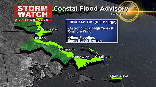
The tides will be astronomically high Monday night with a half foot to one foot surge.
There is a coastal flood advisory on either side of high tide (11 p.m. to 3 a.m. Tuesday). Minor flooding, splashover and some beach erosion is expected in vulnerable locations.
Get the latest forecasts on WBZ-TV, WBZ NewsRadio 1030 and CBS Boston.com