Blizzard Watch Issued Ahead Of Nor'Easter That Could Bring Foot Of Snow
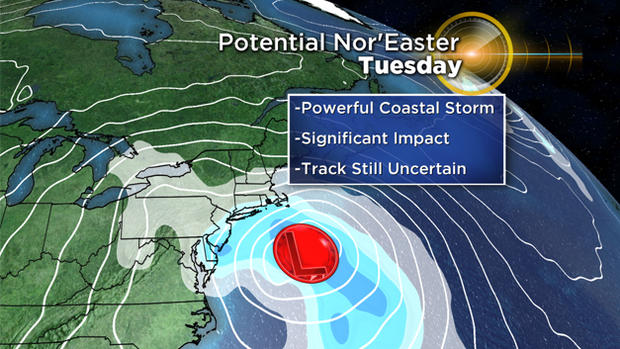
BOSTON (CBS) – As the hours roll by, we receive more details on our Tuesday storm.
It's still too early to pinpoint exact snow totals (track still uncertain), and it's too early to be confident on timing down to the hour. However, here are some new details:
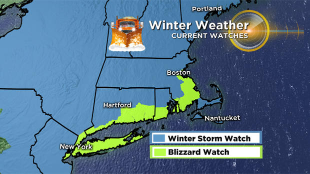
WATCHES
A blizzard watch has been issued for Boston and much of the south shore from late Monday night to late Tuesday night.
Expect not only heavy snow, but strong winds to create blowing and drifting and very low visibility. Damage and power outages will be scattered.
Remember the definition of a blizzard is: considerable falling and/or blowing snow with sustained winds or frequent gusts over 35 mph and one-quarter of a mile or less visibility for at least three hours.
A winter storm watch is up for most of the northeast from Monday night to Tuesday night. Heavy snow and gusty winds will occur, but may not quite reach blizzard criteria.
These watches will be later updated to warnings.
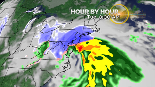
TIMING
Tuesday morning the snow starts to spread across southern New England from southwest to northeast. This is a long duration storm so be prepared to sit it out at home (and possibly without power for some time).
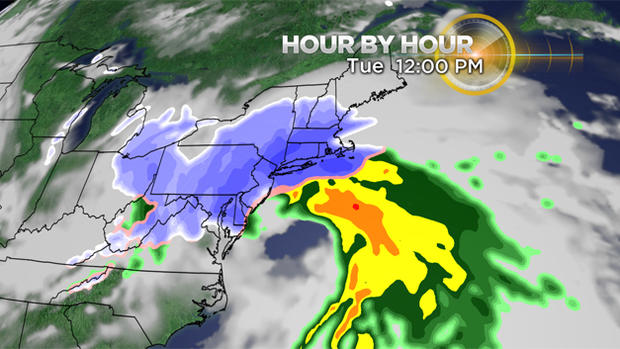
Heavy snow and near blizzard conditions will be reached for most by noon. After that, we may see a switch-over in precipitation type. This depends on the track of the low.
Snow should taper off as we go to Wednesday morning. Again, the exact timing is still uncertain.
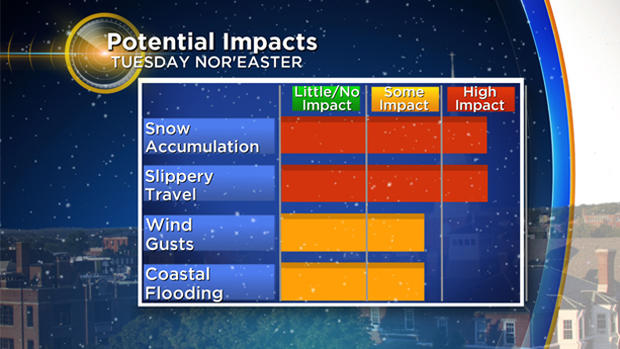
IMPACTS AND PRECIPITATION
Heavy snow is looking likely for most of us. However, if we get a more northern track, the Cape could see more of a wintry mix.
Still several inches of snow, but a mix or changeover to rain would greatly hinder the higher snowfall totals.
As for accumulation amounts? Well it's still too early since the track is so uncertain. Plan on around a foot of snow for most (give or take a few inches) and maybe two feet.
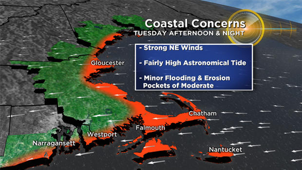
COASTAL CONCERNS
This will be a dangerous storm along the coast and for mariners. Wave heights Tuesday could be around 20 feet. That along with a northeast wind Tuesday afternoon, will lead to some coastal flooding.
Minor to moderate flooding is expected around high tide (1-2 p.m. Tuesday). Tides are astronomically high because of the full moon on Sunday.
The high tides late Tuesday night (1-2 a.m.) will still create some splashover, maybe minor flooding in the most prone locations, but the wind may change direction, coming more from the northwest. These are details that will be sorted out in the next couple days.
We are just as anxious to share the info with you as you are to get the details! Again, stay tuned for further updates from the WBZ-TV weather team as we anxiously read through the numbers and analyze the weather charts.
Follow Pamela Gardner on Twitter.


