Saturday Storm Likely Biggest Since 2015 For Parts Of New England
BOSTON (CBS) - After yesterday's appetizer, the main course of snow will be served this afternoon and evening. For southeastern New England, this will be the biggest snow producer since Valentine's Weekend of 2015.
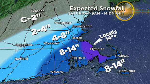
Boston's biggest snowfall last year was 6.8 inches on February 5 and today's event will release eight, possibly up to 10 inches, at Logan Airport. The lower totals will exist farther west and north of the city being on the outer fringe of the snow shield of the storm which will pass south and east of the so-called benchmark at 40N 70W.
This track suggests that all of the precipitation will be in the form of snow with no ice and rain lines to deal with and that is just fine for all of us forecasters. So the main issue will be the prediction of snowfall amounts. It will be a low density snow meaning it will be quite fluffy and easy to remove all areas except perhaps the outer portion of Cape Cod.
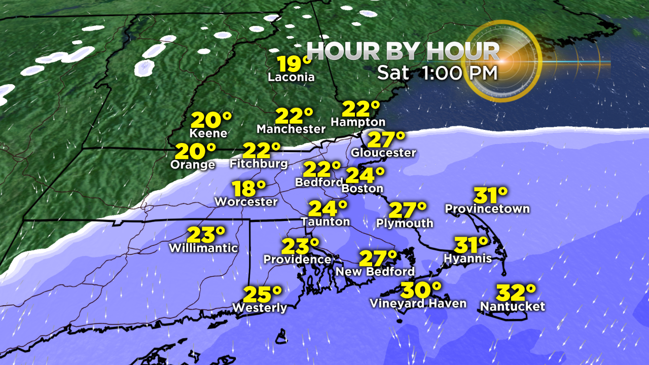
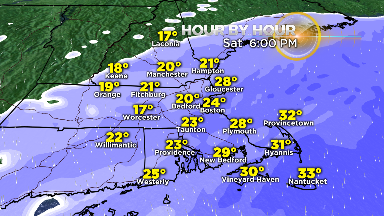
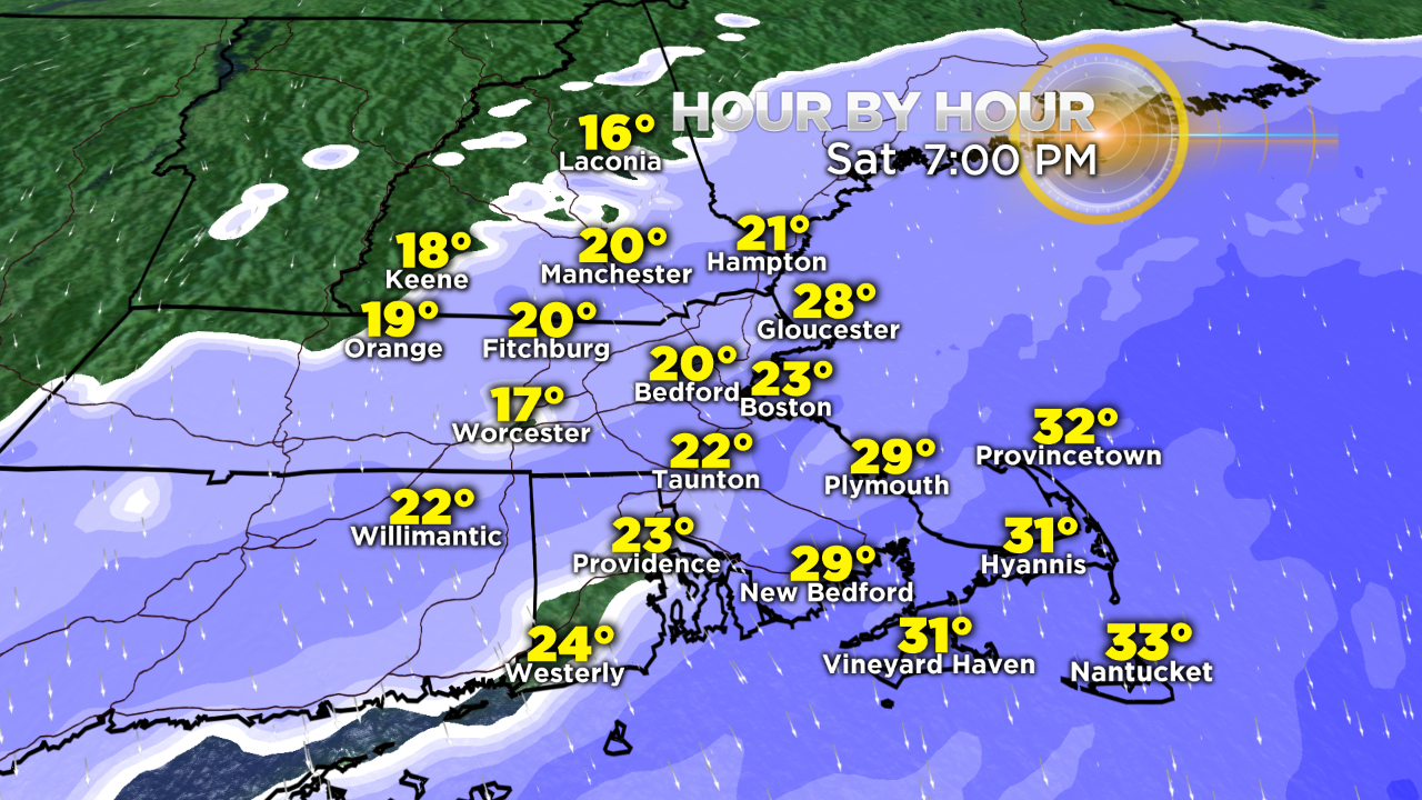
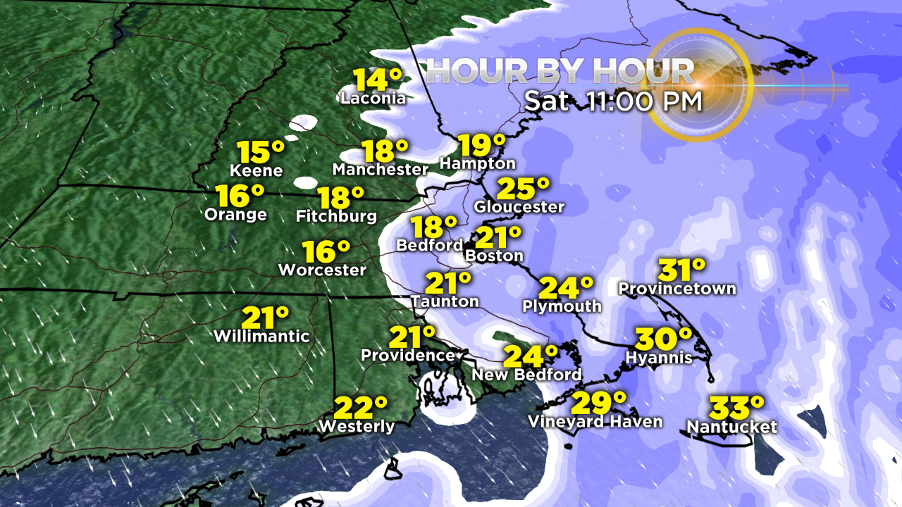
The flip side is that the snow will easily blow and drift with temperatures falling from the middle 20s back into the teens north and west of Boston this evening.
As a result, a low water content storm can still generate some impressive snowfall totals as was witnessed in the parade of storms which buried the region in late January and February of 2015.
This storm will be moving right along with no chance that it will slow down and get blocked.
TIMING:
A few spotty "ocean-effect" snow showers may break out along the coast this morning followed by the shield of snow associated with the storm expanding northward to cover areas up to and north of the Mass Pike by early afternoon.
The heaviest snow should occur between 2 and 10 p.m. when snowfall rates may ramp up to 1-2 inches per hour at times primarily over southeastern Massachusetts up into the Boston area to Cape Ann.
Farther north and west of Boston, the snow tempo will be mostly light to occasionally moderate.
The snow shield will track eastward so the back edge will be approaching the coastal plain late this evening and pushing offshore near or just after midnight.
WIND:
The north-northeasterly wind will strengthen during the afternoon and evening featuring gusts in the range of 35 up to 50 mph along the coast from Cape Ann to Cape Cod. The peak wind will likely happen over Nantucket and the lower Cape closer to the offshore storm where the pressure gradient is greatest.
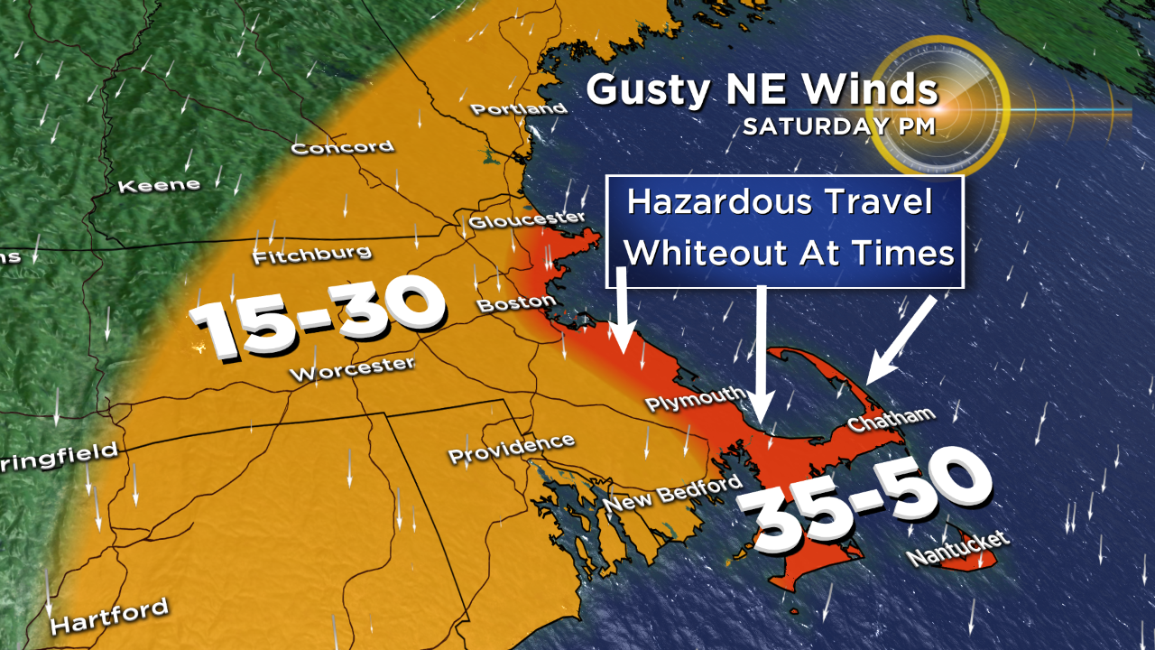
Consequently, there could be only scattered power outages mainly along the coast but plenty of wind for widespread blowing and drifting snow across the entire region.
Coastal flooding is NOT a concern as tides are astronomically low this time of the month. However, the gusty winds will generate rough seas later in the day and into tomorrow but, thankfully, no flooding is anticipated. By the way, the high tide is scheduled for just after 6 p.m. today and close to 7 a.m. tomorrow.
TEMPERATURES:
As the wind ramps up, the real feel temperatures will drop with single numbers tonight and tomorrow. It will continue to get colder tomorrow night although the wind will be decreasing.
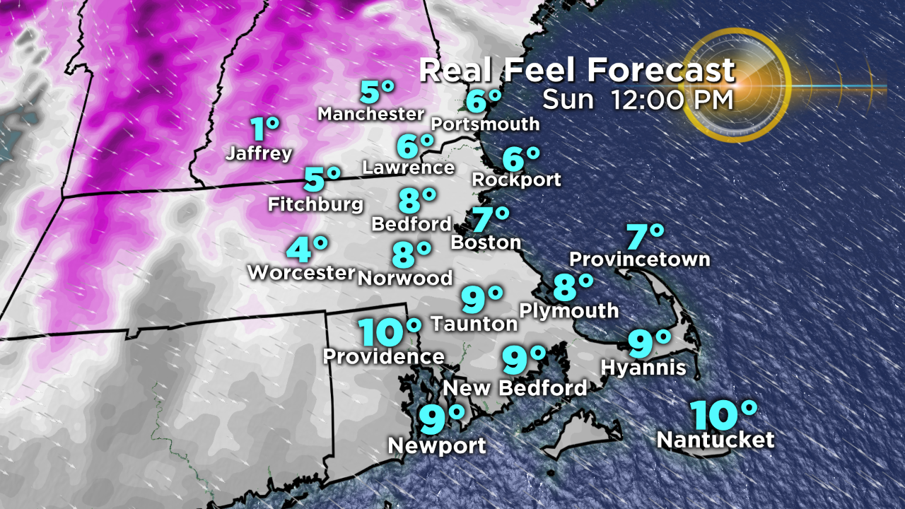
Therefore, the "real feel" will not drop so dramatically during Sunday night. When you head out to school and work Monday morning, a cold breeze will exist with the thermometers displaying 0 to 5 degrees and "real feel" temperatures slightly below zero.
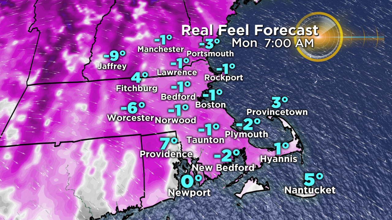
A few inland locations where the wind becomes calm before daybreak Monday, the actual temperature could drop a few degrees below zero!
The good news is that the potential exists for a genuine January thaw the second half of next week! There COULD be 2-3 days of temperatures in the 50s! So hang in there and bundle up until then.
Get subsequent updates on WBZ-TV, myTV38 and CBSBoston.com