WBZ Storm Watch: Snow Will Make For Tricky Travel Sunday Night Into Monday
BOSTON (CBS) -- The WBZ AccuWeather Team has issued our STORM WATCH/WEATHER ALERT for Sunday night into Monday morning. The reason for this is to alert you to the potential of tricky travel during that time frame.
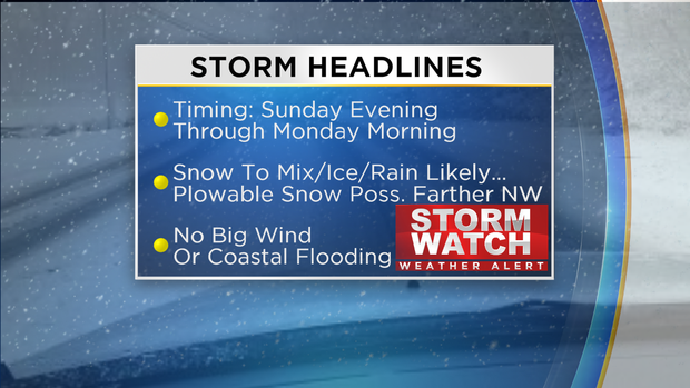
This is NOT a MAJOR storm but sufficient snow will fall to make for some treacherous travel primarily father west and northwest of Boston. There will NOT be any weather woes through Sunday afternoon. Flurries will break out and blossom into a period of light to perhaps moderate snow for much of the area Sunday evening.
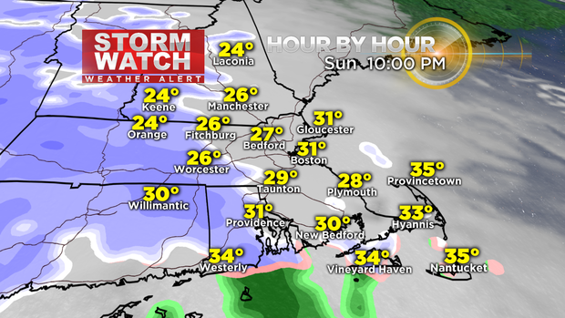
The snow will switch to rain rather quickly over extreme southern New England extending up onto South Shore communities. The rain line will gradually advance northward through the predawn hours keeping the snowfall at a minimum mainly south of the Mass. Pike and curling close to Boston up to outer Cape Ann.
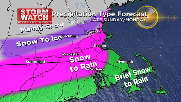
Meantime, farther west and north of Boston, the spell of snow should last longer resulting in some accumulation and plowable amounts primarily near and outside of the portion of I-495 which is near and especially north of the Mass. Pike.
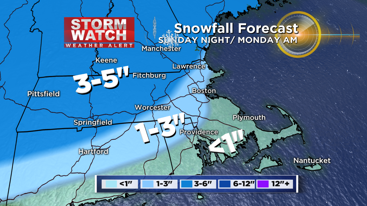
I think that the highest amounts of 4-5" are most likely across the northern Berkshires into southern VT, southern and central NH and southern ME away from the immediate coast. 3-4" totals are probable across much of northern MA west of I-495. There is a risk that cold air will be trapped in the lower levels down to the surface across this zone resulting in a period of freezing rain that could glaze over surfaces Monday morning during the commute before it warms above freezing at ground level and/or the shield of precipitation exits the area later in the morning. Breaks in the clouds are expected by sunset.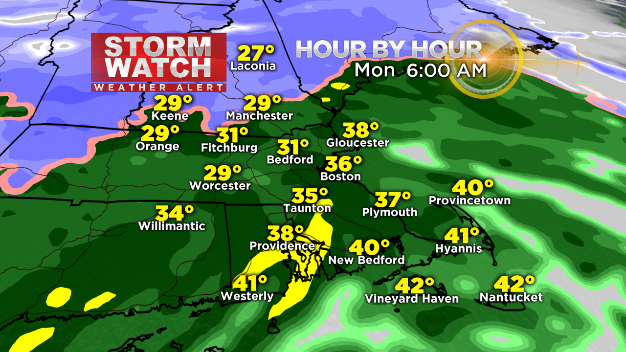
Storm Impacts:
Trickiest travel starting later Sunday evening through the predawn hours of Monday. A transition to rain plus crews treating the roads will produce improving conditions during the Monday AM commute.
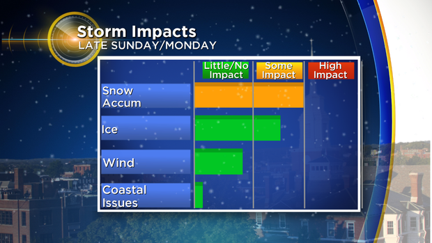
Many of the roads especially the major ones MAY be all wet over southeastern MA extending up into the Boston area westward into the I-95 corridor by 7AM. It will be more sketchy farther and farther northwest of Boston you might be traveling but improvement is due out in those zones as well as the morning progresses.
High Tides:
While no coastal issues are expected from this minor storm, the tide will be running extra high again this upcoming week due to astronomical conditions. The "spring tides" are being generated by the final supermoon in this series... the supermoon trifecta following the supermoons of October and November.
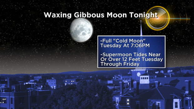
The moon will make a rather close approach to Earth again but not as close as last month but the tides are only a couple tenths of a foot below last month's levels. Consequently, you can expect high water in the marshes and flooding of the usual vulnerable low-lying shore roads within about an hour of either side of high tide. The tide is high around 9am Monday, 10am Tuesday, 10:50am Wednesday, 11:42am Thursday and 12:35pm Friday. Without any strong onshore winds through the whole week, thankfully, no serious coastal flooding and damage will occur.