Heavy Rain, Damaging Wind & Western MA Snow On The Way
A pretty potent system is heading our way, and will arrive as early as later on this afternoon. This is almost an "everything but the kitchen sink" storm, as areas of snow, locally heavy rain and damaging wind will all impact parts of New England over the next 24 hours. So let's break down the details…
Snow:
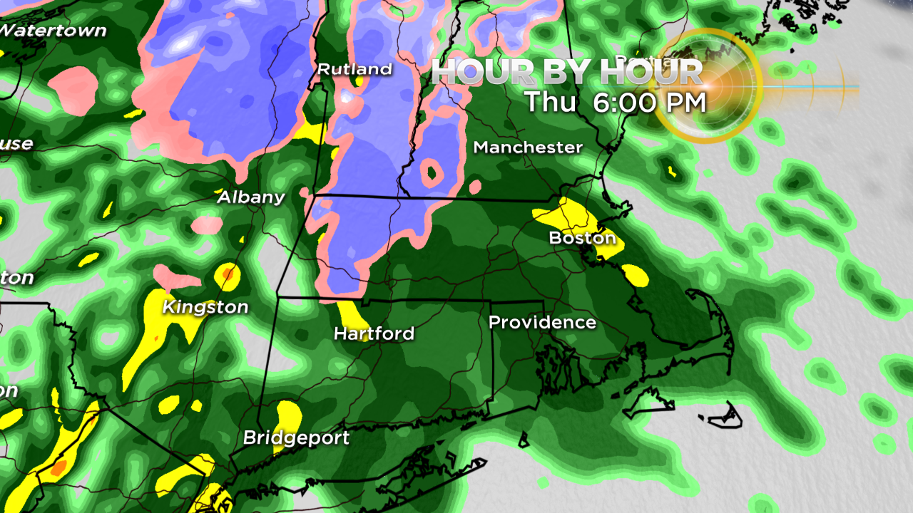
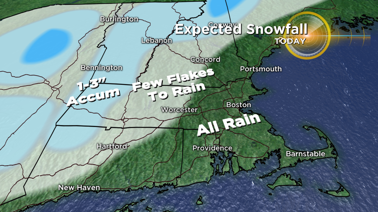
Areas of light to moderate snow continue to expand across parts of central NY & eastern PA this morning, and will overspread western MA by midday. Temperatures should be above freezing at that point, so accumulation will be mainly confined to grassy surfaces. As the snow picks up intensity a bit through the afternoon, temps in the Berkshires may cool back down enough for the snow to stick on some roads. In turn, slippery travel will result. Accumulations will generally run around an inch or two, although some 3" amounts are possible, especially above 1000' in elevation. The snow will transition to a chilly rain between about 6-8PM from south to north.
Rain:
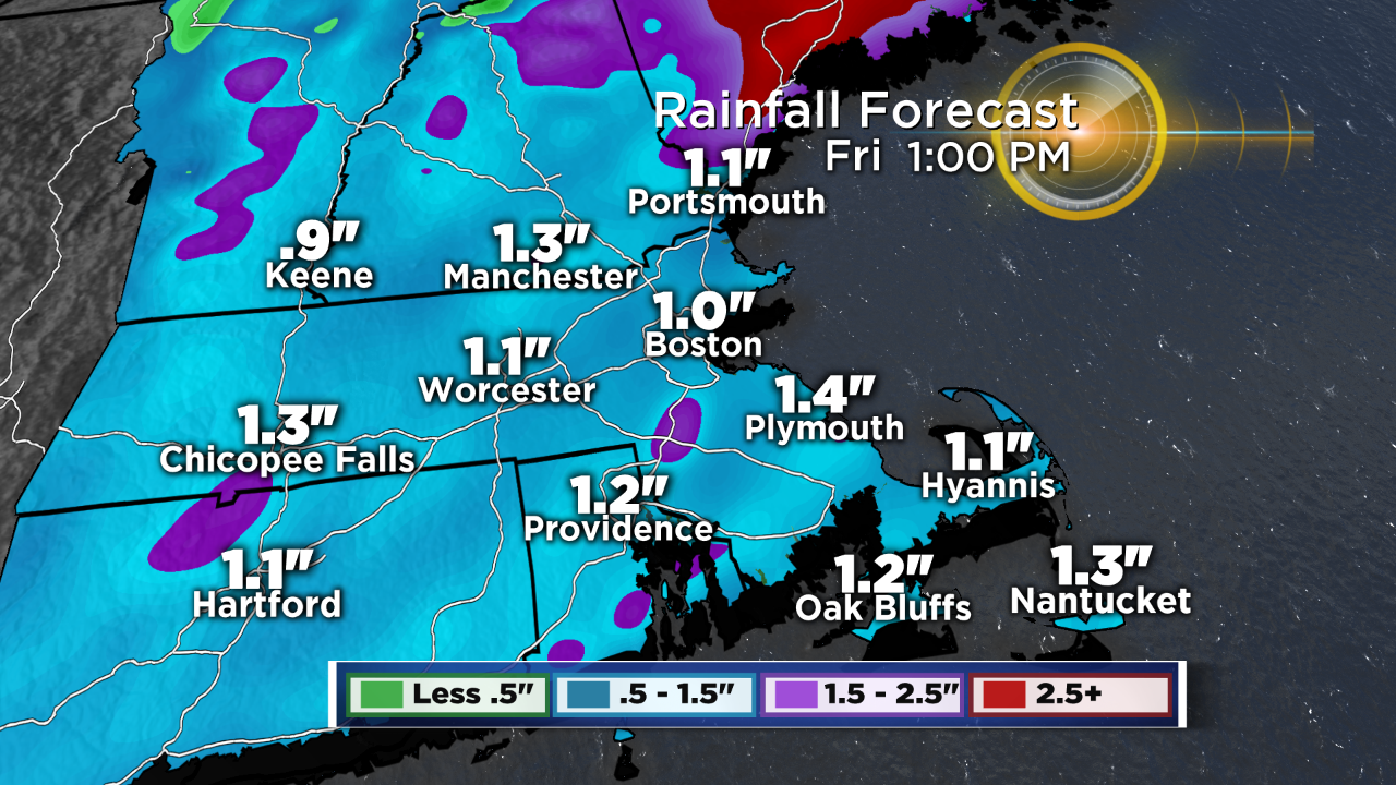
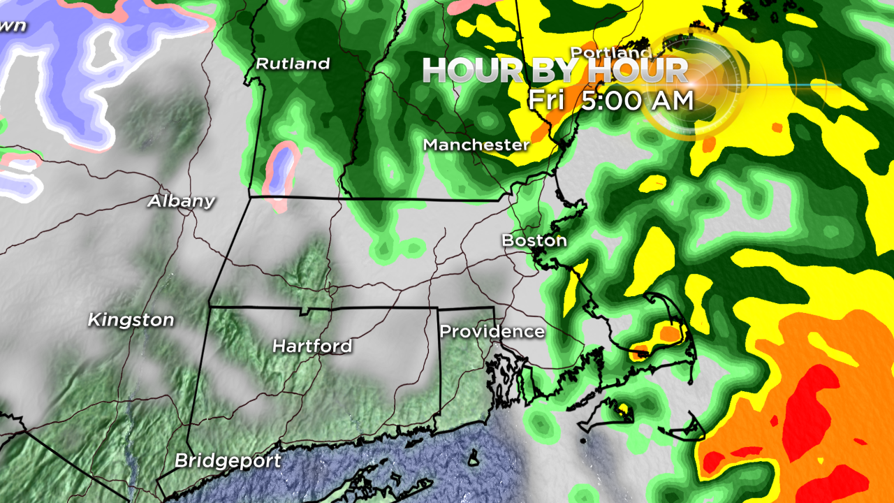
Even though it's a dry start, you'll want to pack the umbrella or raincoat for later today. A few spotty showers develop through midday before steadier rain fills in between 2-4 PM. The rain only gets steadier and heavier from there, with the brunt of the heaviest rain arriving after midnight until pre-dawn Friday. I wouldn't be surprised if some of us wake up to rumbles of thunder with embedded thunderstorms within the downpours overnight. Rainfall totals will generally be between 0.5" and 1.5", although some locally higher amounts will be possible where any thunderstorms develop. Some localized urban and poor drainage flooding will likely result. With lots of leaves on the roads now, keep in mind they become really slick when wet – so use caution for your morning drive. The good news is that the rain will be wrapping up between 5-7AM.
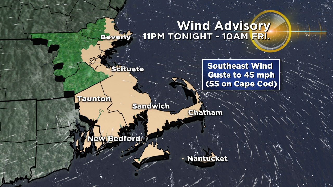
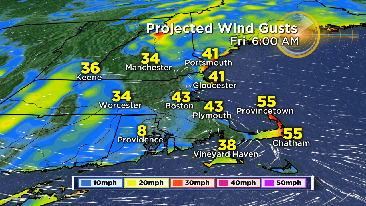
Wind:
The wind is going to ramp up from the southeast this evening and overnight, with the strongest core of wind passing over the region during the pre-dawn tomorrow. Inland gusts will top out around 35 mph, while far eastern MA can expect gusts to 45 mph. The highest gusts will be focused on the Cape and Islands where gusts will top out between 45-55 mph. Some isolated pockets of tree damage and outages will result.
As always, stay tuned to WBZ for the very latest, on air and online.
-Danielle