Stormy Friday? Severe Storms Possible To End The Week
Find Eric Fisher on Twitter and Facebook
Summer storm season has finally arrived after a tranquil and dry start to the season. Monday's microburst in the Plaistow/Haverhill area and macroburst in the Wellesley to Weymouth/Hingham area reminds us that while many storms are garden variety, there's always the chance nature will throw a brief fit of violence. After we soak up a few days of beautiful weather, storms will come knocking again to end out the week.
One thing Northeast forecasters are always wary of is 'northwest flow.' This is a pattern in which fast upper-level winds race down toward us, with embedded disturbances zipping through that flow. They can, if conditions are right, produce high-end severe weather events with wind damage being the primary focus. At this time, it looks like some of those conditions may come together this week. We have a huge ridge of high pressure building across the middle of the country, but not quite all the way into the Northeast. You can see how a blast of upper-level wind is pointed right at us, which can act as a railroad track for storms.
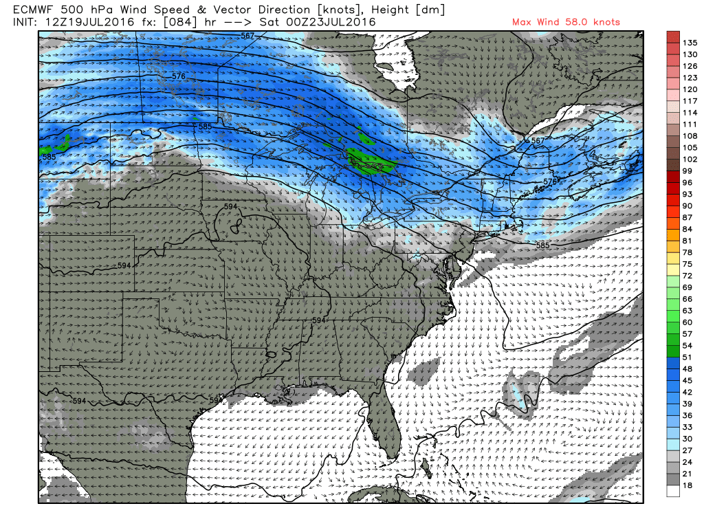
Wind speeds at 500mb on Friday evening. Can easily spot the huge ridge over the middle of the country, while a blast of stronger winds aloft move down into New England. Source: Weatherbell
So we know that we have wind energy in the atmosphere. In fact, there's also some turning with height, or 'wind shear' forecast for Friday. Surface winds look to be southwesterly, and so although our main focus would be on damaging straight-line winds, isolated tornadoes could also be possible. What about the rest of the ingredients? Well one thing we're currently enjoying is dry air! It feels fantastic out, and humidity will be slow to return. In fact, it will just be starting to kick in on Friday as high pressure drifts offshore and southwesterly winds increase. We're also in a drought, and it's been interesting to watch how our little area has been able to dry out more than all surrounding areas over the past couple of weeks. There have been several occasions when dew points have soared into the upper 60s/low 70s around us, but stayed in the low 60s locally. Drought begets drought, as the saying goes. Indications are that dew points should be able to recover into at least the low 60s on Friday. It's not 'ideal' if you're looking for severe storms, but would likely be enough.
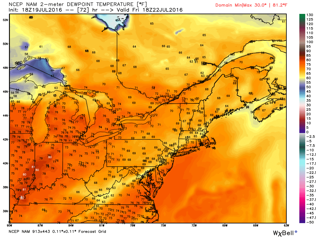
A look at what the NAM is currently showing for dew points Friday afternoon. Source: Weatherbell
That humidity helps to play into instability. Right now, the Euro EPS is indicating a good probability of CAPE over 1000J/kg in the area (particularly NW of us). That's enough fuel to get strong to severe storms, but some of it hinges on that moisture return. It also hinges on how hot we get, which is a product of how fast this system drops down out of northern New England. If it arrives right at peak heating in the mid-afternoon to early evening, we'll be ready to rock. If it speeds up and swings through earlier, we won't tap the full potential of that instability. Often times, the strength and lasting power of storms all comes down to a couple of hours difference in arrival time.
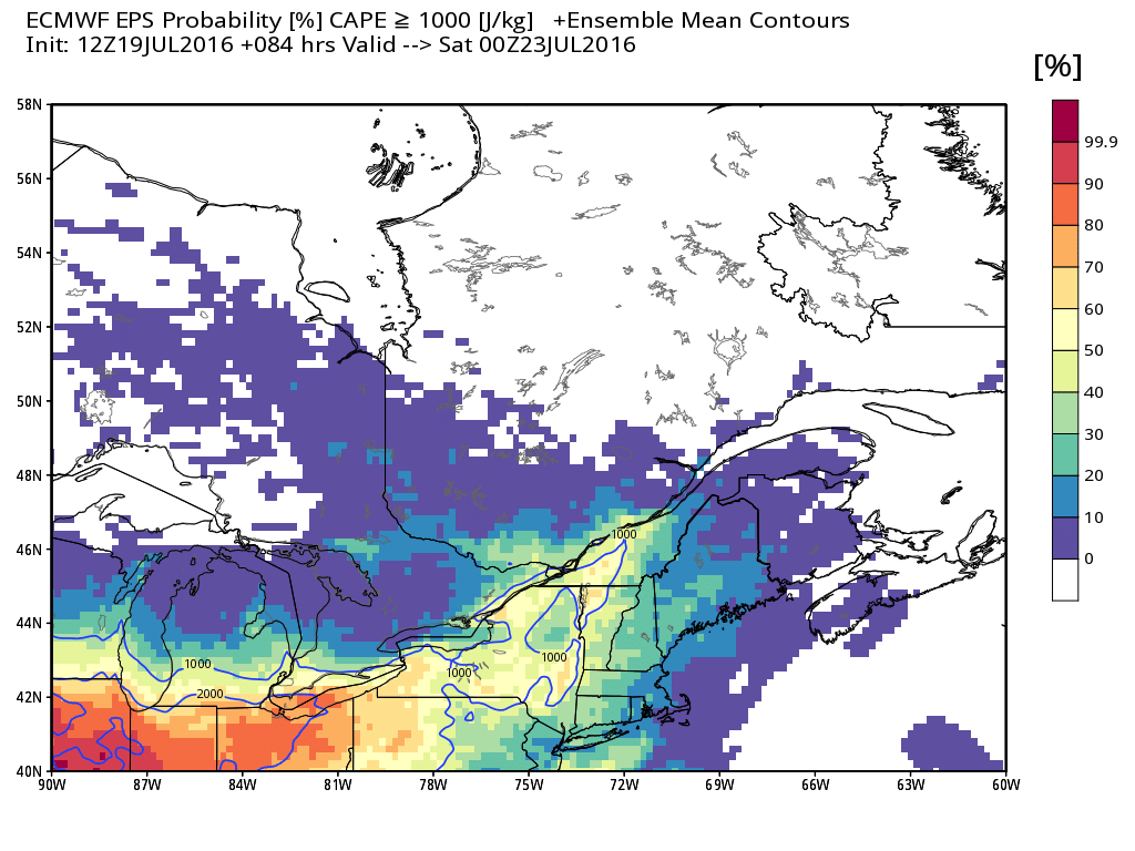
ECMWF EPS probability of CAPE > 1000J/kg on Friday. Source: Weatherbell
Something else we watch out for, particularly in northwest flow situations, is an EML - an elevated mixed layer. Think of this as the atmospheric profile starting over. In these cases there is usually a strong 'capping inversion' to start with at the surface, where temperatures actually get warmer as you move up in the atmosphere. But then, at the top of that capping inversion, lapse rates (the rate as which air cools with height) become steep. Once a capping inversion is broken (with daytime heating and/or strong forcing) you tap those steep lapse rates and storms can rapidly go severe. These EMLs can form thousands of miles away, toward the desert southwest or the Rockies. They advect, or move, well off to the east and often stay intact for the whole trip! There are hints that we'll have an EML in play on Friday, which is a pretty key ingredient for severe weather in New England. Something to keep tabs on.
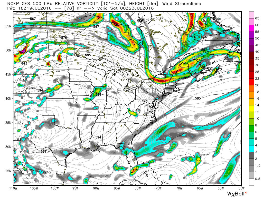
GFS showing a strong disturbance digging in across New England on Friday. The exact timing of its arrival is still in question. Source: Weatherbell
It certainly appears that we'll have a significant mid-level disturbance moving through the flow on Friday, diving down across New England. Again, the key here is timing. Too early in the day and we won't tap max heating potential. Too late and we may get storms, but lower end. A little farther north, and the main push of severe weather may stay up across New Hampshire, Vermont, and Maine.
So we still have somethings to work out when it comes to timing or exact placement. But I'd ring the bell that damaging storms are a decent likelihood on Friday afternoon, and we'll keep updating the forecast as we move through these next couple of days. If you have any Friday afternoon or evening plans, keep an eye on the forecast.