Tired of Beautiful Weather Yet? Yeah, Me Neither
Find Eric Fisher on Twitter and Facebook
Okay, as a meteorologist this article needs the disclaimer that we're getting very dry. Drought conditions are cropping up, as addressed in a previous blog post. BUT...if you ignore the lawns turning brown...this has been pretty sweet. We've had a great month of June, last weekend was arguably the best of the year so far, and we're going to make a run at more of the same this coming weekend. So if you haven't put on your flippy floppies yet, get ready for some prime pool/beach weather for the next few days.
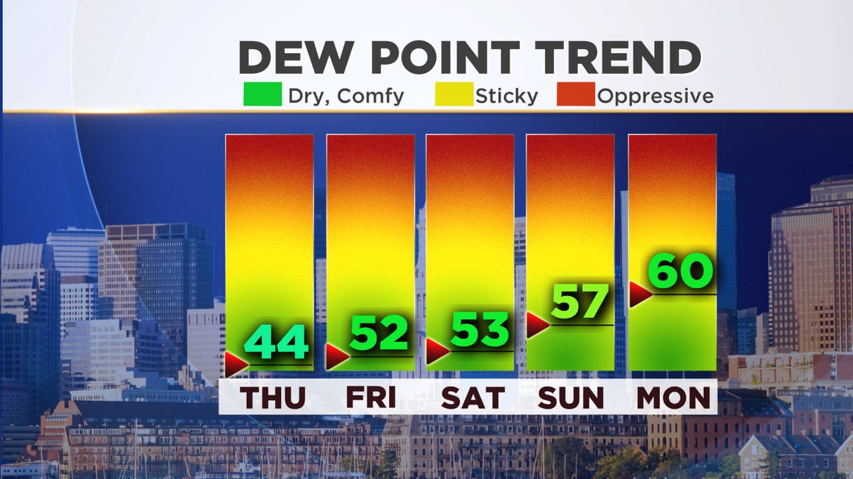
The real creme de la creme of this stretch will be Friday through Sunday. High pressure just sits right over the top of us for several days, keeping skies bright and rain away. This position does a couple of things. First of all, it keeps humidity from building. Without a 'Bermuda High' setting up off to our southeast, we don't see big influxes of muggy air. The average high position this month has been OVER New England, not off to the side. More of the same will keep dew points in the 40s and 50s through this weekend, rendering humidity a non-factor by summer standards. That dry air allows us to cool off at night, even after a warm day. So most will drop below 60F each of the next 3-4 nights.
High pressure overhead also helps to relax the pressure gradient, which is going to bring sea breezes into play Friday and Saturday. Natural AC will keep highs from reaching 80 near the coast, while inland areas soar up into the (mainly) middle 80s both days. That's about as good as it gets!
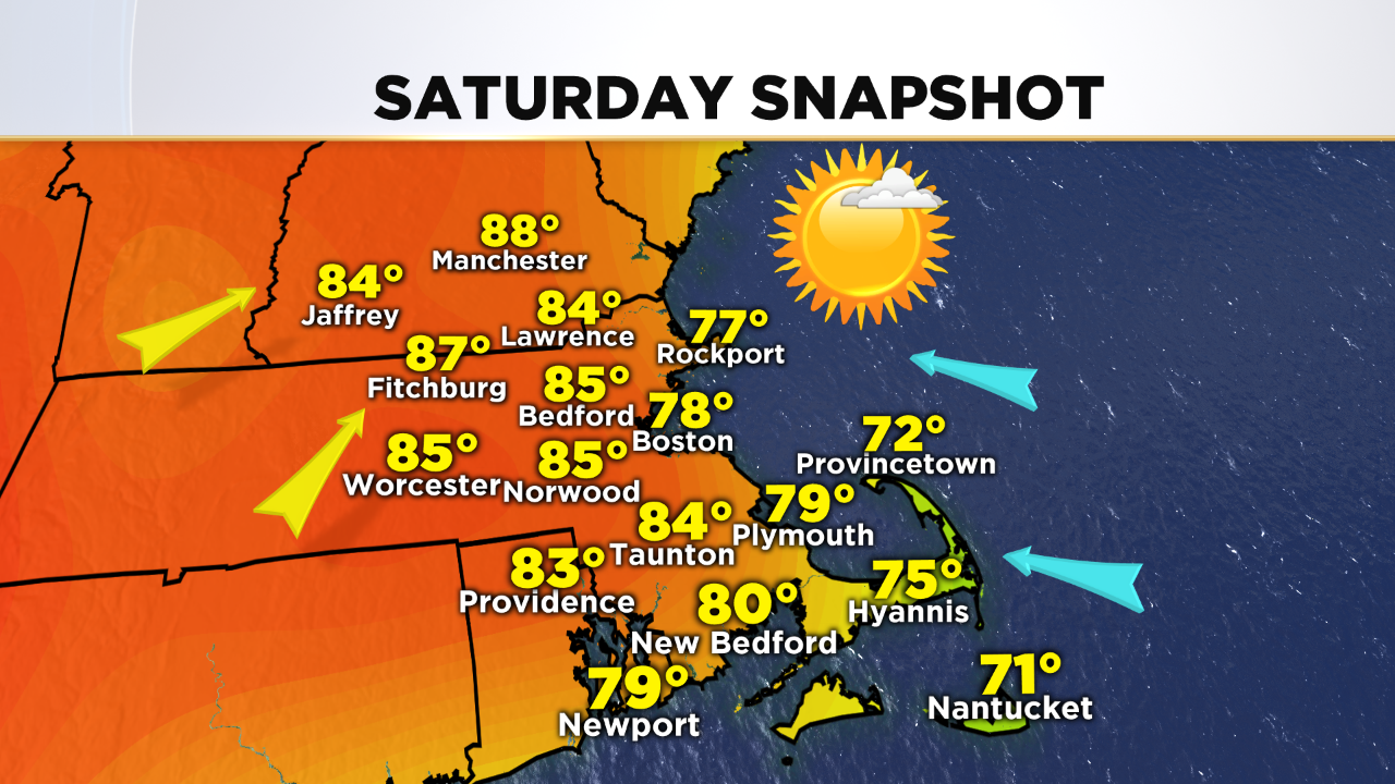

The same high drifts a little farther east on Sunday, which will turn the wind direction more southerly. Warming air will allow temps to top 90 degrees inland, especially in the Merrimack Valley and southern New Hampshire. Meanwhile, South Coastal communities and the Cape/Islands will stay cooler in the 70s with the wind off the water. Our dry weather plays a role in the overall warmth - with little soil moisture and low dew points, it's easy to 'overachieve' over these next few days. That makes for peak temps in the mid 80s Friday, upper 80s Saturday, and low 90s Sunday for inland locales.
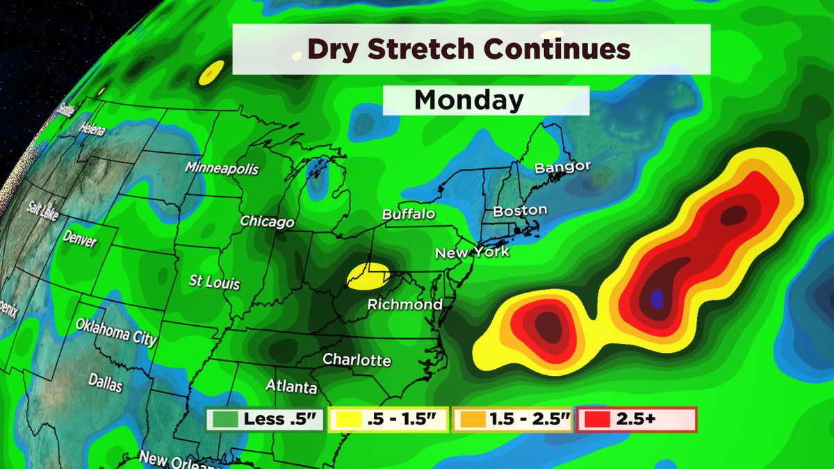
Another day over 90 looks likely for inland areas on Monday to kick off the final week of June. There's a *low* chance that a few towns NW of Boston could get an official heat wave, if they can manage to hit 90 on Saturday. We'll also start to bring in higher dew points and humidity by Monday, and especially on Tuesday. At the same time, a cold front approaches from the west by Tuesday, which is our next chance for any rainfall in the area. We'll have to hope this one can stir up some decent thunderstorm activity to drench the area, because it should be looking pretty crispy by that time.
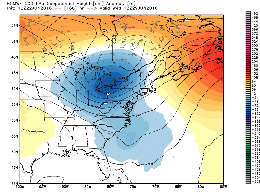
Approaching trough will bring thunderstorm chances next Tuesday and Wednesday, hopefully offering some much-needed rain. Source: Weatherbell