Beyond The Forecast: Severe Weather Unlikely Saturday With Nice Week Ahead
BOSTON (CBS) – I am extremely happy to say that the threat of especially strong to severe thunderstorms is almost zilch today! Hooray!
These convective characters are always beyond annoying for us forecasters. While research by brilliant scientists have provided much new knowledge about their makeup and existence and modern technology enables us to pierce into their inner cores, the reality is they still exude uncertainty in numerous ways. With the constant changing state of the atmosphere, these beasts cycle rapidly as the veritable array of parameters gyrate. From the weather recipe box, we closely monitor the ingredients paramount in the production of severe storms and tornadoes. It is all about the delicate balance of these ingredients to complete the recipe and that creates sudden and explosive development sometimes.
The goal of the National Weather Service and private forecasters is to provide timely information for public safety. As great as the science and technology has become in more accurately predicting severe weather, it is not good enough yet. The Doppler Radar now has the ability to detect rotation occurring within thunderstorms. Warnings are disseminated when rotations are detected but not all rotations descend to the surface creating an official tornado! Perhaps you have become aware of the increase in warnings over the last two or three years. It has nothing to do with climate change. These rotations have always existed within some thunderstorms. Now we have the technology to detect them but the science and technology is incapable of determining positively if a touchdown will occur with some of these rotations aloft. Consequently, NEVER ignore the warnings!!
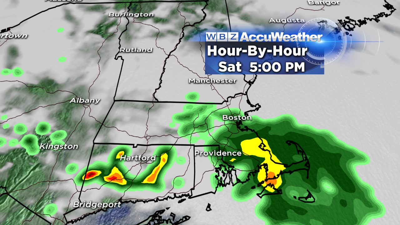
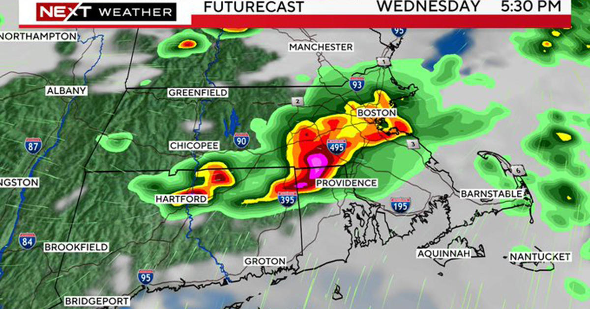
Based upon current and predicted conditions, that, thankfully will NOT happen today. There is a slight risk that a few stronger thunderstorms could percolate over CT and points west and south late this afternoon and evening where conditions are more favorable in a more unstable environment closer to the warmer and more humid air. Meantime, an impulse diving southeastward from southern Canada initiated a cluster of showers that will continue to shift southeastward across southern New England this afternoon. There could be some embedded lightning and thunder mainly near and south of the MA Pike with this batch. Most areas will receive up to a couple of hours or so of rain. Fortunately, this initial package of rain will limit the surface heating and instability across our region.
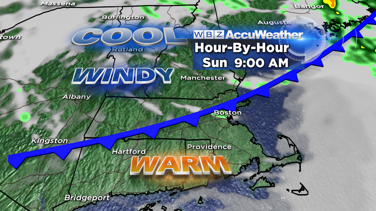
Although I cannot totally rule out a few isolated showers and storms overnight as it becomes more humid, a strong cold front will be closing in on the Boston area around 9am tomorrow. There is a slight risk of a shower or storm with the front then the wind will shift to west-southwest and gust to 35 mph as dry air rushes into the area. Sunshine will give way to lots of clouds streaming in from the northwest later in the afternoon as the temperature falls back several degrees from the midday 75.
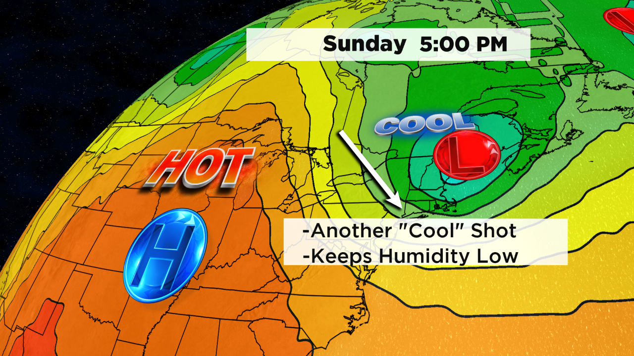
We receive another cool shot on Monday with a slight risk of a brief passing shower in the cool, unstable air. After that, it will turn out to be a terrific week with pleasantly cool nights for sleeping and mild to warm days from 75-80 or so in nice dry air through Saturday.
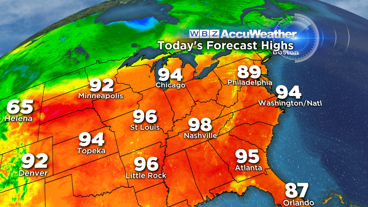 Looking way ahead, this hot weather that is currently baking much of the country probably break loose and arrive here for a couple of days starting on Father's Day! While it is a week away, most current signs suggest that temperatures nudging or exceeding 90 may occur! We shall see.
Try to appreciate this needed rainfall today and get ready to enjoy a nicer day tomorrow despite the gusty wind.