Round 2: Heavy Rain, Damaging Wind Gusts On The Way
Well Part 1 of our storm didn't cause too much of a disruption here in New England, but Part 2 could create some issues tonight into tomorrow. The moisture and energy from the second round was responsible for deadly tornadoes and severe weather along the Gulf Coast states last night. The threat for severe storms extends up and down the eastern seaboard today, with the highest risk over eastern North Carolina and Virginia. While we may see some isolated strong thunderstorms here at home tonight, I'm not anticipating any widespread severe weather in eastern New England.
So let's dive in, starting with the rain first…
Timeline:
Light rain and leftover drizzle with be with us this morning, along with patchy fog. It won't be pouring the entire day, but a batch of steadier rain with a few downpours will fill back in during the early to mid-afternoon. Your evening commute will feature areas of rain, generally light to moderate as we wait on the heaviest band to push in.
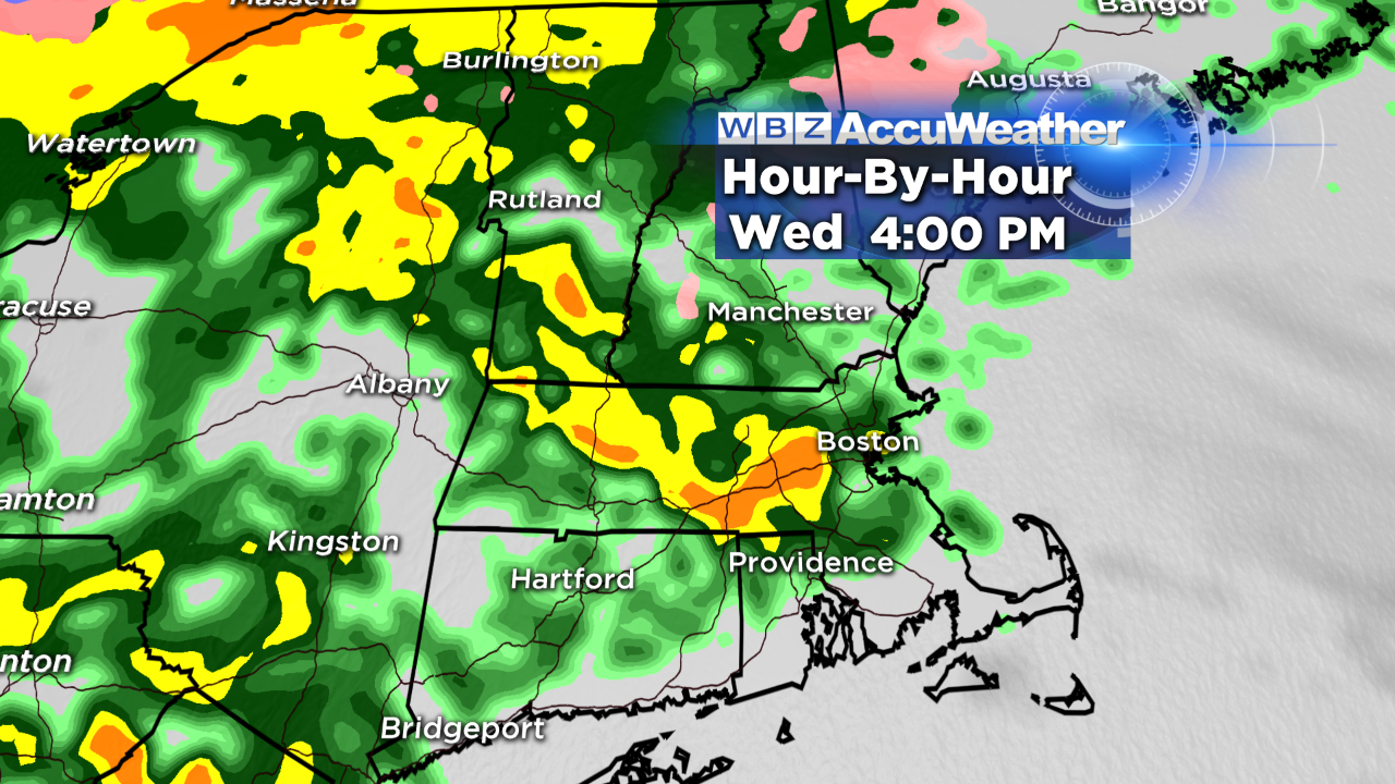
That band arrives after midnight tonight from west to east. It is going to absolutely pour – there's a decent amount of instability in our atmosphere too, so embedded thunder is a possibility. The great news is that this squall line is fast moving – so it sweeps out of here quickly during our Thursday morning commute.
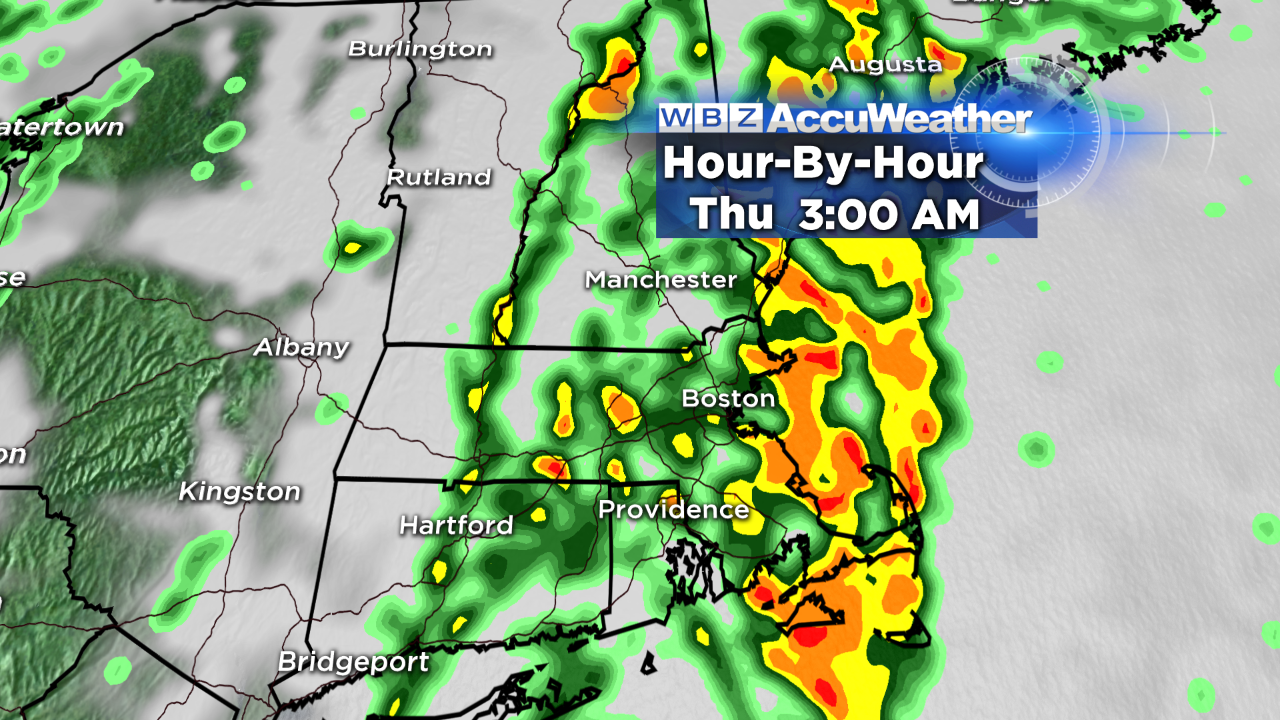
Rain ends around 5AM in Worcester, 6 AM in Boston, 7AM in southeast MA, and between 8-9AM on Cape Cod. In other words, the tail end of morning rush hour will feature some improvement. Breaks of sun may actually emerge in a few spots by the late morning. Totals will range between 0.5" and 1.5" for most of eastern MA with locally higher amounts (over 2") in the lower Connecticut Valley and Berkshires. River flooding isn't expected, but some typical poor drainage flooding and urban flooding is likely.
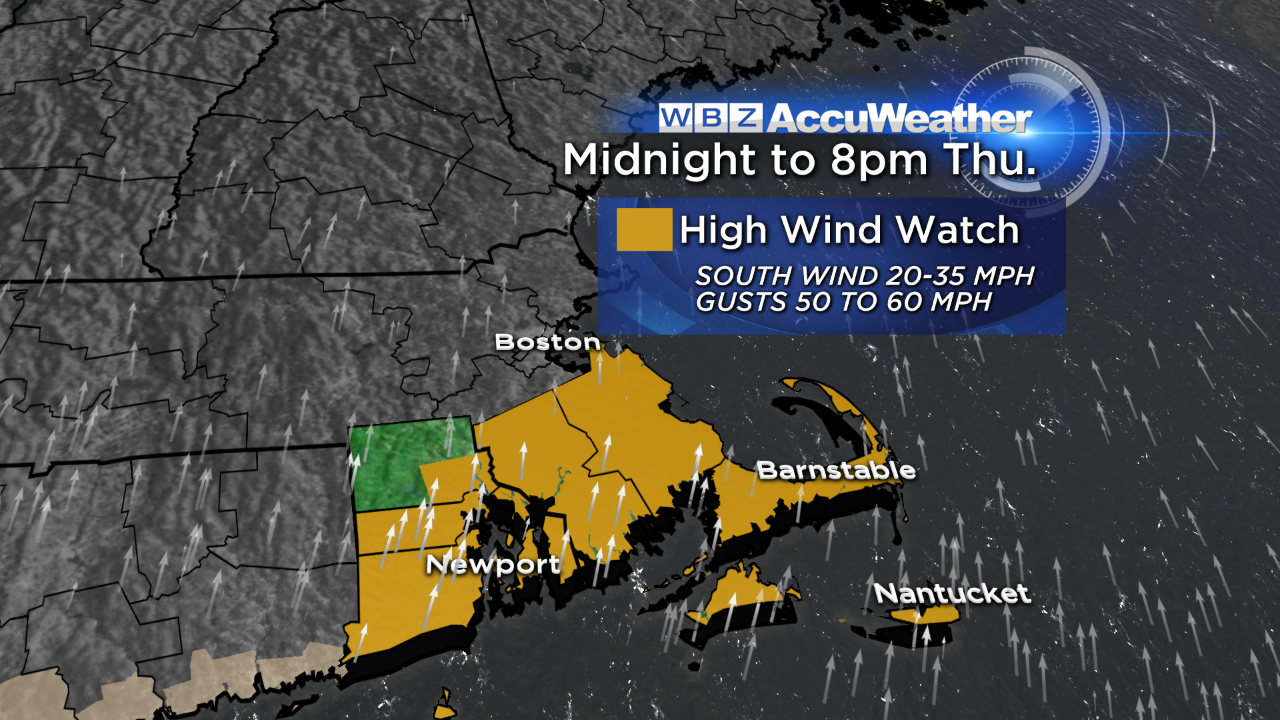
Wind:
Since the rain is going to be out of here so early, the biggest impact you'll notice tomorrow is the wind. There are two time frames of concern; the first is between 2-6AM where gusts 50-60 mph (coinciding with the heaviest rain) could cause scattered pockets of damage/outages. Then 4-8 PM, another blast of wind gusts 45-55 mph is possible in southeastern MA.
Temperatures:
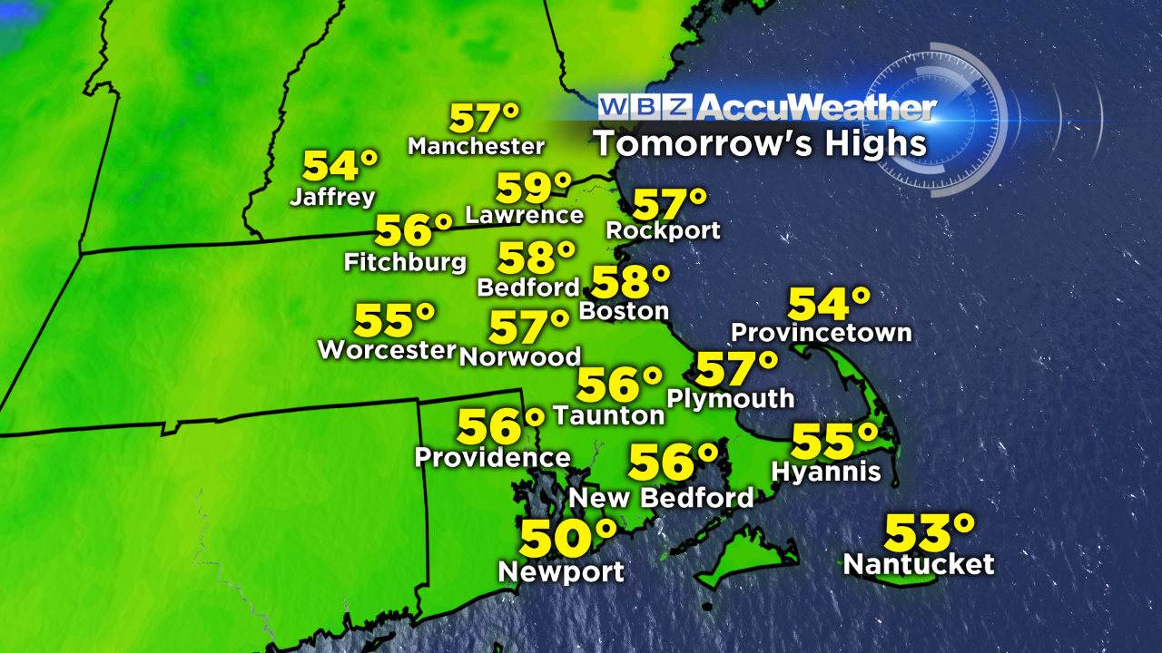
Any lingering icy patches outside of 495 will melt away through midday today as temps gradually rise. We'll be in the 40s this afternoon in most communities, with some 50s south of the MA Pike. Tonight, we continue to rise…through the 50s to near 60 by the morning! We stay in the 50s tomorrow afternoon before tumbling by more than 20 degrees on Friday. The weekend is looking good with seasonal temps Saturday and another warm up for the start of next week.
-Danielle