Tracking Trouble?
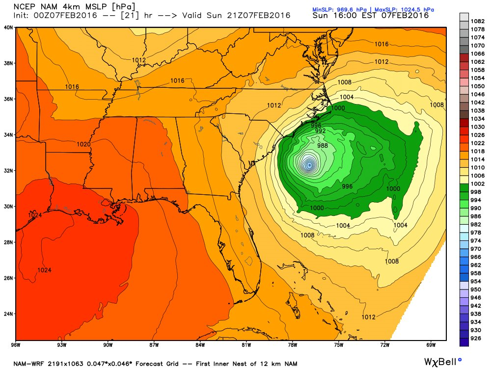
 The beautiful balmy days of earlier this week are gone with the wind and a new pattern has taken over as introduced by yesterday's 4-12" of snow. The potential exists for several snowy events over the next couple of weeks. This is typical under a weakening El Nino that is taking on a Modoki look meaning the anomaly of warmest sea surface temperatures exists over the Central rather than the Eastern Equatorial Pacific. Anyway, it remains to be seen how many of these will materialize for a direct hit. The first one in focus is still somewhat fuzzy in how it will ultimately impact our region. It will intensify explosively off the FL/SC Coast today.
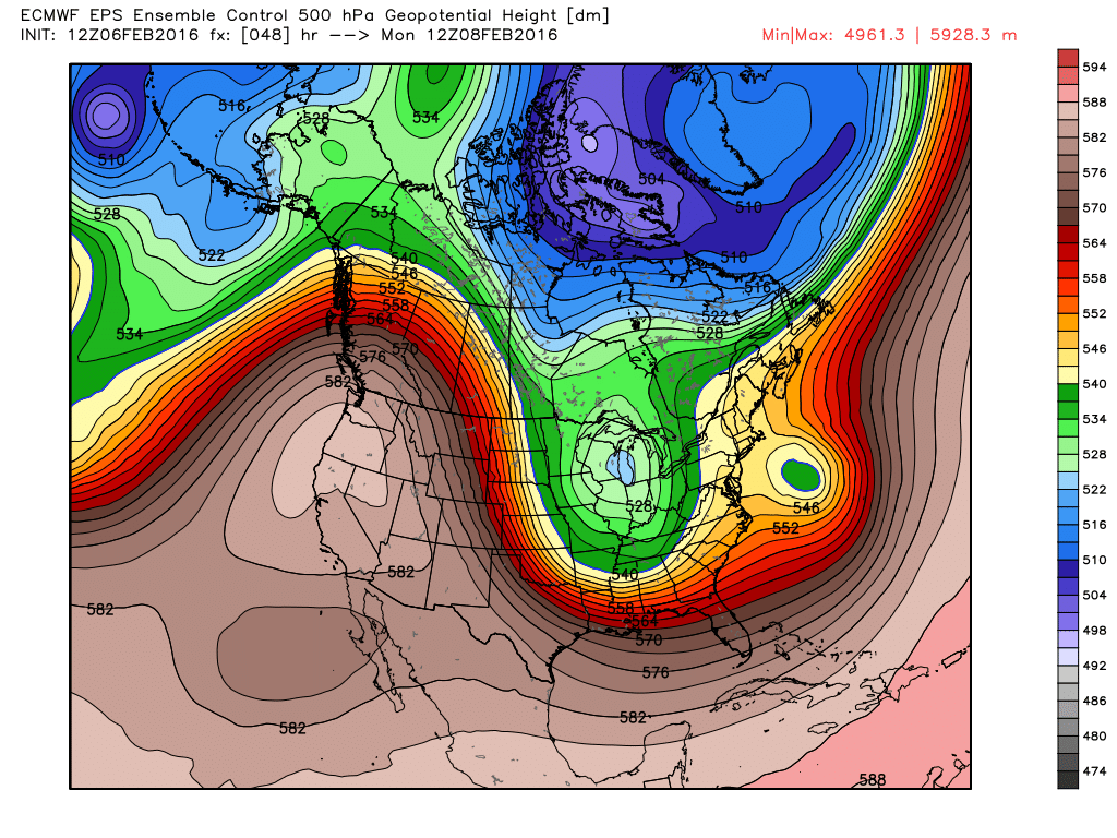
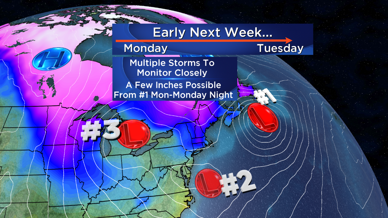
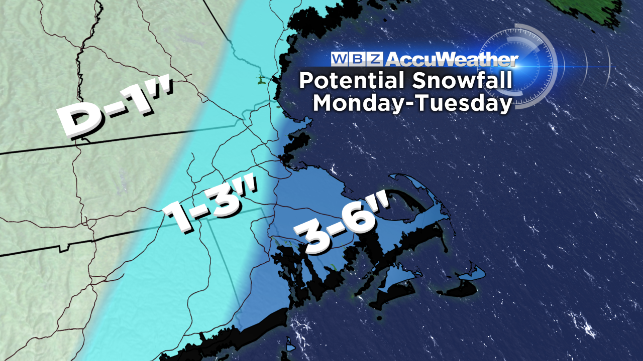
The southern stream of the jet has been very active in this El Nino season and will continue to provide action going forward. The energizing disturbance in the southern stream will track way out to sea well south of New England but as it takes on what we call a negative tilt, the outer bands of snow are destined to spiral toward New England. The snow will spread into southeastern MA first thing Monday morning. It may be warm enough to support rain initially on Cape Cod. The bands will expand northwestward to reach the Boston area before noon tomorrow then proceed into central MA up to southern NH in the afternoon. The snowfall totals will be greatest over southeastern MA where a few pockets over 6" are possible. On the outer fringe of that vicious storm, northeast to northerly gales are expected certainly over the Cape extending up into coastal Plymouth County. Consequently, some minor to moderate coastal flooding is possible tomorrow primarily south of Boston.
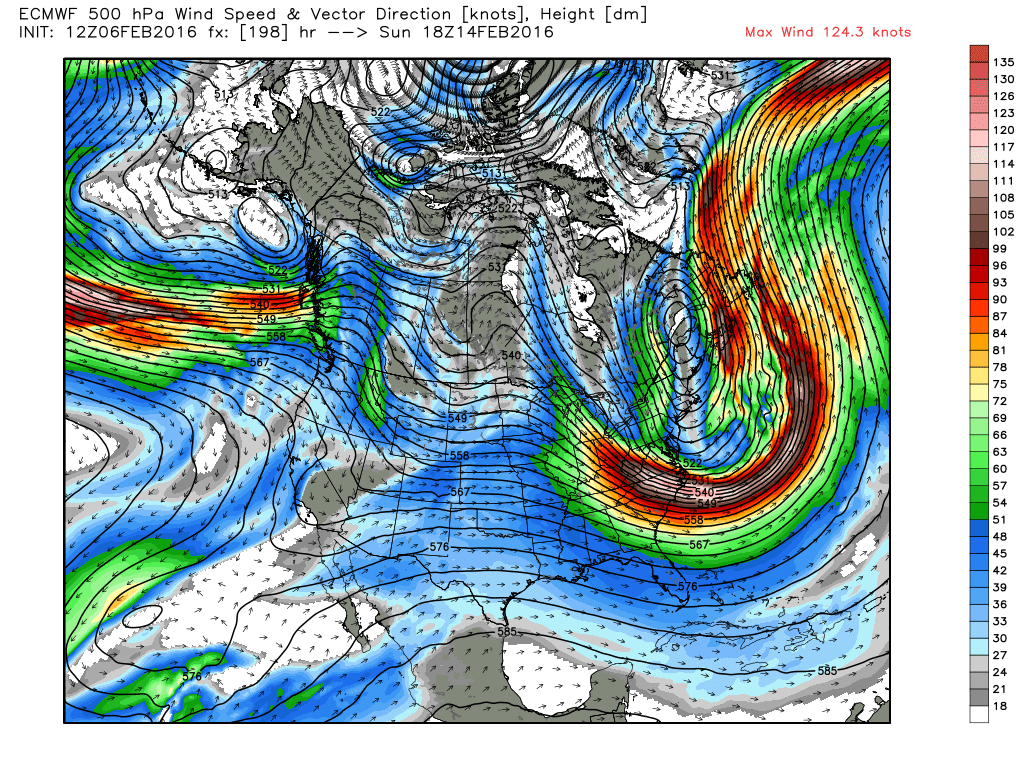
Subsequent systems could release some spells of light snow or flurries on Tuesday and again on Thursday but these are both projected to remain quite weak. I am not expecting any big weather issue for the NH Primary- just some areas of light snow or flurries. Beyond that, we'll be keeping an eye on a Polar Vortex cutting loose and shifting into southeastern Canada late in the week. This action would propel a mass of extremely cold air right into the Northeast on Valentine's Day weekend! Daytime highs MAY be only near 10 degrees on Saturday and closer to 5 on Sunday!!! Widespread subzero readings are possible next Saturday night. Boston's record low on February 14th is -3 set in the coldest February ever, 1934. Hopefully, this scenario will change a bit in the days ahead and we will not be blasted directly by this arctic air. In the meantime, enjoy a delightful Sunday with highs of 42 degrees causing more melting.
More information later today. Enjoy the rest of the weekend... and the Super Bowl here on WBZ.