Weekend Storm - Latest Trends For Saturday
Find Eric Fisher on Twitter and Facebook
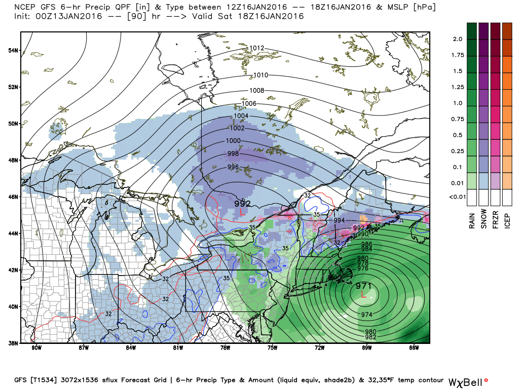
This would be a spectacular waste of a 'benchmark' storm. A classic snowstorm position and models hinting at quite a bit of rain (this being one GFS run late Tuesday). Subsequent runs have trended a little farther east. Source: Weatherbell
It's not too often you get a full blown nor'easter bombing out off our coast in mid-January...and get rain. But that's what it's looking like for many of us on Saturday. A fairly bizarre turn of events considering A) we have single digits out there Wednesday night B) it's the middle of winter C) we're in a -NAO/-AO pattern. But weather can be fun/frustrating like that. Wanted to post a short update here on the trends we saw on Wednesday.
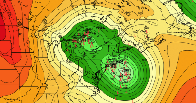
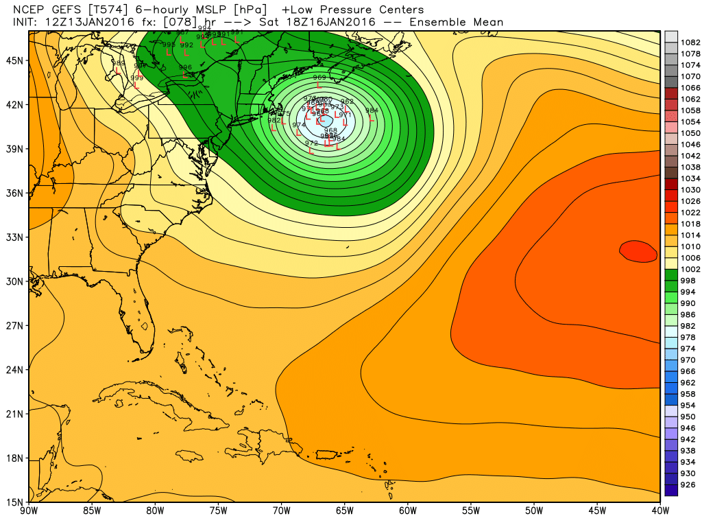
GEFS clustering is well east of Nantucket, while the ECMWF EPS shows two clusters (one southeast of the benchmark, one right up through Long Island). Source: Weatherbell
The biggest trend today was a track farther east. The GFS operational started to move farther out to sea, as did the ECMWF. The NAM is a complete miss. Additionally, the GEFS strongly showed a farther eastward track. The ECMWF EPS members showed a slightly different story. There are two clusters of solutions - one well to the east and another right up the chute into southern New England. One (the out to sea) track would bring us just the edge of the storm, the other full blown rain. Neither are all that wintry.
I do still think that a dynamic and rapidly deepening system could help cool the air column and bring some wet snow, but we would have a difficult time accumulating much of it. Clouds will fill in rapidly Friday night, cutting off radiational cooling. So we won't be getting much colder than 28-34F for lows. We also have a moist flow of air advecting higher dew points in, so there isn't much opportunity for wet bulbing once the precipitation begins. Models are projecting a marginal air mass near freezing at 850mb, but all the air 2,000+ feet below it is above freezing. And our winds will be southerly/southeasterly for the two days leading up to the event. The final mitigating factor - no cold high to help at least drain some cold down into southern New England.
So yes, a storm undergoing bombogenesis can certainly help 'create' some of its own cold air. But there's a lot to overcome. Even if it does, surface temps above freezing for most would keep snow ratios very low (think wet, sloppy snow) which has a tough time accumulating without long duration and/or intensity. That would help to limit overall impact.
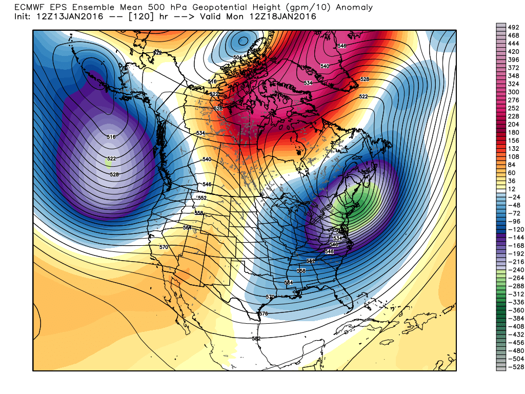
As for the -NAO part of this, yes there is blocking. But it's not in a good spot. The blocking in this situation is displaced more westerly toward the pole, allowing this storm to rip on out to sea. Typically in a -NAO setup blocking can slow the storm down...but that won't be the case here. This storm arrives late Friday night and is gone by early afternoon on Saturday.
So here's where we stand for now. I'll write up a more in-depth analysis on Thursday with any potential snow totals and exact timing. Should all be gone before kickoff at Gillette!