Milder Days Ahead
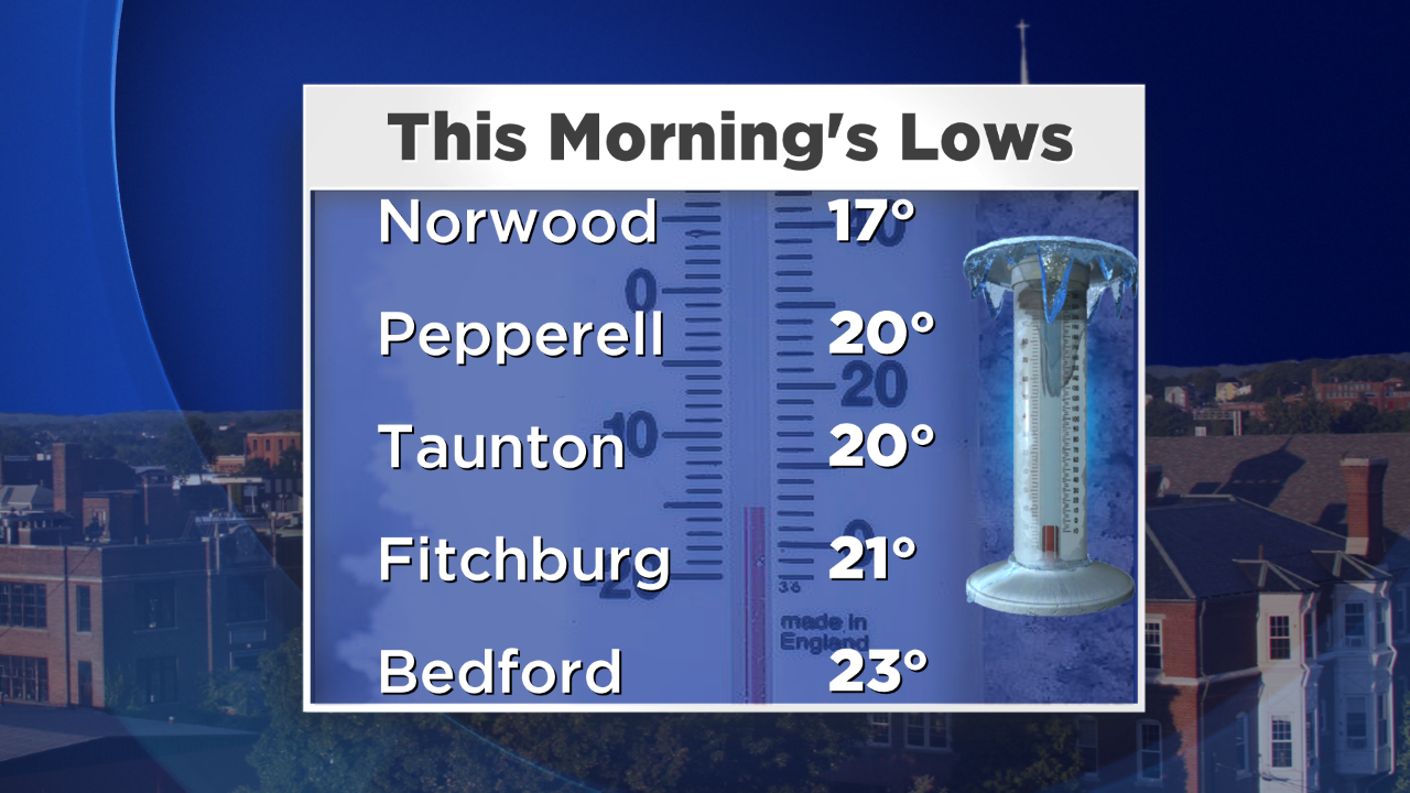
It was cold Monday morning. Really cold. Worcester dropped to 24 degrees which tied the old record set back in 1974. The low at Logan Airport bottomed out at 31…the earliest autumn reading below freezing since 1979. Boston was downright balmy (ok, well maybe that's a stretch) compared to our friends in the suburbs. These cold temps mean the growing season has come to an end with the exception of those on Cape Cod & the Islands.
The heart of the cold air has already passed over us. Now, warmer air - both aloft and at the surface - is pushing into the region, which will in turn, mean a more "normal" stretch of temperatures. Our average high should be around 60 – and we'll be either side of that for Tuesday and Wednesday.
Both days will feature lots of clouds and a few passing showers. In my opinion, nothing even worth having the umbrella for, just don't want you to be caught off guard if you encounter a couple raindrops.
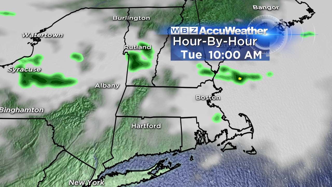
One thing worth mentioning for our Tuesday is the fact that the southwest wind will get a bit gusty – particularly on the Cape/Islands where gusts to 45 mph may result in a few isolated outages and downed limbs/branches.
Thursday looks like the mildest day of the week; we'll push 70 in some spots ahead of a cold front. That front will bring the threat for some late day showers and serves to cool us back off a bit for Friday and the start of the weekend.
Eric is at the National Weather Association annual meeting this week, so I'll be filling in for him on the WBZ news at 5, 6, 10 (on myTV38) and 11 PM. Barry & Pamela will be covering the morning shift. We like to keep you on your toes :)
-Danielle