Heating Up: First 90º Of The Year in Boston?
Find Eric Fisher on Twitter and Facebook
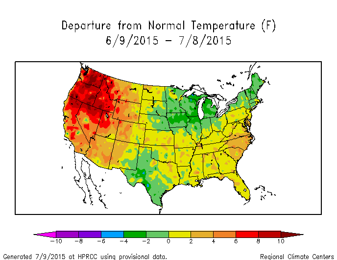
Much like last year, the AC units have been taking a bit of a breather. Organized heat has largely evaded New England so far in 2015. So where's it all living? Go west, young man. In a similar setup to last winter, the jet stream has been hiking up over the West Coast and allowing for plenty of extremely unusual and record-breaking heat to continue. Case in point - Seattle has topped 90º six times already this year! At one point, five of them came in a row. Today could mark the 16th straight day over 80º in the Emerald City - a record for them (it will be a close call...but they've already at least tied the previous record at 15). Alas the Earth is all about balance - and the Midwest/Northeast know about that. It's been a cooler than average summer so far.
For the heat misers out there, you're in luck. We're finally going to crank it up a notch this weekend. While a few towns - mostly in the Merrimack Valley - have touched 90º earlier this year, the city of Boston has not. Proximity to the ocean is a good reason for that. How rare is it to go this long into a year without a single 90+ day? We're getting into unusual territory for sure. This is the longest we've 'waited' for a 90º day since 1998, when the first of the year came on July 14th. *If* we somehow don't manage to reach the mark this weekend, our current streak will go on for quite a while and we'll enter this Top 5 list.
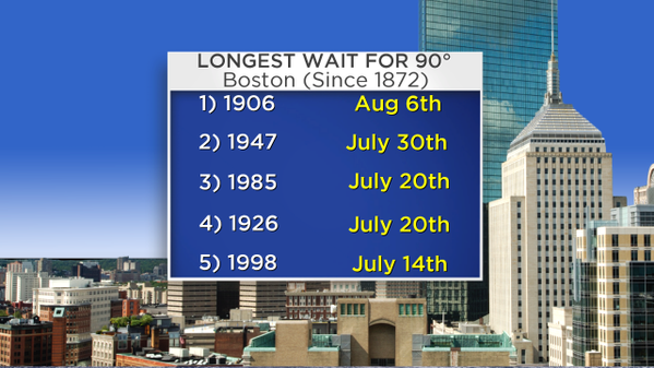
Have we ever gone an entire summer without hitting 90º? Not since records have been kept in Boston (since 1872). I did, however, find ONE year when we failed to hit 90º January-July. In 1906, it didn't happen until early August. So I suppose the bottom line is that if we miss out this weekend, we'd be waiting until after July 15th at the very least and we'd have a shot at going all the way until August. Time will tell, but in any case we're creeping up the leader board. You won't find any complaints from me!
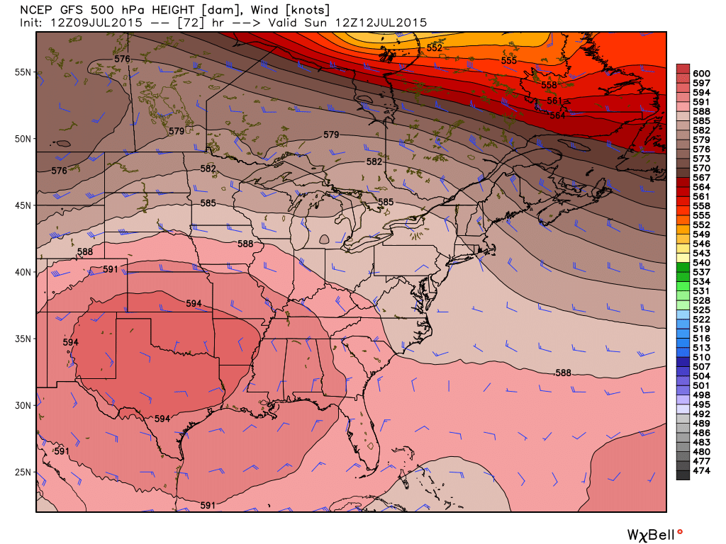
Large ridge centered over the middle of the country will build over toward us for a couple of days. Source: Weatherbell
The setup this weekend is great for the pool, beach and boating crowd regardless of exactly how hot it gets. High pressure will be building in and a ridge in the jet stream will grow over New England. Temps aloft at 850mb should reach around +15C on Saturday and +17C on Sunday, but we'll likely mix even deeper considering the nice westerly wind component we'll have. At ground level, we're talking widespread mid/upper 80s on Saturday and upper 80s to low 90s on Sunday. That's pretty hot, but of course still well shy of how hot it can get this time of year. I actually took a look back and after some digging found that we haven't had a weekend this warm since July of 2013! Wasn't even working at WBZ yet...which sounds crazy when I think about it. Also goes to show how comfortable last summer was - tons of nice weekends but no sizzling summer heat.
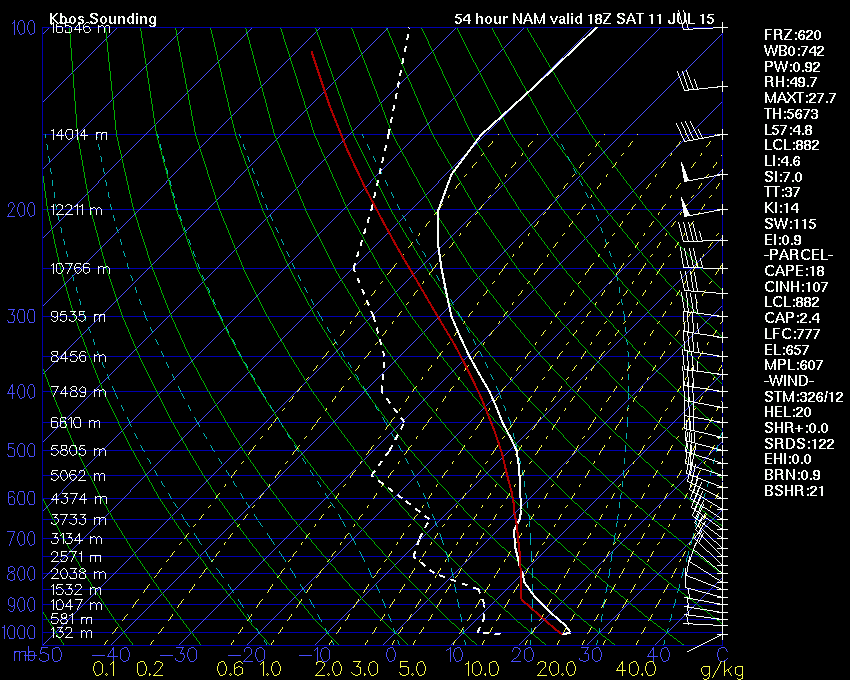
GFS forecast sounding for Saturday afternoon shows plenty of dry air throughout the column. With good mixing, this will keep dew points at a comfortable level. Source: Wright-Weather.com
As for humidity - we're not really looking at HHH conditions. Dew points will stay in the 50s to around 60 on Saturday (very reasonable by July standards) and they'll head into the low 60s for most on Sunday. Definitely not oppressive, which will help keep heat indices down a bit. Either way it's a hot weekend and we haven't had many of them, so stay hydrated if you're spending time outdoors.
The only thing to keep tabs on will be our northwest flow aloft, which tends to bring some high/mid-level cloudiness down into the region. I don't think we'll get clear blue skies, but they'll be bright for sure. A few isolated storms may be able to pop both Saturday and Sunday afternoons across northern New England, so plan accordingly if you're traveling toward the lakes region or White Mountains.
This burst of heat won't last long. We should squeak out one more seasonally hot day Monday (and more humid) before the next trough starts digging in. This will bring an isolated chance for storms Monday afternoon, but a higher chance on Tuesday. Highs will be knocked down back closer to 80 for the mid-week.


