Tuesday Evening Rainbow Bonanza
Find Eric Fisher on Twitter and Facebook
There's the beauty and the beast when it comes to summertime storms. Fortunately, we got more of the beauty without the roar of the beast on Tuesday. While there were several severe thunderstorm warnings issued by the National Weather Service, damage was spotty in MA/NH (more widespread around the Albany area and into western Vermont). We were left with some beneficial downpours and a beautiful show of rainbows for the evening. Wanted to give a shout to those who send in great weather pics all the time, so here you go!
As expected, the southerly flow put much more stable air in place over SE Mass, providing a 'shield' from any storms trying to move in. This impact is felt frequently in the spring and early summer when the water is still very cool relative to the air, and tends to become less of a problem later in the summer or in the fall when water temps get into the 70s.
Looking ahead, we may get a different setup later this week. The next weather maker on tap is a cold front that will race south out of Canada on Thursday. In fact, it may arrive as early as late Wednesday night or early Thursday morning for much of the area. Timing will be everything with this front - the faster arrival would reduce any severe weather threat. If it slows down over the next 36 hours, then that threat would go up across the area. Something for us to monitor on Wednesday.
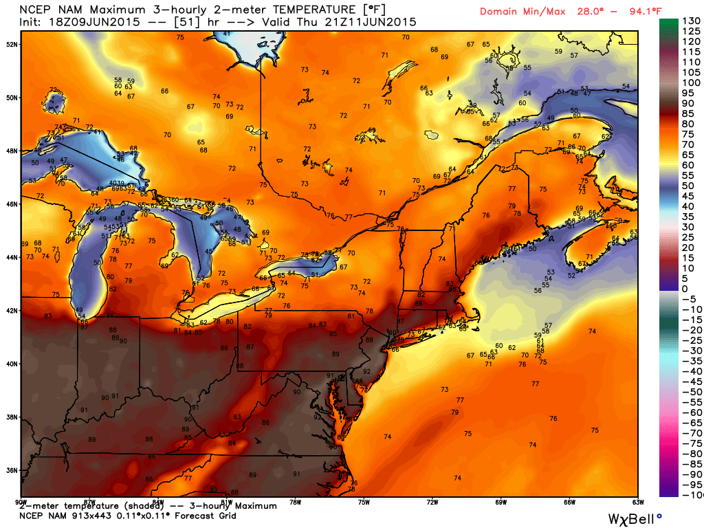
High heat on tap for Thursday south of the front, essentially south of I-90 from Boston to Chicago. Many 90s off to our south. Source: Weatherbell
Ingredients that will be in place include heat and humidity, as highs are expected to soar into the 80s (maybe a town or two hitting 90) and dew points will be up into the 60s for the southern half of the state. There should also be a significant amount of wind shear in the atmosphere. However, the setup is lacking a strong disturbance aloft (a vort-max). It's also lacking cold air aloft, which means mid-level lapse rates are not expected to be impressive and storms would likely not be in much of a hurry to grow tall and strong. The heat and humidity, combined with convergence along the front, may be enough to generate some action on their own. But a widespread severe weather outbreak doesn't look likely at this time.
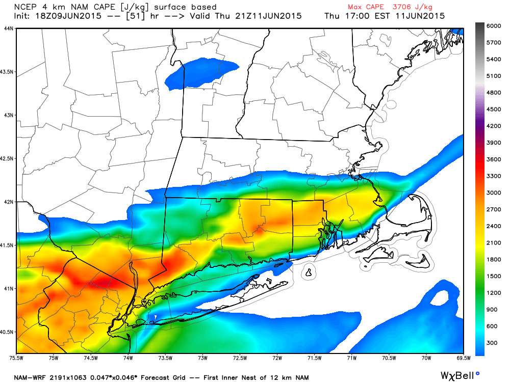
Highest CAPE values (instability) are expected to be south of the Pike on Thursday as a front will have already passed through northern MA/NH/VT early in the day. Source: Weatherbell
So to summarize all that geek speak up, the highest risk of storms on Thursday appears to be along and south of the Pike. That's a 180 from Tuesday, and could help bring some beneficial rain to some very dry areas. Thursday looks like our hottest day of the week across the area, and the storm threat looks low for northern MA and NH/VT.
Those in search of more rain chances need only look toward Friday night/Saturday. The timing is still very much up in the air with this one, but storms do look likely one way or another. The trend over the last 24 hours has been to place us in the warm sector of an approaching storm system Friday night into Saturday morning. This could potentially steam us up with high humidity and temps soaring into the 80s Saturday morning. That would be followed by a round of showers and storms popping up along the cold front before we dry back out toward the late afternoon/evening.
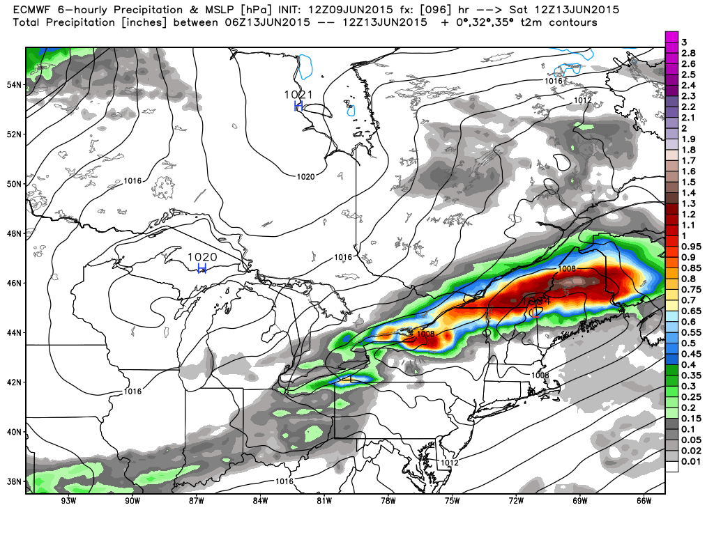
Low pressure is expected to track just south of the St. Lawrence River Valley on Saturday. Typically, this can bring us some storm storms in southern New England. Source: Weatherbell
Uncertainty is still very high regarding the exact placement of these features and how strong any storms would be, so at this point I wouldn't go changing around any plans. We'll take a look at new data over the next couple days and zero in on the expected outcome. But I don't think we'll be able to avoid at least some rain, and Sunday is by far looking like the quieter and more comfortable part of the weekend with seasonal temps and lots of sun.