Temperature Tantrums - Extremes Abound In Recent Months
Find Eric Fisher on Twitter and Facebook
You know what grinds my gears? 'Normal.' I can't stand the use of the word 'normal' when it comes to weather. To me, it's a misleading phrase that implies there's some sort of consistent normalcy to our weather. Sure, it tends to be cool to mild in the spring, hot in the summer, and cold in the winter. It tends to snow in February but not in July. But the real word to use when comparing weather is 'average,' and even that can be a load of rubbish sometimes. Average is what it is - the middle of extremes. It does not mean that most of your days will be right near that 'average high' or 'average low.' Just look at our spring. A ridiculously cold March, a record setting warm May, and you know what happens when you go back and look at it in the record books? Average. Temps came out even March through May. Doesn't really tell much of the real story, does it?
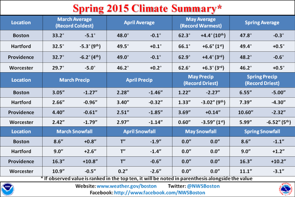
That brings us to recent times when our weather has had more mood swings than a Taylor Swift concert. Let's use Worcester as an example. That's where some official records have been kept for over 100 years, and what stands for Worcester tends to be the story for most of central Mass and Metro West.
In just the past few months, we've seen:
- The biggest snowstorm on record (34.5", January 26th-27th)
- The snowiest month on record (53.4", February)
- The coldest month ever recorded (February)
- The driest May ever recorded (0.60")
- The 3rd warmest May ever recorded (62.9º average temp)
That's a lot of ups and downs to deal with, even by New England standards.
How about Boston? The city racked up:
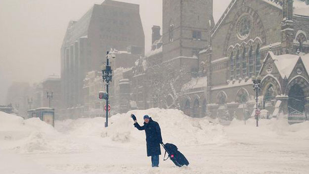
- Snowiest winter on record (110.6")
- 2 Top 10 largest snowstorms (6th and 7th place spots)
- Coldest month since records moved to Logan in 1936 (February)
- Top 10 warmest May
- Coldest June day (tie) ever recorded in the city.
143 years, and there hasn't been a day colder than Monday. I smelled wood smoke in my neighborhood. In June.
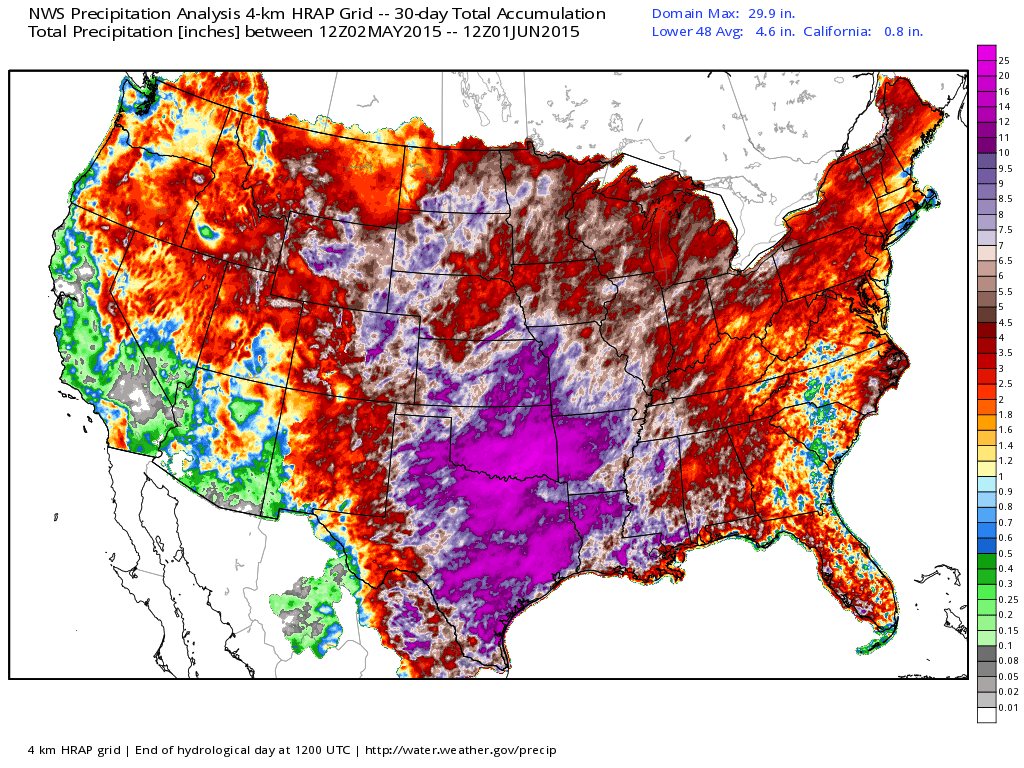
Rainfall over the past 30 days shows an unbelievable soaking over the middle of the country. Source: Weatherbell
And then there's the rain. Barely a drop for over a month. Rivers nowhere close to their springtime flow. Lawns looking like it's mid-August and we've already had to give up on a green front yard carpet. The deficits, even with snow, crept up to near double-digits. And then the rains came. It's pouring out as I write this, and many towns are picking up 2-3" of rain from Sunday through Tuesday. A few towns will top 3" total, and essentially our mini-drought will be eased just like that. It's not a Texas-style deluge, but it's enough to flip our fortunes and green up the grass.
All across the country there have been some pretty wild extremes recently, the causes of which are constantly debated here online or in research circles. I believe most will point to some oceanic phases that have been helping to drive our weather patterns (like the PDO and El Nino). The west has been hot and dry, the Plains have gone from severe drought to epic floods, and Alaska has been experiencing its hottest weather ever seen in the 49th state. It has actually been warmer in the Alaskan interior than here!
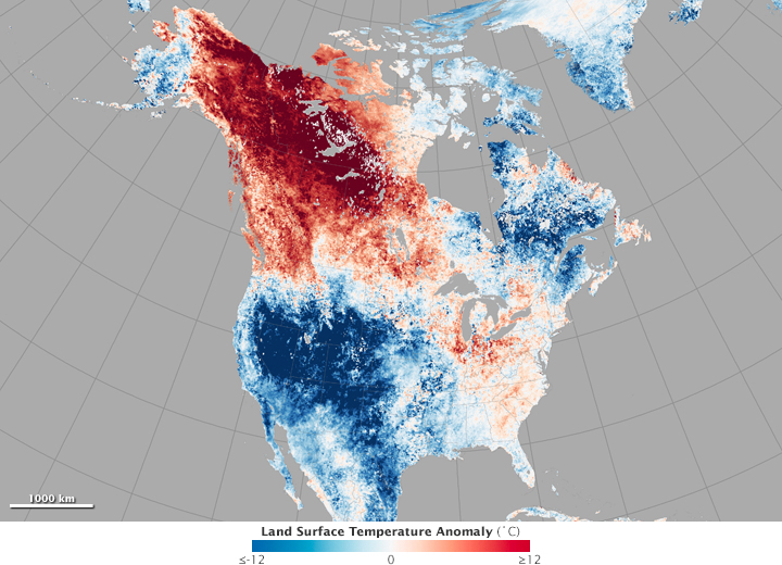
Source: NASA
So what's next for us? Right now I think we're on track for a slightly cooler than average and wetter than average June. In essence, we had our June in May and will have our May in June. After a several week stretch of pure summer weather, indications are for lots of SE Canada high pressure for the first couple weeks of the month, which will in turn bring plenty of onshore flow days and cool air. That doesn't mean every day is going to be as ugly as Monday (or Tuesday), but I don't foresee the consistent heat we saw in May. More 60s and 70s, at least for the first half of the month, than 80s and 90s.
We're off to a wet start, which helps load the odds in favor of a wetter than average month as a whole. Once we clear Tuesday's rain, more showers will be possible by Friday. Another round looks likely toward the start of next week. An average June in Boston receives about 3.43" of rain.
The good news is that an extreme departure from average doesn't look like in the temp department, so hopefully we can shelve the record breaking talk, which has become a broken record in itself.