Back To Bad Habits
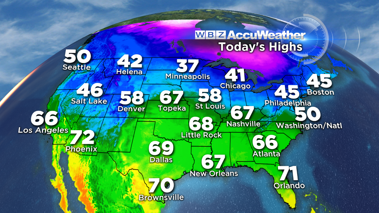
On this MLK holiday, the nation was in a January thaw mode. Above to well above average temperatures existed across much of the country. Boston's 45 was about 10 degrees above the average max for this date. So after the recent frigid weather, it was a nice break to have it warm up from a high of only 22 on Saturday to 51 yesterday. The mean temperature for the month is still more than 3 degrees below average which is the reverse of December which ended up at 3.8 degrees above average. Global factors in place matched with analog years reveal that February will be colder to possibly much colder than average. Furthermore, despite the snow drought thus far, the rest of astronomical winter is certain to be snowier and eventually yielding potential seasonal totals at least near average.
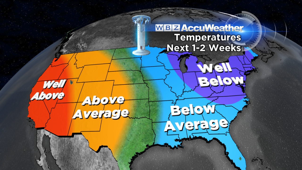 With persistent pooling of warmer than average ocean water over the eastern Pacific supporting a semi-permanent ridge of high pressure near the West Coast, we will be vulnerable to more arctic attacks from central and eastern Canada as the resultant configuration of the jet stream occasionally taps masses of frigid air. Enhancement is inevitable as the present polar stratospheric warming will encourage the negative phase of the Arctic Oscillation (AO). A weak El Nino can periodically produce an active southern branch of the jet which would carry systems entrained with rich moisture across the southern states. Expectant phasing with the polar jet will deliver more East Coast storms. Most of this action so far this winter has produced so-called "inside runner" storms releasing rain like yesterday's deal.
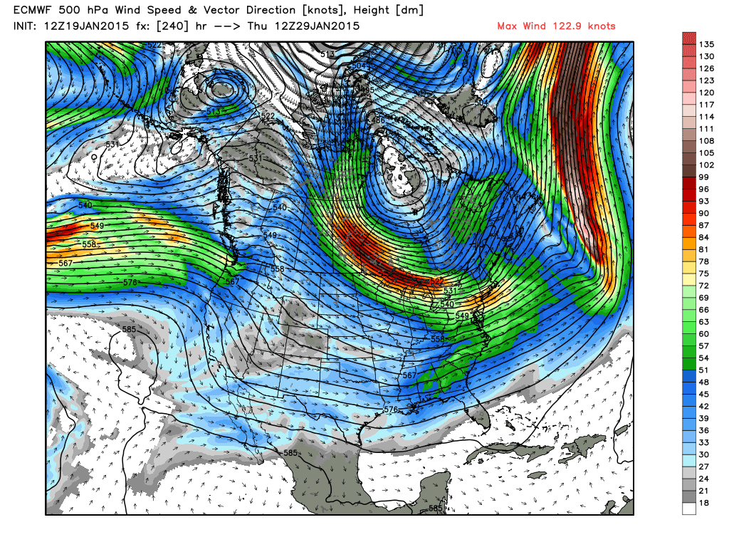 With that said, we must also recognize that the Quasi-biennial Oscillation (QBO) favors average to below average snowfall when its direction of the equatorial zonal wind over the tropical stratosphere is easterly as it is this winter. So there are some mixed signals in play. The phase of the North Atlantic Oscillation has been primarily positive thus far but a negative phase tends to be more common in the second half of winter so we'll be watching any flips in this important forecast tool. The negative phase encourages atmospheric blocking over Greenland westward and can create nasty blizzards on the East Coast. This graphic (left), courtesy WeatherBell, depicts a flow from the North Pole directed to the northeastern portion of our country.
We will be watching the warm ocean water over the eastern Pacific because past episodes of warming in this zone last about two years. With time in the next few months, this water will be gradually cooling and the ridge of high pressure will weaken. This may be one of the factors that leads to a hotter summer for us this year.
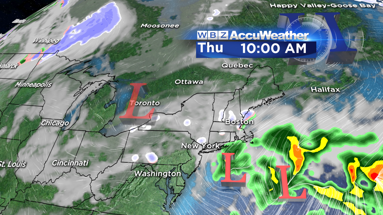 In the meantime, all eyes are focused on some energy that will lead to storm development over the ocean later this week. Present indicators would place most of the action over the ocean but sufficient moisture and lift may be available to trigger at least some snow showers Wednesday night into Thursday. Another similar situation may occur over the upcoming weekend into Monday. That one may be a bit more productive.
For the rest of this week, expect temperatures slightly below average which is about 35 for a high. After that, we'll be watching to see if we receive a direct hit from the frigid air in Canada.
Make it a great week!