Coming Attractions
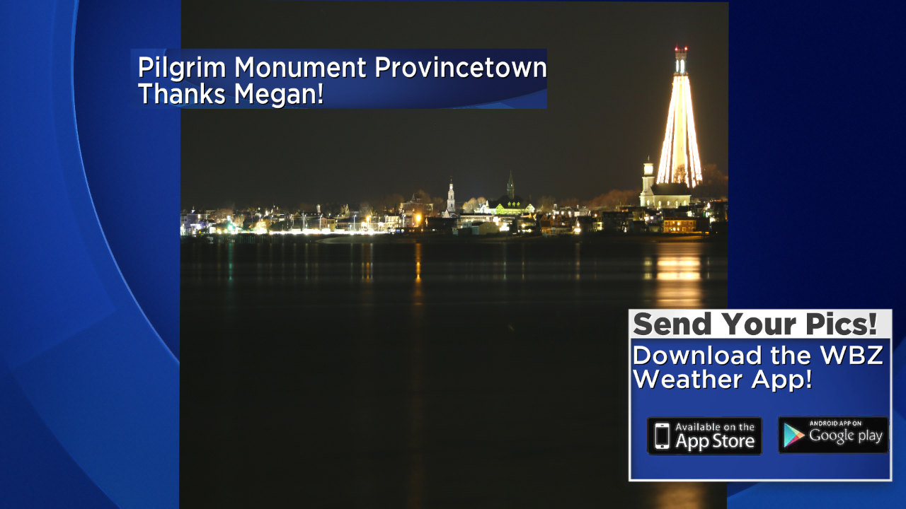
Check out this attraction in Provincetown. It is the Pilgrim Monument and beautifully lit in this picture taken last evening. At 252 feet, the monument is the tallest all-granite structure in the United States. It was built between 1907 and 1910 to commemorate the first landfall of the Pilgrims in 1620 and the signing in Provincetown Harbor of the Mayflower Compact. While the sky was clear there, a solid layer of clouds existed from western Worcester County westward. The dilemma is determining if this shield of clouds at a level of about 2000 feet will expand farther east during the day today. The daytime high temperatures are highly dependent upon the cloud cover. Without the clouds, they rise to at least 45 today but with them, they will fail to rise above 40. To complicate matters, there is much warmer air arriving aloft to establish a temperature inversion and the deck of clouds underneath that inversion becomes trapped. Presently, I will remain cautiously optimistic that there will be some sunshine in eastern sections today but I really wouldn't be surprised if the clouds fouled up that prediction.
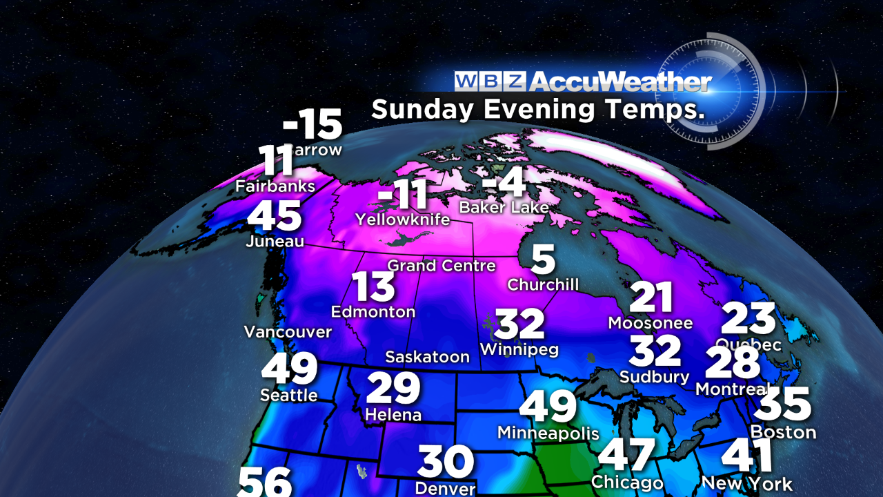
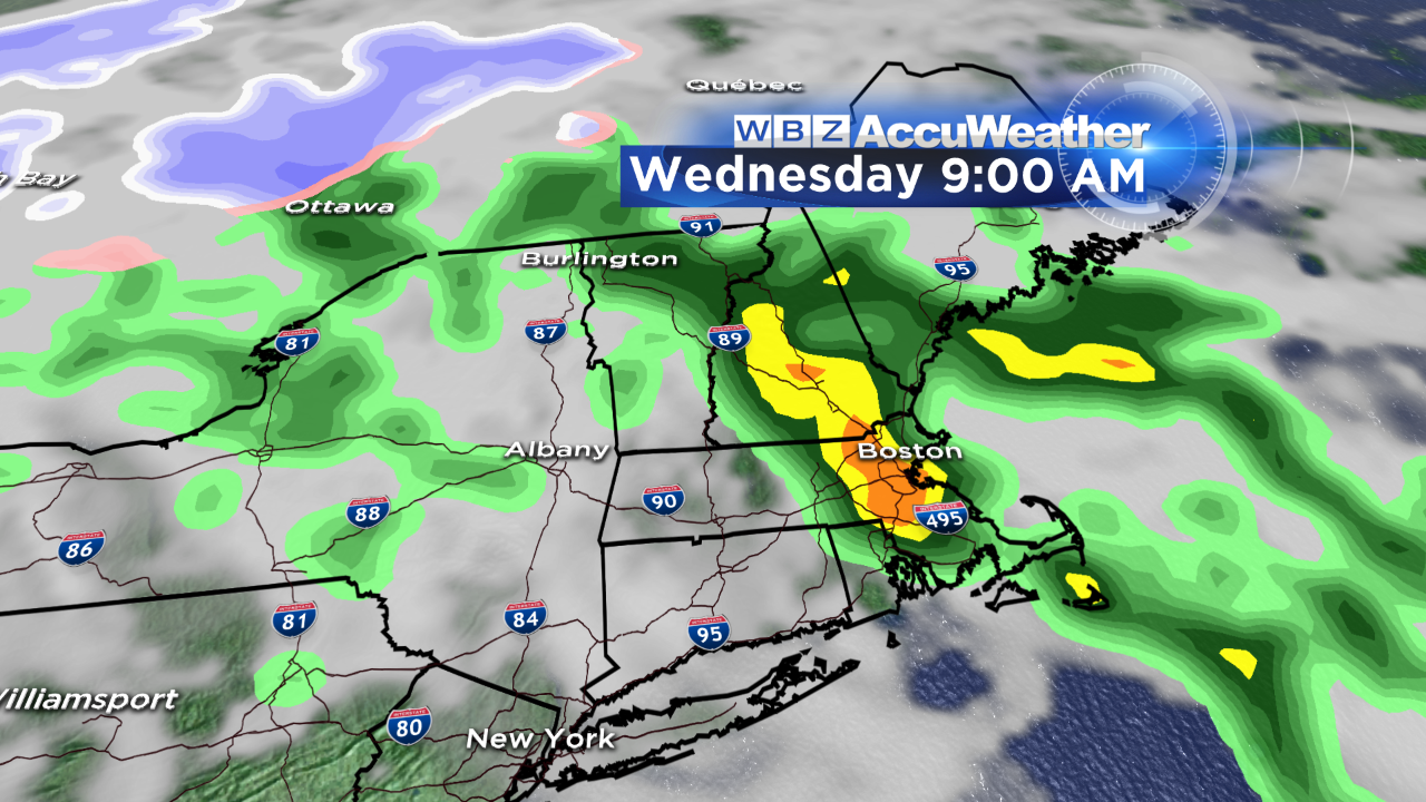 Aside from that, we are in a relatively quiet period through the week. There are a couple of minor systems to briefly shake things up a bit. The powerful storm that pounded the West Coast several days ago will only manage to release a few showers as it crosses over New England Tuesday night into early Wednesday morning. After that, a quick-hitting short wave may trigger a line of snow showers and a few isolated snow squalls early Thursday morning. Temperatures will rise to the lower to middle 40s tomorrow, to the upper 40s on Wednesday then drop back as the colder air rushes in on a gusty wind Thursday.
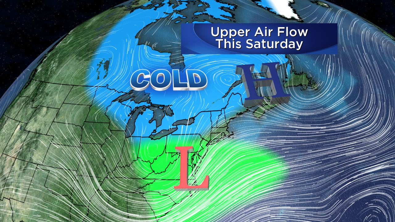 The next weather maker is destined to arrive late Saturday and possibly continue through Sunday into early Monday. It is too premature to be confident about the details of this threatening storm. Presently, it is projected to develop over eastern TX and the western Gulf of Mexico. The subtropical jet stream will carry this system toward the Carolinas. The precise path from this point is fuzzy so it is impossible to pinpoint any parameter until at least Wednesday of this week. We'll be watching the evolution of the varying meteorological models as they zig-zag through the upcoming days. It would appear that sufficiently cold air will be available to fuel a sizeable snow event for the region especially farther inland. A wind component off the ocean would suggest mostly rain along the coast. Forecast confidence should rise sharply the second half of the week.
 The Canadians have enjoyed a warmer December following a very cold November but that is about to change in the next week as the pattern flips to cold and subzero weather again. There is evidence of polar warming which will produce a tanking of the Arctic Oscillation. The Polar Vortex will be weakening, the jet stream will shift southward escorting much colder air southward again with an activating storm track in the northern stream and an already active storm track in the southern stream. The conclusion is that a colder and stormier scenario is in the works for Christmas week and beyond for much of our nation.
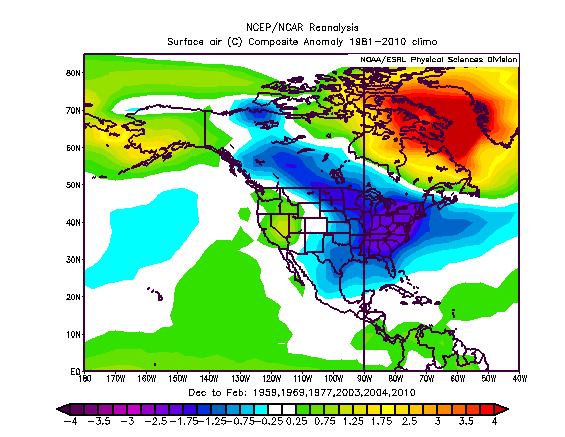 The present set of global factors in play or about to go into play matched with analog years yields a colder than average meteorological winter months of December, January and February. So far, however, Boston's mean temperature for this month is close to average and will go a bit above average in the next few days. After that, chillier times beckon especially after Christmas and more likely in January when below to much below average temperatures are projected from the Upper Midwest, Great Lakes into the Northeast. Thankfully, the cost of heating oil has decreased sharply. On the other hand, unfortunately, natural gas prices have risen and will likely keep going up. While our sunsets are already running a few seconds later, the shortest day of the year and the official beginning of astronomical winter, the Winter Solstice, occurs next Sunday at 6:03 pm.
You can watch the weathercasts presented by Danielle Niles through 9 0'clock this morning and at noon and I shall return to deliver the weathercasts on the 5, 6 and 11pm WBZ News and its 10pm show on myTV38. Make it a great day!