Pictures, Prospects & Ponderings

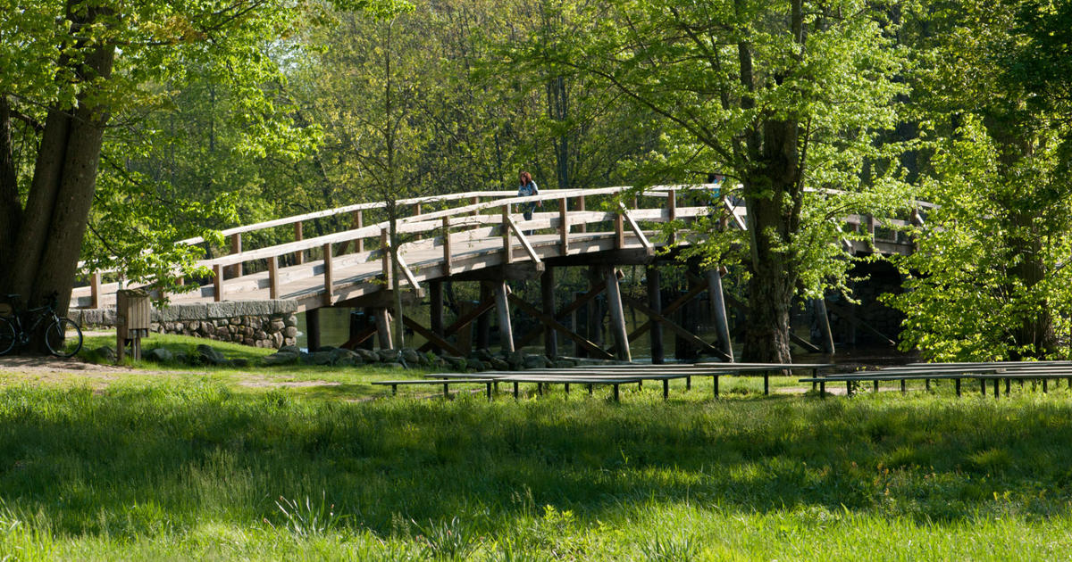
This stunning sunrise shot was taken early this morning at one of my favorite locations namely Newburyport. The departing clouds from a narrow broken band of showers and isolated lightning and thunder aided in creating a colorful picturesque sky in many locations across eastern New England. Thank you to one and all for taking the time to contribute photos and we welcome them anytime from anywhere. Please send them to weather@cbsboston.com. We will post them on the CBSBoston.com site plus on Facebook and Twitter. The narrow axis of energy that produced the sliver of showers is well offshore. There were sprinkles ranging up to brief downpours amounting to a quick quarter of an inch of rain. An aditional impulse/trough will primarily impact VT, NH and ME for the rest of the day but occasionally there will be some parcels of clouds straying down into portions of MA. Over the weekend, the sky will feature varying amounts of clouds and sunshine. Sunshine should be prevalent much of the time tomorrow and breaking out during Sunday after morning showers depart.
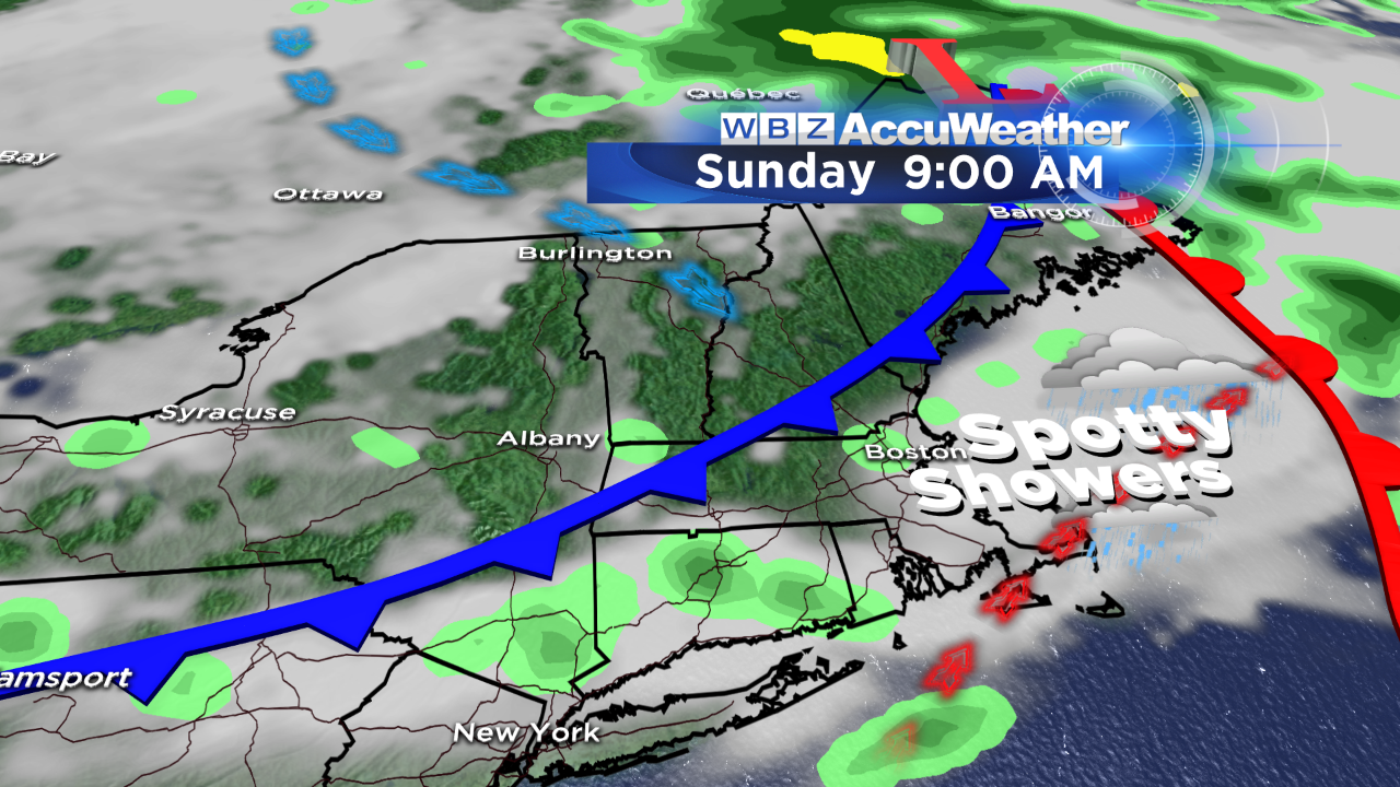 This action stems form a disturbance tracking southeastward from Canada. It is possible that many of the showers will track across the region in the early morning hours of Sunday and shift offshore a short time after dawn. After that, there is a remote risk that sufficient instability will exist to trigger a few more widely scattered showers in the afternoon but most places will remain dry. As a result, drying will enable some sunshine to break out. A cold front will move offshore by late morning and drier air will take over again. It really isn't going to get that humid before the cold frontal passage. Presently, it appears that a wave of low pressure may pass south of the region late Tuesday and Wednesday so not much rain is now expected for the coming week. Instead, high pressure building down from the Canadian Maritimes will probably keep us dry and pleasant through much of the upcoming week with temperatures remaining below average for the third week in August. The wind will be light each day leading to afternoon onshore breezes at the coast.
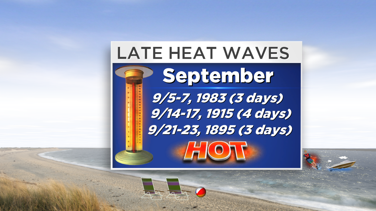 Sadly for many, meteorological summer ends only two weeks from this Sunday! Can you believe it? Does that make you sad or happy? Summer always seems to go faster than any other season and when it has been as nice as this one, it rockets. So for me, I am disappointed that the summer is almost finished. In my opinion, it has been a great one to enjoy all types of outside work and sports activities. We have enjoyed many nice warm days with numerous alternating spells of splendid dry air and uncomfortable sticky air. The mean temperatures were slightly under a degree above average for the months of May, June and July. August, however, is below average by more than a degree so far. Speculatively, there is a risk of some sizzling weather the last week of August but it is too premature to be confident of that forecast considering the repetitive pattern of this summer. On average, there are 3 days at 90 degrees or higher in August so a day or so of 90 degrees cannot be ruled out but time is running out if you desire a heat wave. Four years ago, we had a 5-day heat wave from August 29 through September 2. Interestingly, Boston has experienced only 3 heat waves in September with records dating way back to about 1870!
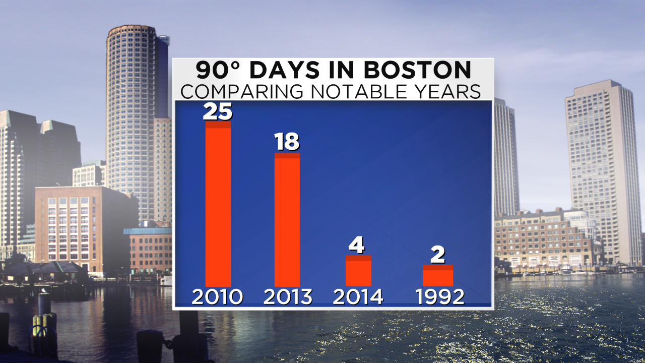 Over the past few weeks, I had been wondering if there was another year with no heat waves and limited few days at 90 degrees or higher like this year. So I checked back through Boston's records and was surprised that I didn't have to go back too far to discover 1992. The crazy thing is that I had forgotten how cool it was that summer. I don't understand why some folks are saying that 2014 is the year without a summer but I guess it is based upon the absence of intense heat. The reality is that 1992 takes the prize for the closest year without a summer. In contrast to this summer's slightly above average temperatures, 1992 was a chiller especially in July when the mean temperature that month was a whopping 4 degrees below average! In fact, below average temperatures existed every month of that year from March through November! There were only two days at 90 degrees or higher specifically the 92 on May 23 and 91 on August 11! It turned out that the following winter of 92-93 was extremely harsh in New England with Boston receiving close to 84" of snow with 39.4" of that falling in March! That month featured the Storm Of The Century that severely impacted much of the eastern half of the nation!
Although many of the global factors are indicating a preliminary prognosis of a rough winter ahead meaning below to perhaps much below average temperatures with the potential for near to above average snowfall, we cannot in any way conclude that the upcoming winter will match the magnitude of the winter of 1992-93. A huge player that contributed to the cold 1992 and the stormy winter to follow was the cataclysmic volcanic eruption of Mt. Pinatubo on June 15, 1991 and that is missing this go around. It will be fascinating to see how the myriad of global factors align this fall in determining a final forecast for the upcoming winter. We will issue our ideas later in November. In the meantime, lets all enjoy the rest of summer and hopefully a nice autumn ahead.
Todd Gutner delivers his latest forecast on WBZ News at 5, 6 and 11pm today and I will be on duty all day tomorrow.
Have a happy and safe weekend.