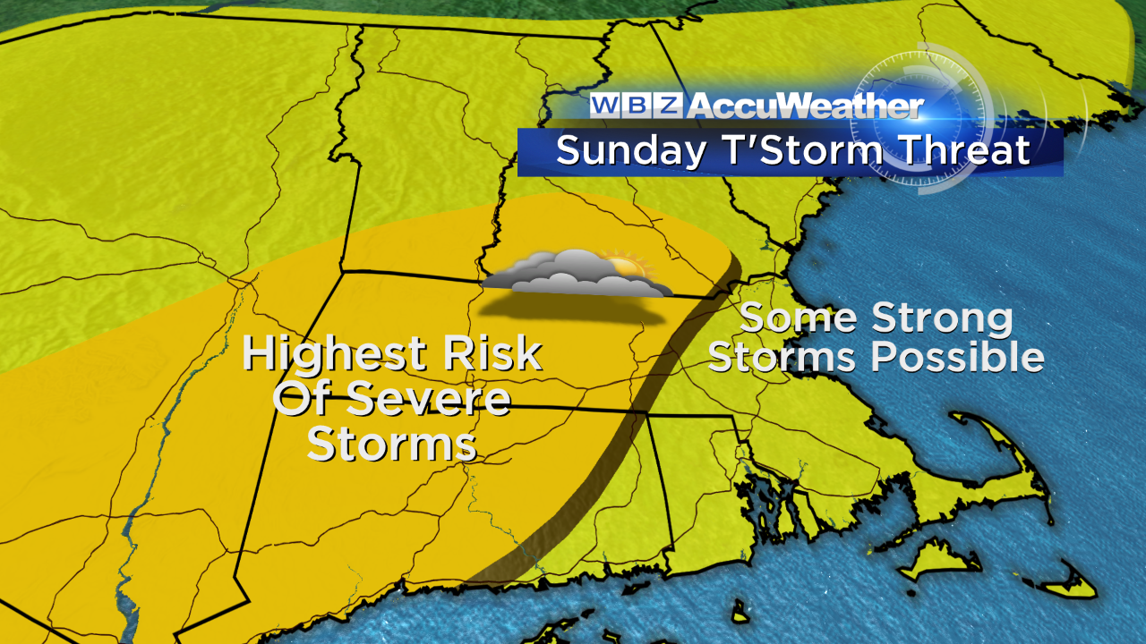
Risk of Severe Storms Sunday
A nice summer day is on tap for the region this afternoon! High temperatures will top out in the mid 80s for many of us with a southwest wind and intervals of clouds and sun. There may be an isolated shower north and west of Boston later on today, but the majority of us won't see it.

Now tomorrow is a bit of a different story. An approaching warm front will bring a surge of humidity, and in turn, spark scattered showers and even a rumble of thunder from mid-morning into the early afternoon. I do think some breaks of sun will emerge, but that's not necessarily a good thing…because that will increase the instability in the atmosphere. Additional thunderstorms will fire during the afternoon and evening hours and some could reach severe thresholds.
No, it won't be wet the entire day – but today is definitely the pick of the weekend. If you have flexibility to change your outdoor plans to today, I would! If not, have the backup plan in place to get indoors tomorrow should a storm head your way.
Expect another round of showers and storms on Monday with some localized flooding possible as an energetic disturbance comes in from the west. The front associated with it will push offshore sometime Tuesday with a return to less humid air for the middle and end of the week. There are signs the boundary may try to retrograde by Friday, so we'll watch the threat for some showers on the Cape.
-Danielle