Powerful Midweek Storm Takes Center Stage
There's a lot to discuss in the weather department so I'm going to dive right in here. An arctic cold front will cross the region today ushering in a noticeably colder airmass. Afternoon temperatures will hover in the upper 30s under mostly cloudy skies and perhaps a stray flurry. The northwest wind will kick behind the front, gusting at times over 20 mph later today and overnight. Wind chills will be running either side of 0 when you wake up tomorrow morning.
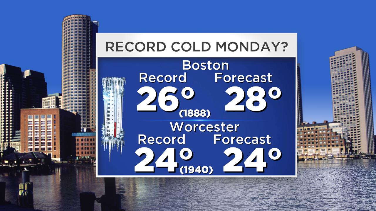
Bitter cold and a biting wind will make tomorrow downright frigid. We will challenge record cold high temperatures in some communities.
The arctic air blowing over the relatively warmer ocean water will cause ocean-effect snow showers to develop on the mid and outer Cape overnight into the morning commute. Scattered coatings of accumulation may result in a few slick spots for your drive in these areas.
Now…onto the midweek powerhouse storm. Let's stick to what we know. We know there's going to be cold air in place. We know there's plenty of energy and moisture to work with. And we know that this storm will develop off the Carolina coastline and undergo rapid intensification as it passes south and east of Nantucket . The main uncertainty right now is the exact track of the low. The typical model pendulum swings are taking place…a little shift east last night…then a shift back west this morning…as the guidance hones in on a solution.
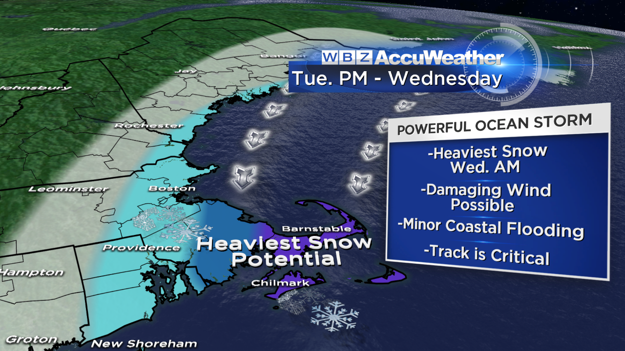
Snow: Areas of light snow will likely develop on Tuesday afternoon, turning to a steadier snow from south to north during the evening and ramping up overnight. The heaviest bands of snow should be focused over southeast MA, Cape Cod and the Islands Wednesday morning, tapering through the afternoon. There will be a sharp northwest cutoff to the snow. It's too early to give exact amounts…but the potential is there for several inches of accumulation, particularly in southeast MA where 6"+ is possible. More than a foot? Not out of the question.
Wind: The strongest wind will come overnight Tuesday into Wednesday morning…with the highest gusts closest to the storm center. Coastal communities could gust over 40 mph, perhaps in excess of 50 mph on the Cape/Islands, 30-40 mph inland. This will mean blowing and drifting snow. There is the potential for blizzard conditions over southeastern MA.
Coastal Concerns: Thankfully, the storm will be progressive, so the wind will shift to blow from the northeast Tuesday night to the north by Wednesday morning and northwest by Wednesday afternoon. Some minor coastal flooding during Wednesday morning's high tide cycle is likely, especially along north facing shorelines.
We will be fine tuning details in the next 24 to 48 hours, so stay tuned for important updates.
Until then…stay warm :)
-Danielle