Don't Shoot The Messenger
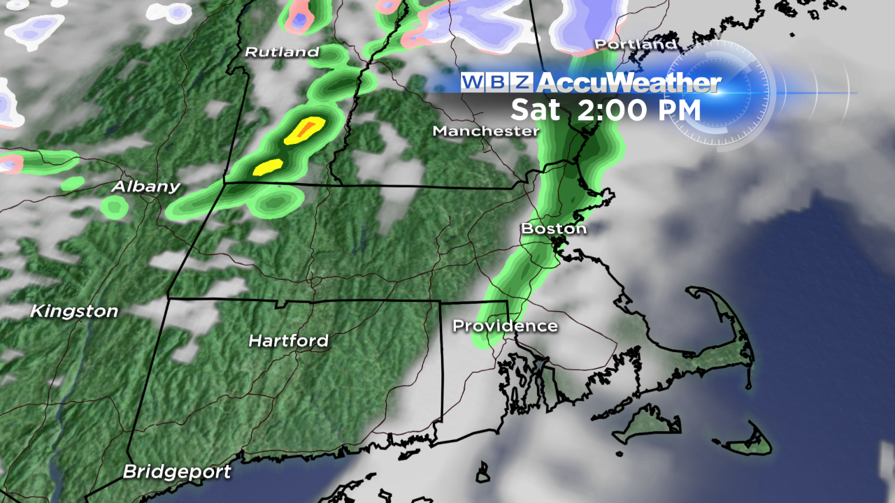
Let's start with the good news, shall we? Today will feature mild air with temperatures rising into the 50s for many of us this afternoon! There will be a threat for rain showers, mainly between 1-5 PM, but anything that does come through will be brief and passing. You will notice a gusty wind though, shifting from the south to the west as the front comes through.
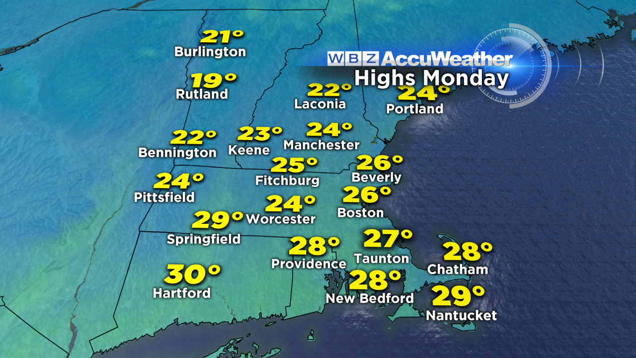
Tomorrow, noticeably cooler air will be in place. We'll only top out around 40 and with a northwest wind 10-20 mph, gusting occasionally higher, it'll feel like it's around 30 under varying amounts of sun and clouds. A reinforcing shot of arctic air arrives Sunday night; high temperatures Monday will be brutally cold…in fact, record low high temperatures could be threatened. It's going to feel like mid- winter through Wednesday with temperatures only in the lower 30s. There is a light at the end of next week's tunnel - a warming trend! We should be back up around 50 by Friday.
The other big weather headline is the potential for a significant winter storm late Tuesday into Wednesday. This ocean storm is going to be powerful. Strong wind and building seas will mean intense and dangerous conditions for our mariners, particularly those who take to the outer waters where seas could build upwards of 40 feet!
Now in terms of the threat for snow, confidence is growing in a plowable event for much of the region. The greatest impact from this storm will be felt in areas that are closest to the storm center - in other words, across southeast MA, the Cape and Islands. The exact track of the low will determine where the heaviest snow sets up and how strong the wind will be. Plenty of details to iron out in the next several days, so stay tuned!
-Danielle