Spring Is Almost Here! Will The Weather Listen?
Find Eric Fisher on Twitter and Facebook

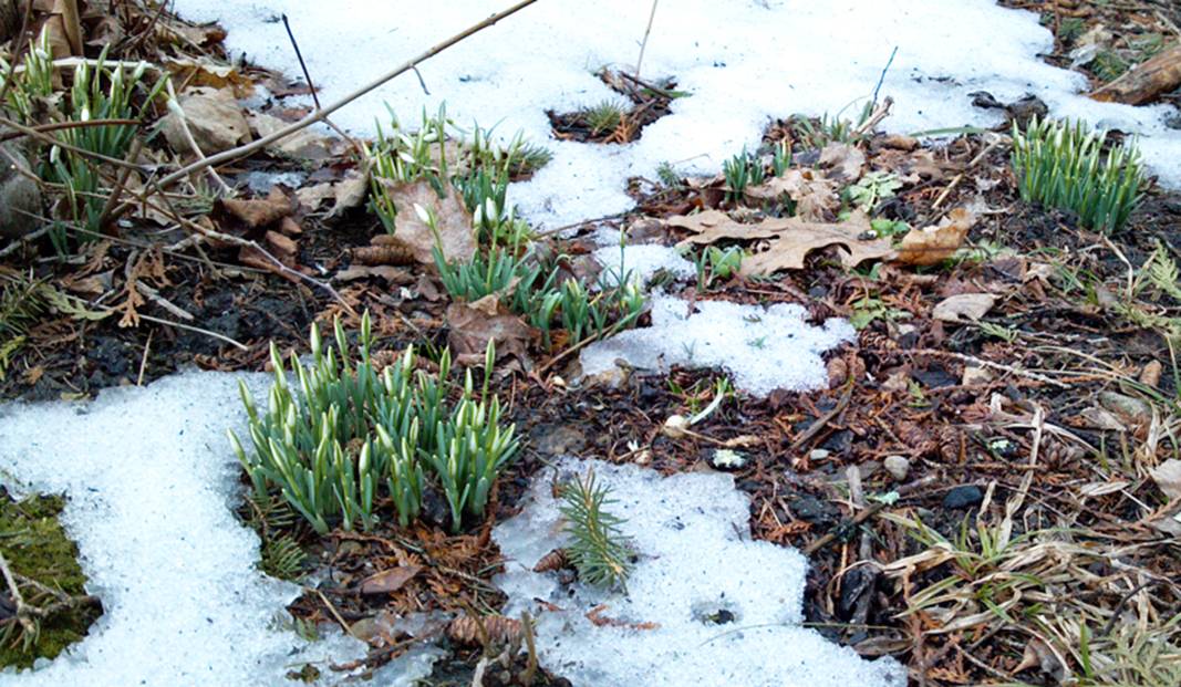
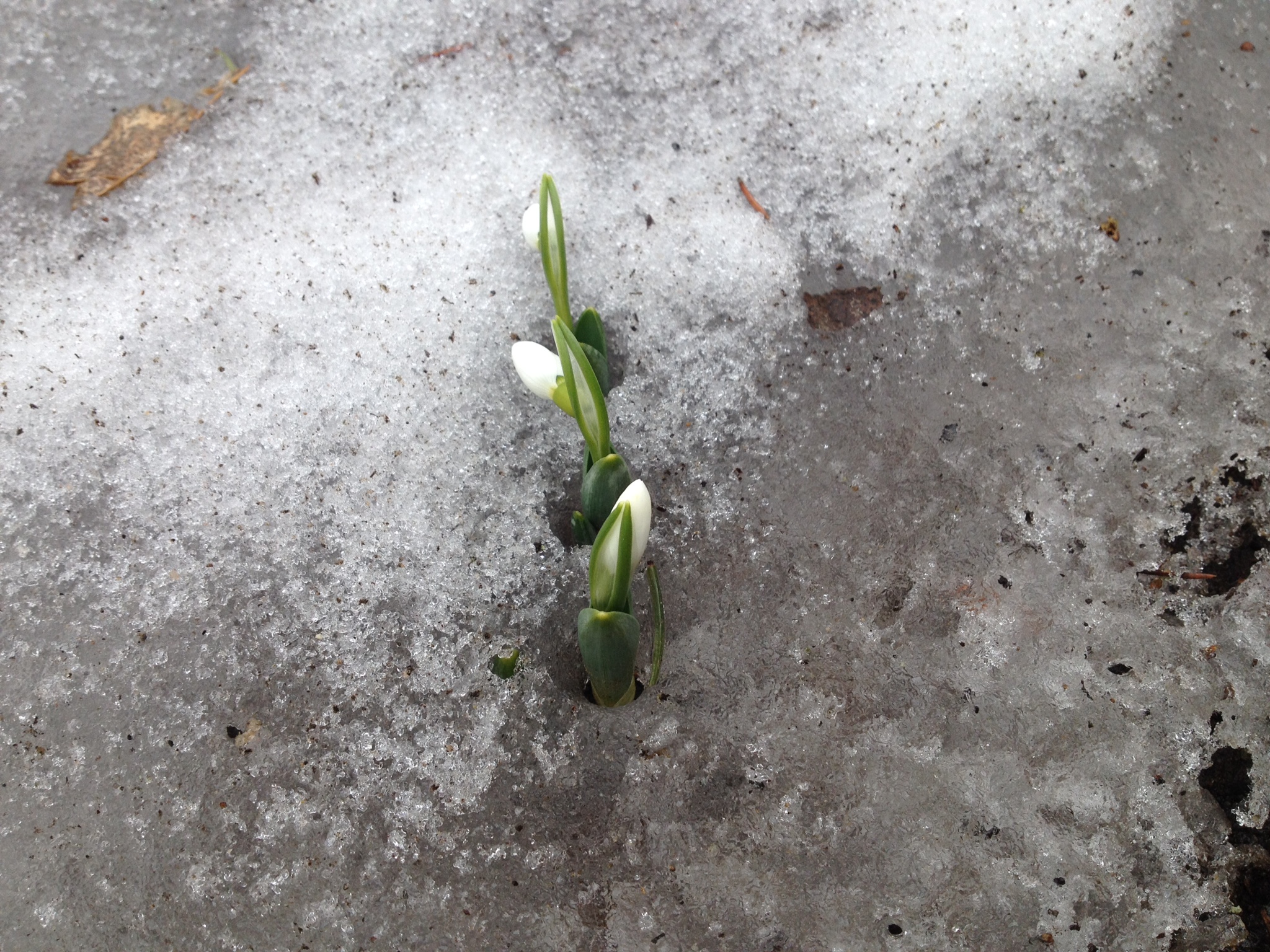
Thanks to Jack in Lexington, Liz in Lancaster, and Millie on Cape Cod for sending these in!
I gotta say, I've been very encouraged by all the photos viewers have been sending in over the past 2 days. We've seen a rapid spike in crocus/snowdrop shots in our inbox (of course not everyone can see the bare ground just yet, but we're getting there). Even with all the cold, these hardy bulbs know what's up. Tonight is the final night of winter, daylight is increasing, and they want to party. So up they come to bring a little color to our lives once again! I will not refuse their efforts. Highs near 40 today were again well below average but no one noticed.

Also fitting, the WBZ Weather Team taped our Spring Preview Special today. Todd, Barry, Danielle, and myself have put together an outlook for the upcoming months, a look at severe weather potential, have revisited the 39-mile tornado scar from the 2011 tornado, checked in with local garden experts, and found some spring flavors with brewers and chefs in the Boston area. Very excited to show it all to you on Saturday, March 29th at 7pm. Hope you can join us!
For the last night of winter, there will indeed be a bit of wintry weather to contend with. The National Weather Service has hoisted some Winter Weather Advisories, which run 8pm through 9pm tomorrow. Not expecting a whole lot of mess, but there will be some sleet pellets and snowflakes coming down for the first half of the overnight north of the MA Pike. We could see a coating to 2" of this wintry mix up to the NH border, and 1-3" of it in southern NH/VT and the Berkshires. Dew points are in the 20s and so there may be a time when the air cools enough to make surfaces slick, so be wary of that possibility. Overall not a huge deal, and the rain line will be moving northward overnight. So there shouldn't be much left when you wake up tomorrow morning.
Everyone else will just see rain, and there could be a few pretty solid downpours during the middle of the night. Expecting about 0.25 - 0.60" of rainfall, all of which will be gone by the am commute. We should start out gray, but will bring in increasing sunshine as the morning wears on. The Equinox takes place at 12:57pm, huzzah! Just one more milepost on our way to warmer days. Temperatures look pretty fitting for the first day of the season, reaching the 40s across higher terrain and 50s for most of eastern MA. A gusty WSW wind 10-30mph will add a bit of chill, but no complaints. And we can't rule out an isolated pop-up shower or two during the afternoon.
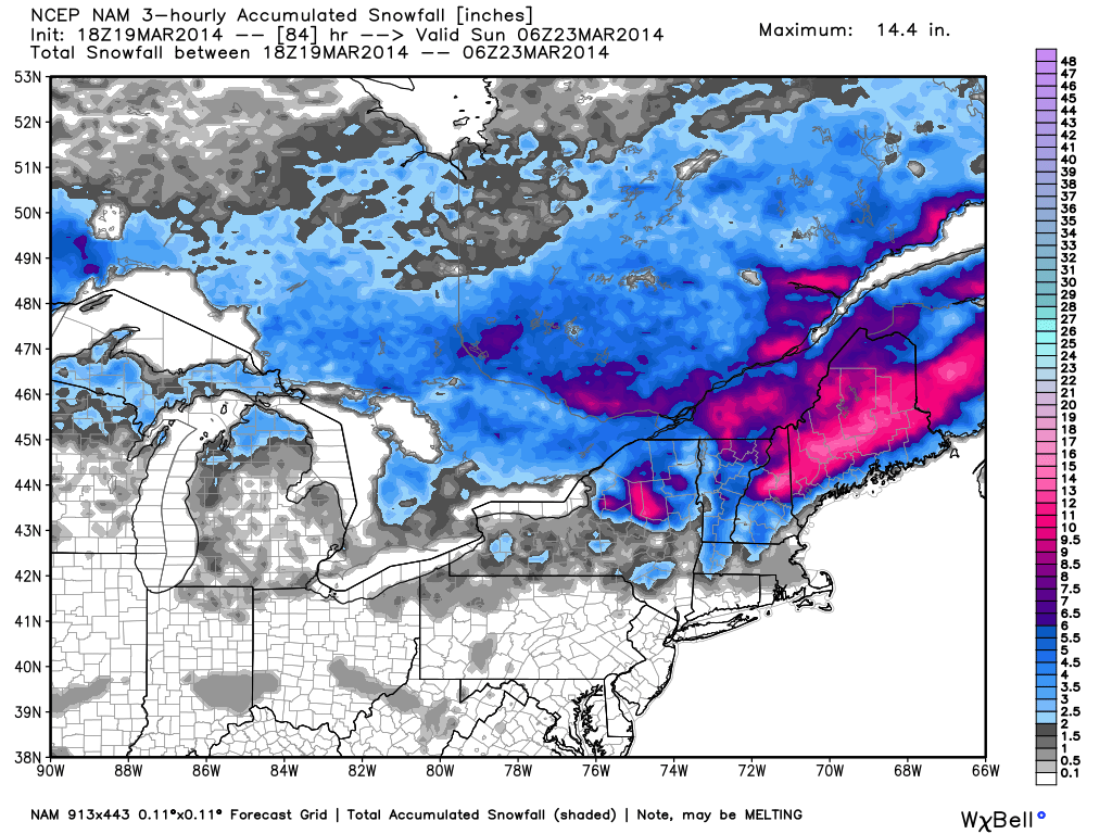
Some new snow for the White Mountain Region and interior Maine from both tonight's system and Saturday's. Should see several inches of the white stuff between the two of them. Source: WeatherBell
Things stay pretty comfy through the weekend. Friday looks just fine with highs in the low/mid 40s, quite a bit of sun, and a breeze. On Saturday a warm front will pass in the very early morning hours with a few rain/snow showers, and then a few more rain showers are possible during the day. But most of the energy and moisture with this one treks across northern New England with a fresh coating of snow for skiers and snowboarders. Temps should manage to rise into the 40s/50s around here during the afternoon. Cooler air comes down for Sunday, but it's not the true Arctic stuff yet. We should be up around 40 again for highs, and the day looks dry and breezy. Models are hinting at a trough of low pressure swinging through Sunday night, which may bring in some snow showers with the latest cold outbreak.
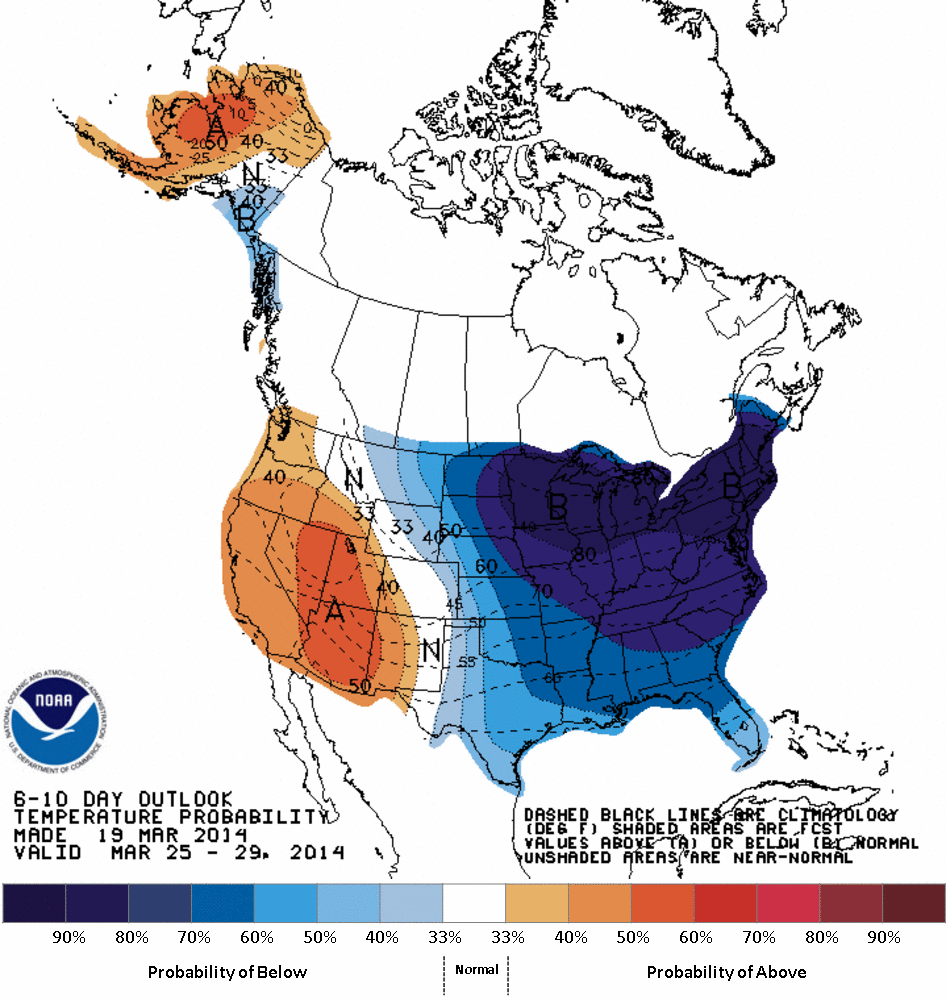
CPC Outlook for days 6-10 days it all. March will end cold, and then some. Many areas 10-25º below average. Source: NOAA
Not much you can say about Monday and Tuesday but COLD. Granted cold isn't now what it was in February, but highs in the 20s/low 30s is about as cold as it possibly can get during the final week of March. Not much to sneeze at there. Should be pretty windy to go along with that cold on Monday. The real interesting stuff is the storm potential. There's no real change tonight to what I wrote last night. Models are hinting at a big storm, the ECMWF has been the most bullish, and the GFS is sniffing around at it to a lesser extent. The majority of ensemble members are still in the 'not happening' camp, but there are enough of them showcasing big snow potential to stay wary.
Bottom line there is high confidence in cold, low confidence in storm track (very typical of a 6-day-out time frame). Of course, whether or not a storm develops and hits/misses us has a lot to do with what happens after Wednesday. If we get decked with snow it'll keep things colder. If it's a miss and nothing happens, there's a good shot temperatures will moderate by the finish of next week. But I'd bank on some pretty significant cold through at least Thursday.
Though it would be fun to do a poll on Twitter re: Do you want another storm, or are you done? Here are some of the answers :-)


