Storm Misses, Cold Air Stays
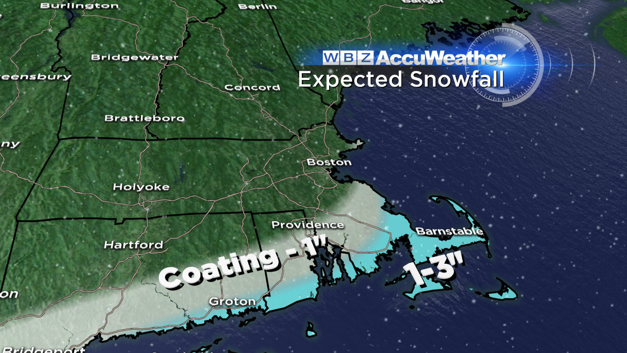
The cold front that came through earlier today will continue to slide offshore tonight, eventually stalling to our south. Low pressure will track along this boundary, grazing the Cape/Islands with some snow overnight into Monday morning.
The steadiest snow will be tomorrow morning on Cape Cod. The rest of us are too far removed from the moisture and storm center – and in turn, won't see any snow from this event. There may be a few scattered coatings on the South Shore to perhaps an inch or two on the Cape/Islands. Snow will end from west to east by mid morning – so this will be a very minor event and low impact on our WBZ iScale.
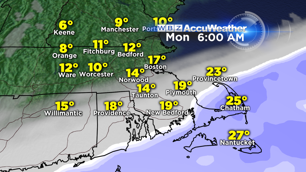
The main weather story this week will be the unseasonable cold air; high temperatures won't get out of the 20s from Monday through Wednesday (keep in mind our average high temperature should be running in the low 40s this time of year). Another front will cross the region Tuesday night into Wednesday, bringing the chance of flurries and snow showers. After that, we'll be keeping an eye on a big ocean storm that may track close enough to impact us by the end of the week.
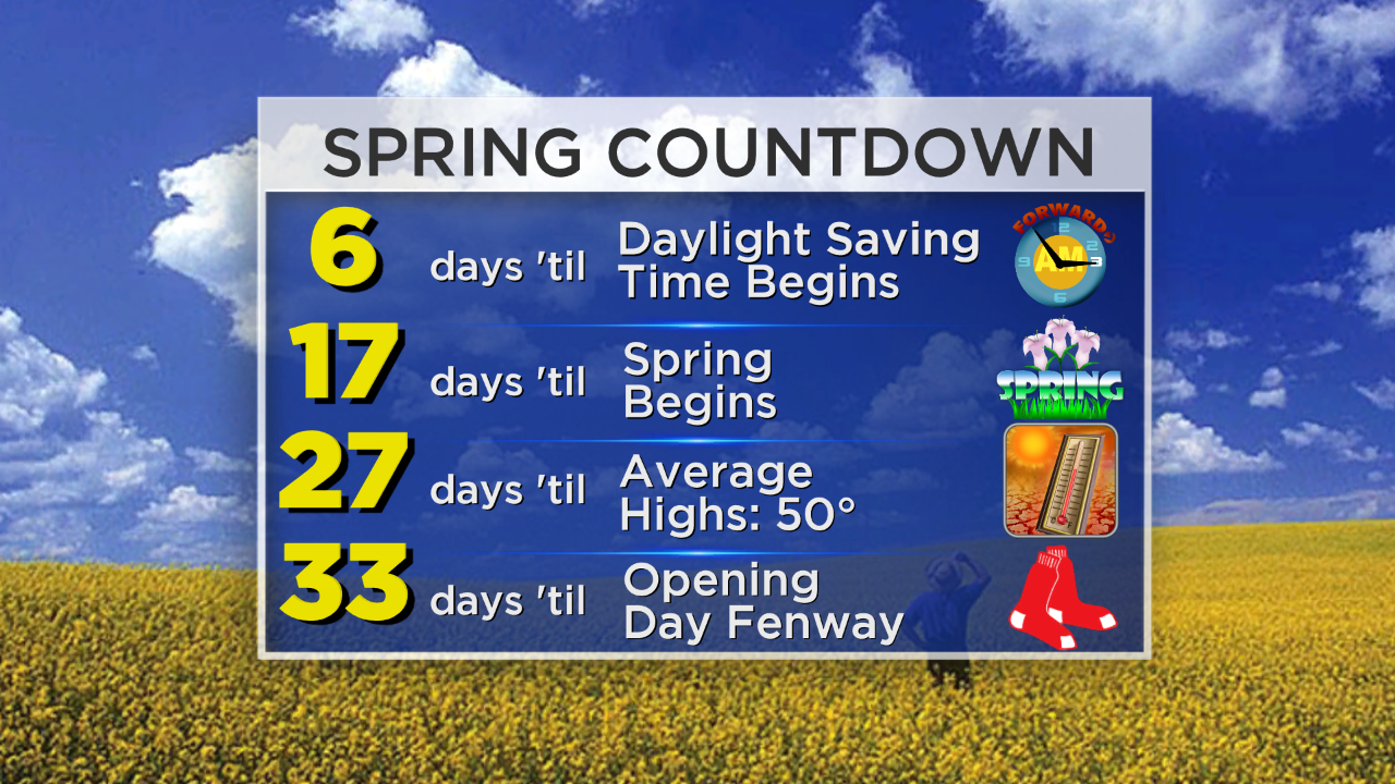
An updated Spring Countdown (as of tomorrow)? Yes, please!
Danielle