One More Mild Day
We won't be as bright or as mild as we were yesterday afternoon…but you won't hear any complaints from me! Our high temperatures will still be running above average out ahead of a cold front slowly sagging across the region.
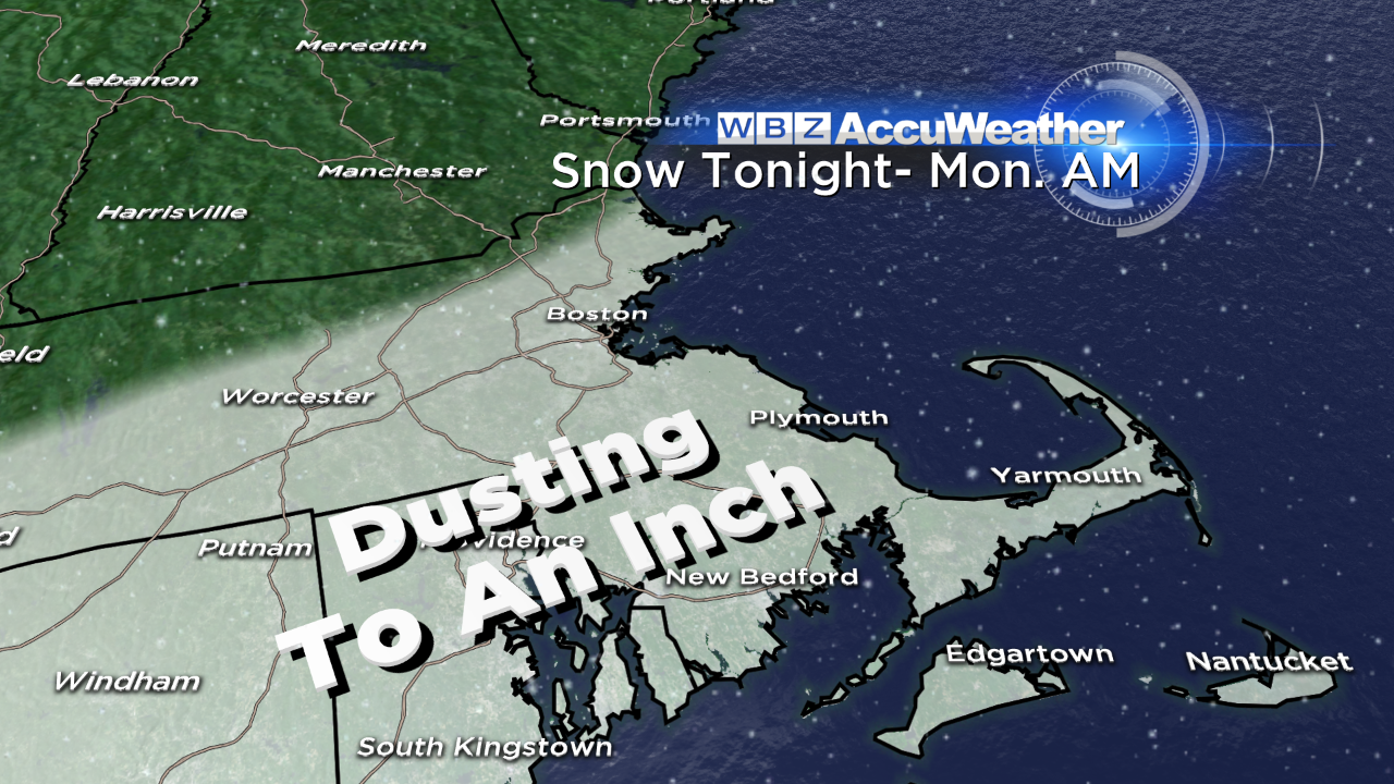
There is a batch of moisture along this boundary…but it's not all that impressive. What does it mean for us? An isolated threat for a rain shower this afternoon/evening (most won't see it) followed by some pockets of light rain changing to snow overnight into early tomorrow morning. Accumulations will be light – generally a coating to 1".
Other than that…the melt/refreeze process means there may be a few icy patches region wide early tomorrow, so use caution during your morning commute. The sun will break through tomorrow, although temperatures will be noticeably cooler – only in the mid 30s with a chilly west-northwest breeze. Tuesday will be even colder with wind chill values in the teens.
We're still monitoring the threat for snow on Wednesday as a coastal low passes southeast of us. While the path and strength of the storm is still uncertain at this point – a few inches of snow seems likely (very early estimate of 2-4", highest totals along the south coast) with the potential for more if the storm tracks closer. Stay tuned to WBZ as we nail down the details over the next couple of days.
-Danielle