From Above To Below
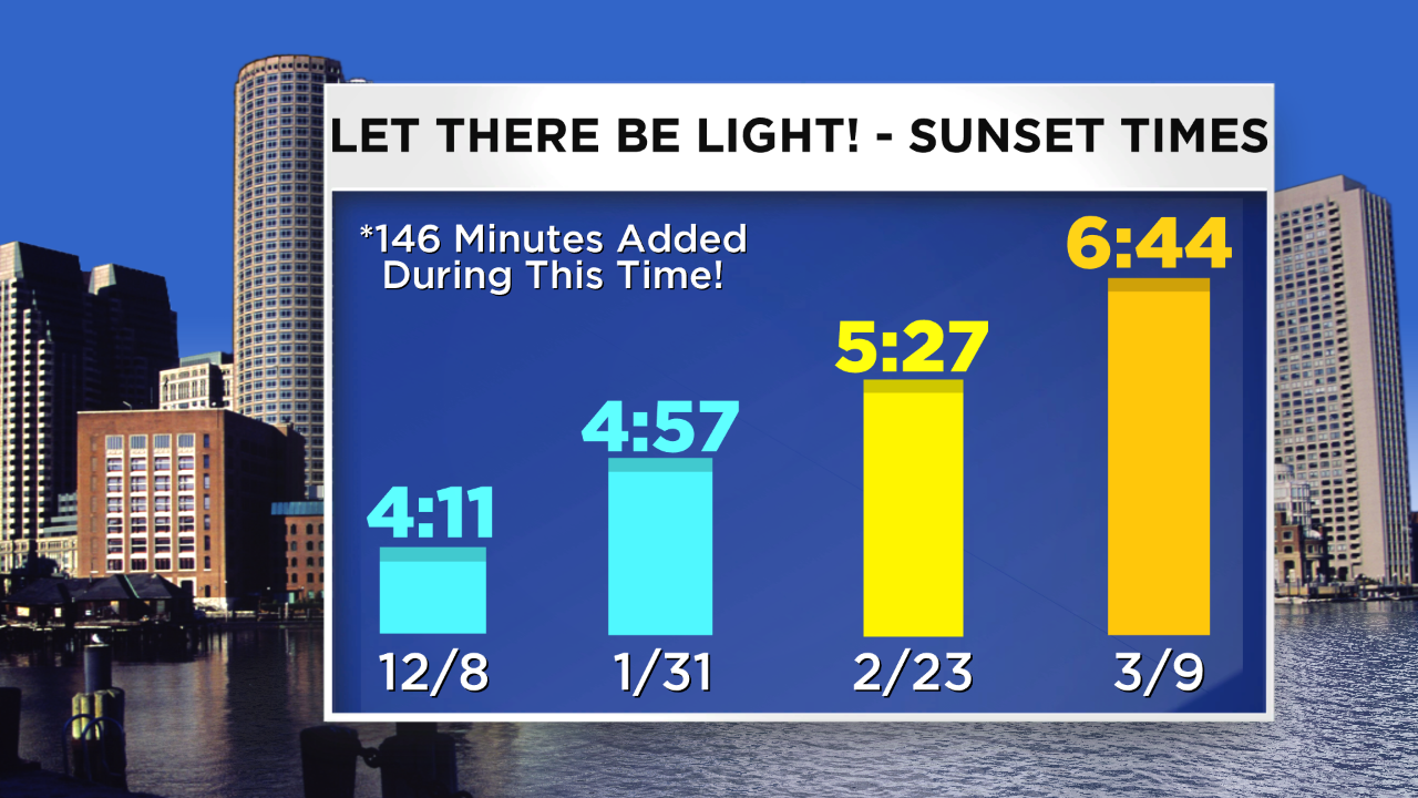 The school vacation is over in MA so it's back to reality and that applies to the weather as well. This weekend has given us hope that spring is just around the corner featuring the Great Boston Marathon. It was great to see all the walkers and runners out and about and that prompted me to get a good run in before spending much time scraping all the ice off my driveway. Today's high of 52 in Boston is a dozen degrees above the average for this date and it felt much milder than yesterday thanks to the weaker wind. It is the 4th consecutive day of above average temperatures in this month that has featured 15 below average days. The rest of the month, however, will have a negative departure with temperatures approaching 12 or more degrees below average daily so it was nice while it lasted. Nevertheless, while the temperatures take another plunge, the daylight will continue to increase and we all feel good about that. The sunset has progressed from the earliest at 4:11 on December 8 to today's 5:27 and two weeks from today, Daylight Saving Time returns yielding a sunset at 6:44. How sweet is that?
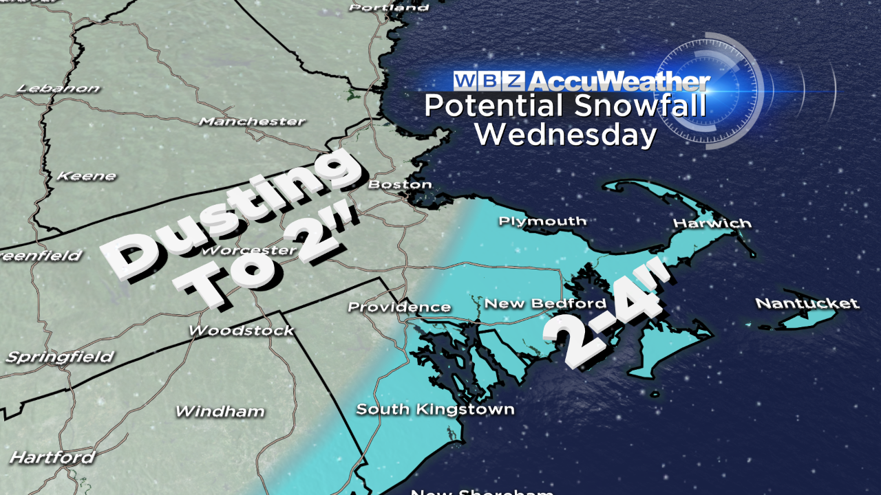 With the return of the winter chill, will it be accompanied by more snow attacks? As the colder air arrives tonight, a very meager impulse may touch off a brief spell of rain showers mixing with some snow flakes mainly over southeastern MA/Cape Cod in the predawn hours. There will also be some scattered snow flurries over the region tomorrow afternoon. I now expect no accumulation tomorrow so we look ahead to the Wednesday potential. Presently, I am not concerned about that one either but I wouldn't rule out a widespread dusting to 2" across the region. There might be a swath of 2-3" over southeastern MA with perhaps 4" on Nantucket. There will be a developing storm in the southern stream and much of its moisture will pass south of New England. As the upper level trough passes through, it should generate the dynamics to release the widespread light amounts extending across northern New England as well. It will be followed closely by another cold front which will trigger some scattered snow flurries on Thursday. Beyond that, there are indications that the next trough of low pressure will amplify as it nears the East Coast so the stage may be set for a few to several inches of snow on Saturday. I am not highly confident of that prediction just yet. If the sharpening does materialize, a more organized storm would form just south of New England with intensification on its way to Nova Scotia. That would tap the frigid air in Canada and we could be hit by an arctic blast next Sunday. It all bears watching.
Todd Gutner posts his thoughts tomorrow morning and Eric Fisher follows later in the day.
Make it great week!


