Close Call
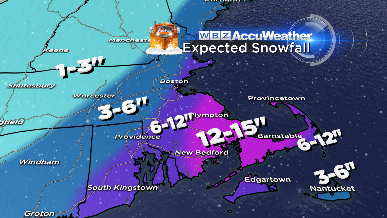 Despite the dire warnings that are out there for parts of the region from tonight's storm, I am pretty much convinced that this system isn't going to deliver much of a blow except perhaps parts of southeastern MA including Cape Cod. Undoubtedly, traveling will be tricky across much of the area where light snow is occurring north and west of Boston but it appears that only slight additional accumulation is expected from western Middlesex County westward as nothing more than a brief burst of moderate snow looks plausible above and beyond the very light snow there. The main package of energy will be passing over southeastern MA so snowfall rates of 1-2" are still possible in this area along with some isolated lightning and thunder. There is uncertainty remaining regarding the push of any heavy snow up into the Boston area. Presently, I sense that the amounts may need to be lowered in eastern MA from Metro-West to Boston. As a result, I am reducing the snowfall to near 5- 6" in Boston with perhaps 6-8" on outer Cape Ann with amounts ramping up over 6" just south of the city to 10-12" or so in many parts of Plymouth County into Bristol County. Jackpot areas may end up being lower Plymouth County onto Cape Cod where a maximum of 12 up to 15" could accumulate. As the storm intensifies explosively, the tightening pressure gradient will crank the winds to 25-50mph with some gusts exceeding 60 mph on Cape Cod on the back side of the departing storm offshore late this evening into the early morning hours. Less wind but still gusty to 20-40 mph over the rest of eastern MA. As the storm coils up off Cape Cod, the snow shield will actually contract and shrink hence the minimal additional snowfall expected over most of central MA westward. Since there is no blocking in the North Atlantic right now, this storm will race out of the picture later tonight. The snow will stop in central MA by 10pm and quit in the Boston area closer to midnight and last a bit longer on Cape Cod.
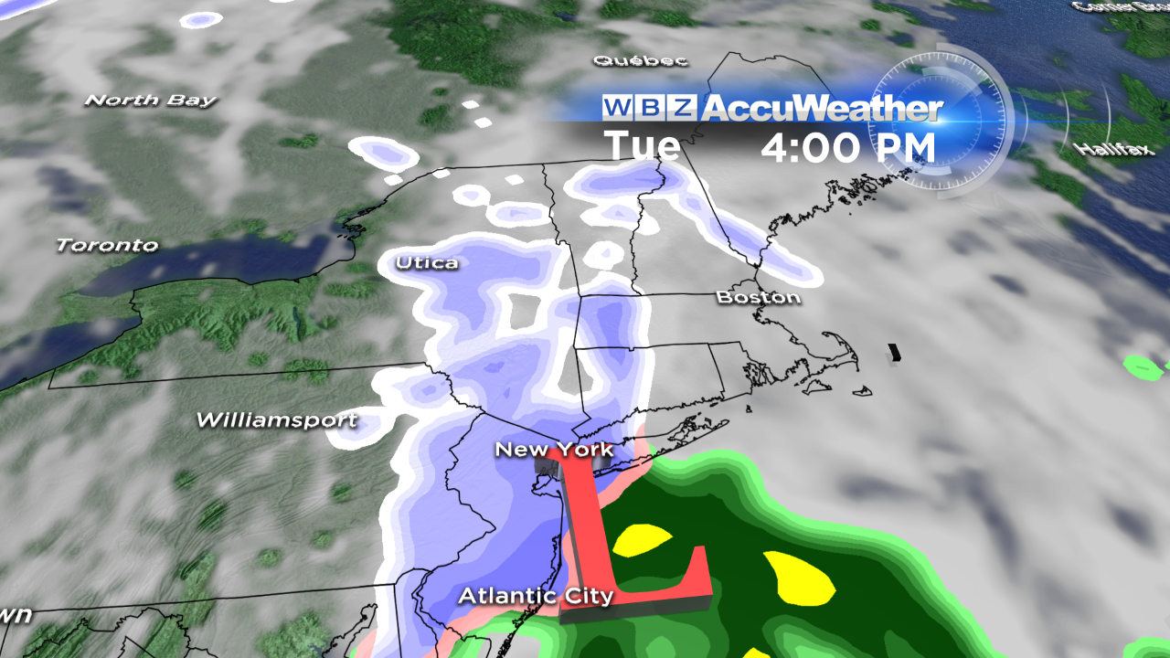 There is another minor storm in the Midwest tonight but that will actually weaken further and only throw a few patches of clouds across our sky tomorrow afternoon. There will be a gusty westerly wind of 20-40 mph tomorrow with an ample supply of sunshine most of the day as temperatures strike 30 degrees. A ridge of high pressure will be building eastward from the Great Lakes tomorrow and Monday. The wind will still be brisk, gusty and cold here Monday morning before decreasing in the afternoon when it hits 30 degrees. Sunshine will be bright all day with a few streamers of wispy clouds seen before sunset. With light wind, it will be chilly Monday night with lows in the upper single numbers to lower teens. High cloudiness will increase late at night followed by thickening clouds Tuesday morning. The next weather maker will arrive to produce another swath of snow starting at midday on Tuesday. Another few inches cannot be ruled out again. This one will not be a major storm for any part of the region and it will exit Tuesday night. After that, a change in the jet stream will steer milder air across the country. I am expecting some sunshine with a recovery to the lower to middle 40s on Wednesday and Thursday. The next storm will track up across the Great Lakes so we enjoy temperatures flirting with 50 degrees next Friday but there is a risk of some spotty showers as a cold front passes through the region. Beyond that, the next storm will emerge from the southern plains to create some snow or rain next Sunday.
For all of us who like to downhill and cross-country ski plus snowshoe and go snowmobiling, the conditions are so sweet everywhere now thanks to the recent snows. This weekend's storm is cranking out only small amounts of snow over most of the resorts but recent big snows of 10-20" have opened up most of the terrain including many of the glades and shoots. You will find powder, packed powder and machine-groomed surfaces on most of the trails. The timing is perfect for the long holiday weekend and the school vacation week. Please be courteous and stay in control and enjoy winter in New England!
Danielle Niles and Todd Gutner will be on duty in the morning and I shall post my latest thoughts later tomorrow.
Have a happy and safe holiday weekend.