Southern Winter Storm Brushes SE Mass Tonight
Find Eric Fisher on Twitter and Facebook
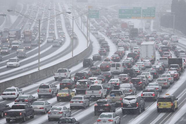
Source: Atlanta Journal Constitution. Taken Tuesday afternoon over I-285
Woooo boy what a mess in the south right now. As someone who lived in Atlanta for a few years before moving back up here, I can tell you that it gets absolutely snOMG ridiculous when accumulating flakes come for a visit. During the last significant event, a few years back, it snowed on a Sunday evening. My wife and I had to stay in separate hotels across the street from our places of work. For days. The interstates shut down. There were no plows, no sanders, no salt trucks. You literally had to just sit there and stare at the ice and snow until it melted. Which was 5 days later. Since then, they've added a few winter weather trucks to help out. But it's a sprawling metro area of almost 7 million, and obviously it had little impact. According to 11 Alive News, it's so bad that schools have held onto busses and are preparing to shelter students overnight. Dozens of vehicles ran out of gas on the interstates. How much snow you ask? 1-3". Thank your lucky stars we know how to deal with this stuff in New England!
*By the way - it DOES snow fairly frequently in Atlanta. It's not a tropical oasis where snow comes around every 10 years. It's crazy to think they have so little infrastructure to deal with ice and snow in that part of the country.
That same storm system is sliding up the East Coast and will bring some snow here to Southern New England tonight. The first flakes should arrive along the South Coast, Vineyard, and Nantucket by about midnight. So any evening plans are fine for travel, albeit very cold! This is yet another storm that's running into air so well below average that precipitation type is no problem whatsoever, even on Nantucket. Lows will be in the single digits and 10s.
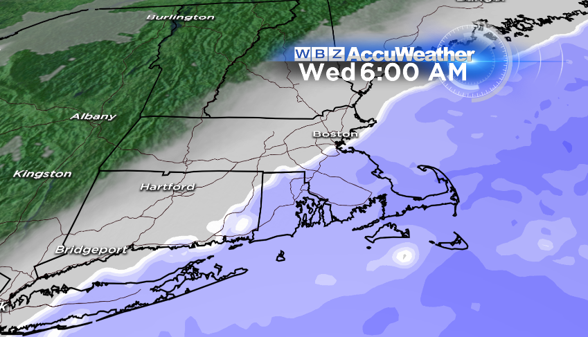
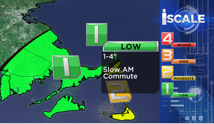
Snow coverage should sneak up toward Boston and Worcester before daybreak, but snow in those cities and their surrounding suburbs should be pretty limited. If you live in northern Worcester, Middlesex, or Essex Counties you'll probably see nothing at all. After sunrise the steadiest snow will be SE of Taunton, and quickly head farther to the east through the morning. It should be all gone by late morning, pulling away from the Outer Cape and Nantucket. With this timing there could be some school issues for the Cape & Islands...possibly a need for a delayed opening. Check back with Todd in the am to see how things are progressing!
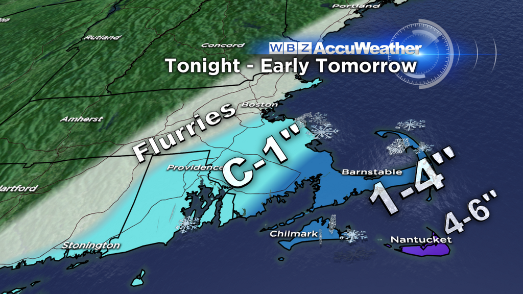
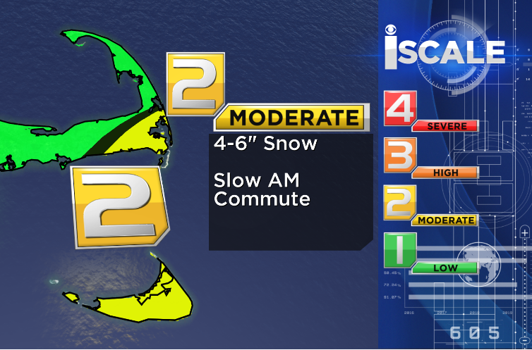
Think about a coating to 1", until you get down into southern Plymouth County. From there and points east thinking 1-4" of fluffy snow, the heaviest of which falls on the Mid and Outer Cape. The King of the Mountain will be Nantucket, where 4-6" should fall on Easy Street and across the Island! Been an incredibly snowy winter so far for the Cape and Islands.
Once the storm shifts eastward it's plenty of sun and cold temps. Highs should reach into the 20s, still well below average for this time of year. After a cold night, Thursday should end up feeling a little better. Lots of sun and highs in the 20s to low 30s are a little more seasonable, and without too much wind should be O.K. The next weather system is a weak cold front that runs into us on Friday. This one is moisture starved, and has a nice southwesterly flow ahead of it. All in all that means a few snow flurries/showers or sprinkles and temperatures that should close in on 40 by Friday afternoon. Not too bad of an end to the week!
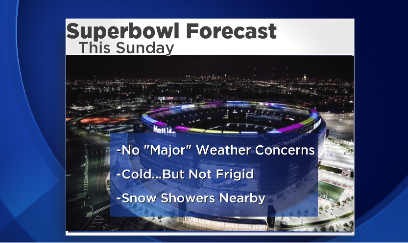
Was anyone else looking forward to a blizzard on top of the Superbowl? Wicked bummed about this...but happy for the fans who don't have to endure the wrath of winter at the big game.
Models are coming into better agreement regarding this weekend's forecast. The same front on Friday will lay down a boundary that will stick around on Saturday. A wave of low pressure with a pretty decent amount of moisture will sweep in late Saturday and into Saturday night. It may be cold enough at the onset, especially for the interior, to start with a thump of snow or ice. We've got plenty of time to watch this one and fine tune the forecast as we get closer. Milder air is expected to invade overnight, so most of that should change over to rain. The wet weather will stick around into Sunday morning before drying out. We get a break on Monday and for most of Tuesday before the next storm arrives. If the GFS is accurate, this one will be loaded with moisture so we'll be watching with interest as to whether it turns out to be rain or snow.
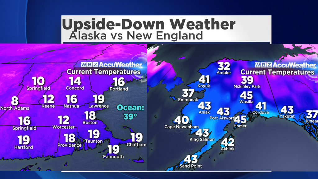
Barely any subfreezing air to be found across much of Alaska!
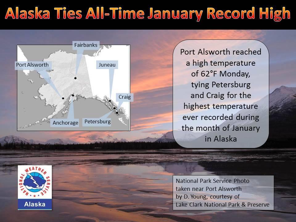
I've been getting a lot of questions lately about 'if it's so cold here, is it really warm somewhere else?' Indeed it is! Take a look at the comparison above, a snapshot taken at 6pm ET. Pound for pound, it's a heck of a lot more comfortable in Alaska! A huge ridge has been persistent from the West Coast right on up into Alaska, with unusual warmth owning the show. In fact, check out the record for the National Weather Service in Alaska below. One town went all the way up to 62º today, tying the warmest January temperature ever recorded in the state in 99 years of record keeping! Rare territory indeed. What we wouldn't do for a day in the 60s around here.
Source: The National Weather Service