December Chill Coming
 The temperatures have been on a roller coaster over the past couple of weeks with delightful middle 60s to lower 70s at the end of last week ranging down to the chilling 40s more recently. The mean temperature for the month is over a degree above average at this time. More swings are likely in the week ahead with seasonable conditions the next couple of days followed by a December chill on Tuesday and Wednesday and much milder air returning the second half of next week.
A storm crossing southern Canada just north of the Great Lakes will sail down the St. Lawrence River Valley in the next 24 hours. A weak secondary system will try to develop over New England tomorrow morning before the fronts shift offshore and a burst of strong to gale force winds sets in during the afternoon and lasts into early Monday. As energy passes over the region tonight into tomorrow, there will be a spell of showers up north with mainly snow over higher elevations where 1 up to 4" of snow could accumulate especially in favorable upslope locations in the Green Mountains. One short wave will exit the coast first thing in the morning followed by a second impulse at midday into the afternoon. This suggests that the sky will be mainly cloudy with a sprinkle or light shower possible prior to or just around dawn then changeable as it briefly clears in the morning then lots of clouds rush in and develop over the area to produce a few scattered showers in the afternoon. The wind becomes most gusty as the afternoon progresses with westerly speeds past 30 mph.
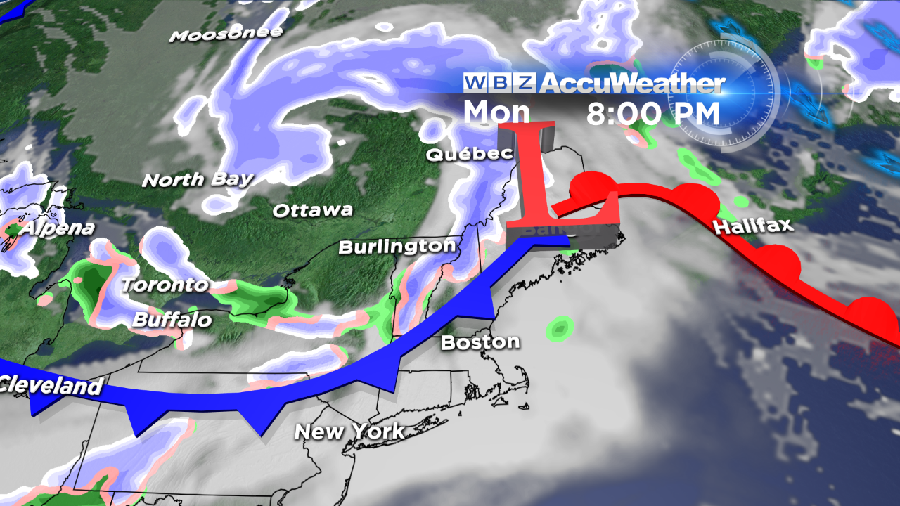 A ridge of high pressure will zip quickly eastward and push offshore Monday morning, Veterans Day. This will result in lots of sunshine as we honor all those people who have served in the armed service. The wind will veer to the southwest ahead of a sharp cold front racing southeastward across the Great Lakes. The cold frontal passage should occur near or just after midnight Monday night. So after highs near the middle 50s tomorrow and the lower 50s on Monday, the temperatures will struggle to reach 40 on Tuesday and Wednesday. There might be sufficient support for some post-frontal snow showers Tuesday morning with sunshine taking over in the afternoon.
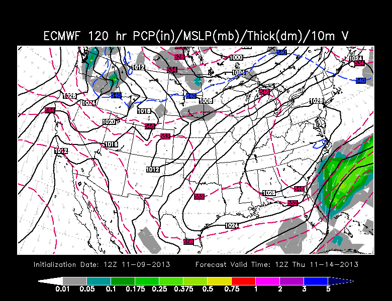 Looking ahead, generally sunny weather is anticipated from next Wednesday through next Sunday. The sprawling, robust zone of high pressure diving into the central part of the nation next week will expand and ridge into the Northeast before sinking southward. Initially, as noted, it will be very cold with temperatures almost a dozen degrees below the average on Tuesday and Wednesday followed by milder weather the second half of next week propelled by more of a southwesterly wind. Max readings in the lower 50s should return next Thursday followed by middle to upper 50s on Friday and Saturday. There are no storms in the works for next week with rain holding off until sometime on November 18th.
Danielle Niles will post her thoughts tomorrow morning and I shall return tomorrow evening.
Enjoy the rest of the Veterans Day Weekend.