Super-Typhoon Haiyan; Strongest Cyclone Ever To Make Landfall
Find Eric Fisher on Twitter and Facebook
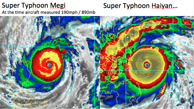
Unfortunately, we've had our share of natural disasters in the U.S. over the past couple of years. Tonight, it's the Philippines dealing with what may be an unprecedented storm. According to Dr. Jeff Masters of Wunderground.com, Haiyan is the strongest tropical cyclone ever to make landfall on the planet Earth since we've been able to keep records. The winds are gusting to a mind-boggling 235mph, with sustained winds near 195mph. The central pressure has plunged below 900mb, something even Katrina was never able to do. Those numbers are estimated by satellite, since they do not use Hurricane Hunters and their on-the-spot data in the Philippines.
It's hard to fathom, considering the pressure is lower than Katrina and the winds dwarf what Andrew brought to Florida in 1992. Granted, the coast of the Philippines is not built up like our U.S. coastline. But what is there will be leveled by winds of that nature. That's the equivalent of an EF-5 tornado in the eye wall!
This is also the same area that was struck by a M7.1 earthquake in October, killing more than 100 people, and it is the 5th typhoon to strike the Philippines this year. While our basin has been active in the Atlantic, the western Pacific has not been quiet at all. A parade of typhoons have been gobbling up favorable atmospheric conditions and the always very warm ocean temperatures for several months.
Below is a collection of some staggering images of this 'perfect' tropical cyclone. You'll rarely see one like this anywhere in the world. The day has now started in the Philippines, and we'll keep our fingers crossed that they've managed to prepare. The only saving grace may be that the eye is forecast to track about 180 miles south of densely populated Manilla.
There are people taking video inside the storm. There are several clips found here: http://instagram.com/p/gbow7rKWz7/

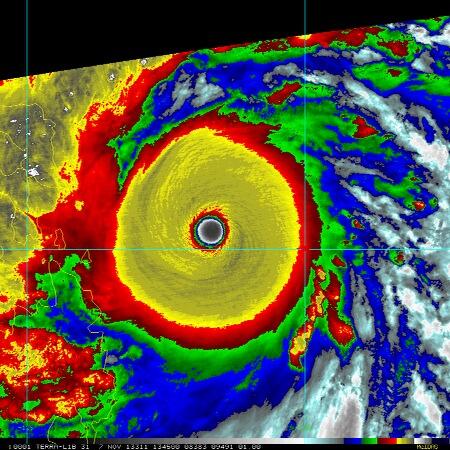
Courtesy: NOAA
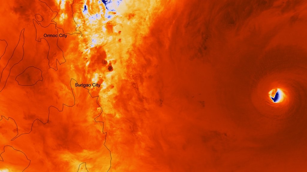
Courtesy: NOAA
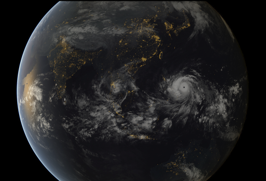
Typhoon Haiyan approaching the Philippines (13:00 UTC 07/11/2013). Image captured by the geostationary satellites of the Japan Meteorological Agency and EUMETSAT.
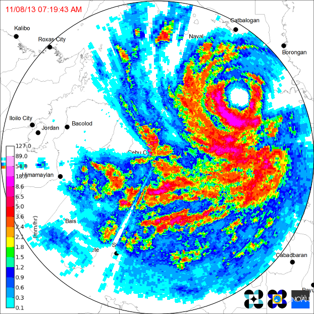
Radar image capture eye making landfall in the Philippines
Haiyan visible satellite loop via NOAA