What A Weekend!
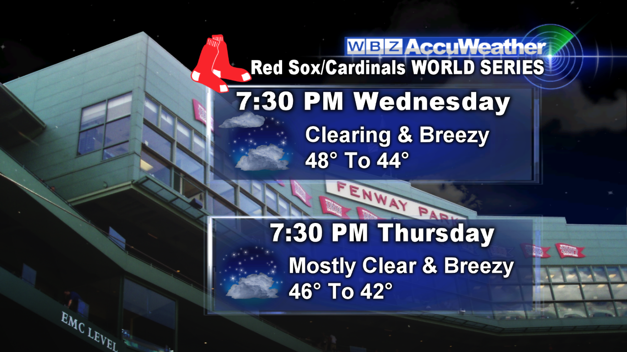 It has been one unbelievable winner of a weekend in Boston! The 49th Head Of The Charles Regatta is featuring nearly 10,000 rowers from around the world and the Boston pro sports teams have all been victorious. The Bruins shutout the Lightning, the Revolution beat Columbus and the Red Sox are the AL Champions!!!!! OMG, it doesn't get any better than that. Three World Series in the last ten years is truly beyond belief. The 109th edition of the World Series starts this Wednesday night right here at Fenway Park. Presently, it appears that a spell of showers during the day should be exiting before the first pitch just after 8pm. As a result, the sky should be clearing during Game 1 as the temperature drops from near 48 down to about 44 but it will feel like the 30s due to a biting wind. It will even be a touch colder during Game 2 Thursday evening! Interestingly, the 1997 World Series Game 4 was the coldest on record as the Indians hosted the Marlins in Cleveland. First pitch temperature was 38 degrees but the howling wind made it feel like 18-20 as occasional snow flurries fell! MLB records started in the 1970s so there were probably a few prior colder contests.
 Following today's early morning cold frontal passage, a dry and stable atmosphere has provided bright unlimited sunshine and that will continue through the afternoon in almost all areas. There is a plume of clouds originating over Lake Ontario. The plume is streaming eastward releasing some rain and lightning over upstate NY with drying into VT and western NH. A few lonesome clouds may dot the deep blue sky mainly well north and west of Boston as the afternoon progresses. The gusty wind up to 30 mph. will continue to produce showers of falling leaves and pine needles as the temperatures top out near or just under 63 degrees. The wind will shut down near or just after the 5:54 pm sunset. Under a clear, moonlit sky tonight, it will be cooler than last night with lows in the upper 40s in Boston ranging down to 35-40 in the colder suburbs. Sunshine will prevail tomorrow with much less wind and a nice recovery to 64-67 degrees. Despite more clouds than sunshine Tuesday afternoon, 66-70 degrees is attainable. There might be a brief shower but most of the action will occur over northern New England.
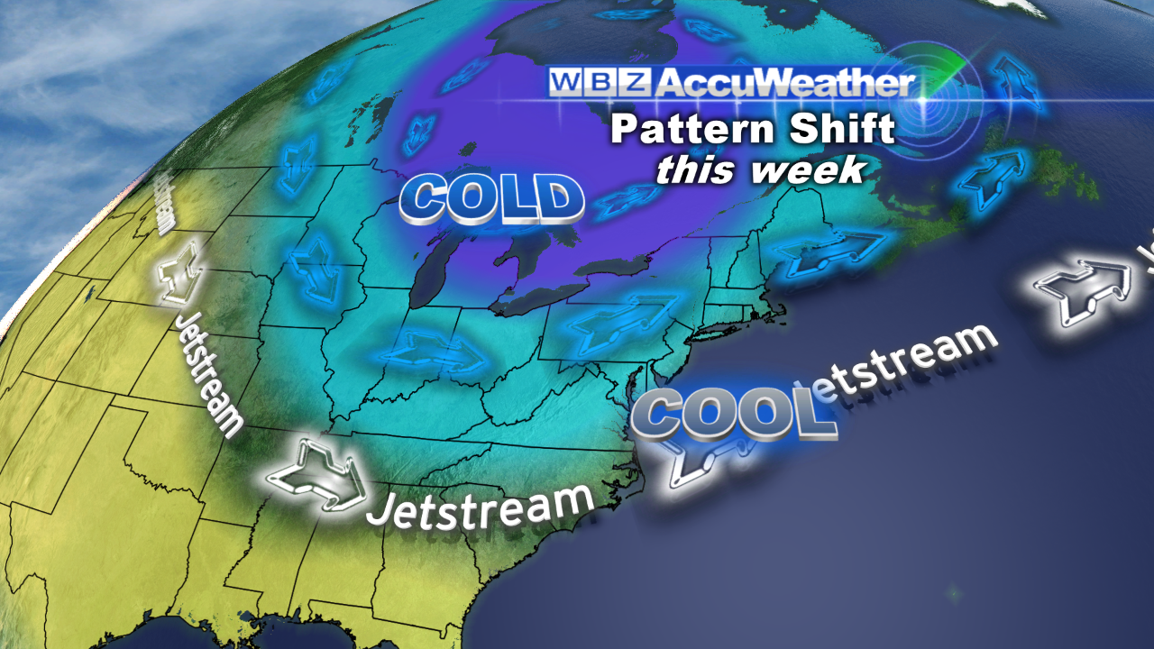 Looking ahead, all good things must come to an end as the advertised upper air pattern change will materialize resulting in the steering currents propelling chunks of chilly air out of Canada over the next couple of weeks. The cold weather will be introduced by a wave disturbance that will generate a spell of showers here on Wednesday. Once the system exits and intensifies over the Canadian Maritimes, it will become blustery with periodic gusts exceeding 30 mph the second half of this week. Consequently, many more colorful leaves will be stripped from the trees plus the many recent days of warm weather will be replaced by below average temperatures thereby dropping the current almost 5 degrees above average mean temperature for October. It now appears that only snow flurries/showers will fall over the hills and mountains farther west and north later this week. No important snowfall is anticipated as the storm departs swiftly.
If any new data warrants a revision of this weather prognosis, I will post an update this evening. Otherwise, Todd Gutner will publish his blog tomorrow morning.
Enjoy the rest of this amazing weekend.


