Many Changes Next 24 Hours
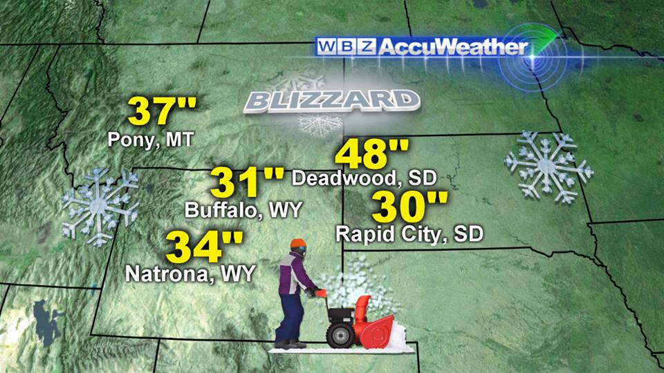 Over the next 24 hours, the weather will feature fluctuations in a wide spectrum of variables including temperature, wind, humidity, fog and cloud content plus rain. The potent weather maker which has been slicing across the country producing a blizzard in the Black Hills of SD to EF4 tornadoes in NE and IA to flooding rains in KY and OH will take aim on the Northeast today. The strong cold frontal boundary will continue to push into warm and humid air and with a tightening wind field and some shear with instability, we have the recipe for some potential severe thunderstorms mainly over NY, PA, MD, NJ into western New England. The primary feature will be the 15% probability of a few damaging wind gusts in these areas. The line of showers containing downpours and some embedded lightning and thunder will shift into eastern NY and western New England from mid-afternoon and early evening with the shrinking swath arriving in the Boston area from about 9-10 pm.
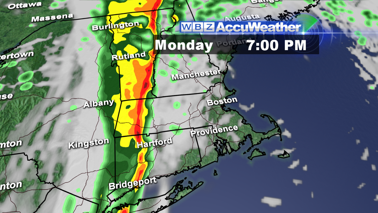 This band will be trucking right along so the nasty showers will not last much longer than 15-30 minutes. Prior to that arrival, there will be scattered renegade showers and possible thundershowers transiting northward over the region starting this morning and continuing through the afternoon. After little fog last night, it has become a real issue during the morning commute with the visibility dropping down to less than a quarter of a mile to a few hundred yards in spots. Reduce speed and drive with caution and allow extra time for travel this morning. The fog will lift and vanish as the muggy air takes over after the passage of a warm front as the morning progresses. Betwixt and between some of the showers will be some brightening episodes and splashes or brief spells of sunshine late this morning and afternoon. As a result, the temperatures will ascend easily into the middle 70s. With the increasing pressure gradient, the entire region will have southerly winds ramping up to 15-35 mph midday through the afternoon.
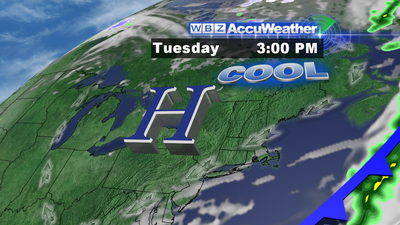 Following the cold frontal passage this evening, the wind will shift to westerly and drop back to 10-20 mph enabling a rush of cooler and much drier air into the area. By daybreak tomorrow, it will have fallen back into the 50s. A stable and dry atmosphere will provide plentiful sunshine tomorrow and with a sprawling high pressure system building east-northeastward from the Midwest, we will enjoy bright and crisp weather through Thursday. Sunshine will be practically unlimited tomorrow and Wednesday with perhaps some high thin cloudiness starting to filter the sun a bit on Thursday. Daytime max temperatures will be in the upper 60s tomorrow to the middle 60s on Wednesday and back to the upper 60s on Thursday. After that, the forecast becomes uncertain based upon the possibility of low pressure taking shape off the North Carolina coast. Some indicators point to this feature shifting slowly northward and developing as it jams against the strong high pressure system ridged across northern New England into the Canadian Maritimes. It is too premature to be confident of any one solution to this dilemma. One school of thought is that one weak wave would release some rain as early as Friday then high pressure would reload to the north and push that system out to sea with another wave returning about a week from today. Another possible scenario is that the initial wave more slowly evolves and shoves its shield of rain into the area much later on Sunday into Monday. Clearly, with the Columbus Day holiday weekend looming, Murphy's Law usually applies so there is bound to be a surprise or two.
Make it a great day.