So-So Weekend
The long range outlook from last weekend for this weekend looked like there was potential for a piece of the Plains heat to stream eastward into the Northeast providing us with some sizzling weather for the so-called final fling weekend of the summer. That scenario, however, became less likely as the atmosphere was becoming contaminated with perturbations that would create episodes of showers and storms as a frontal boundary flounders into the region and becomes quasi-stationary. The reality is If we were to have full sunshine this weekend, there would be some readings at 90 degrees or slightly higher but that is not going to happen. So the first upstream system to foul up the weather works arrives tomorrow. Its main bundle of energy and packet of showers and storms will transit southeastward from Ontario into Quebec, NY and mainly northern New England later today through tomorrow. Its trailing cold frontal boundary is destined to sink into the area and lose its momentum. Here in lies the problem. How active will the front become? Many signals suggest that minor impulses motoring along in the steering currents will occasionally trigger shower and thunderstorm development. Presently, the precise location of the firing of storms is not etched in stone but it appears that most of the action will erupt in an axis mainly positioned north and west of a Providence to Boston corridor. There will be spells of showers and storms over the mountains and lakes up north as well. Meantime, an upper level trough of low pressure will become more amplified with time over the eastern portion of the nation so that enhances the potential for the wet weather. With all of this in mind, the conclusion is that the lowest risk of showers is placed over southeastern MA including Cape Cod and the Islands. Flip side is that some areas may have locally heavy downpours causing flooding in poor drainage locations closer to the frontal boundary. It figures because it is an important holiday weekend and it is not a high confidence forecast. Why couldn't we have an easy forecast and perfect weather like what we all enjoyed last weekend?
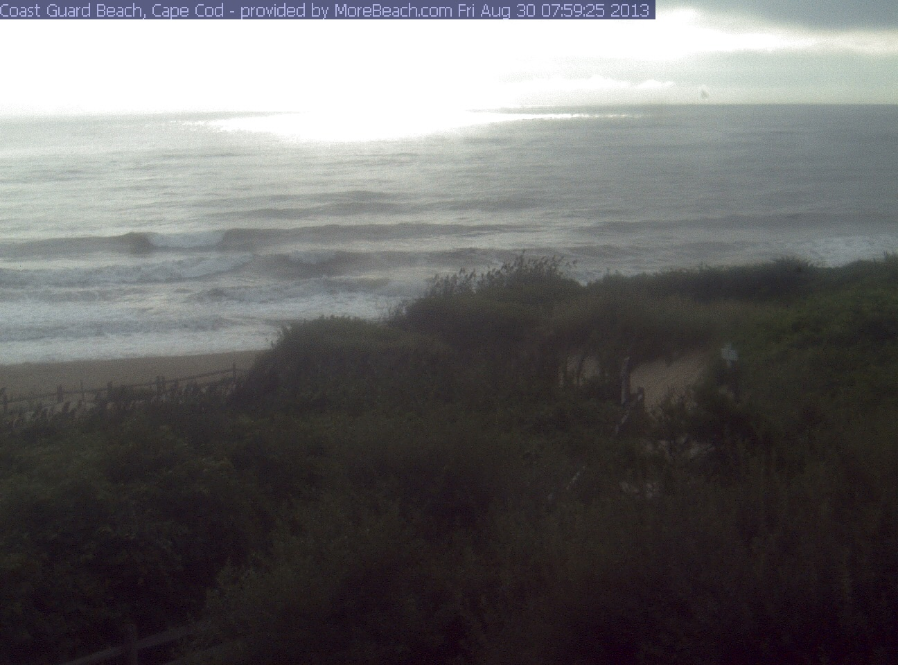 Breaking it down, summer resumes today as the early overcast thins and breaks up enabling the return of some sunshine yielding high temperatures in the lower 80s. Although comfortable most of the day, the humidity will gradually increase and tomorrow through Monday will be very muggy to bordering on oppressive. Overnight lows will range from the middle 60s tonight to the upper 60s to lower 70s on subsequent nights through Monday. Daytime highs will rise closer to the middle 80s despite more clouds than sunshine. Expect a shower or boomer at anytime this weekend with the most probable time for the most widespread action on Labor Day. At this point, the risk of severe weather seems minimal so the only weather worries is dodging the raindrops and the lightning bolts. Poor drainage sudden street flooding is the worst expectation right now. High tides will occur generally between 8 and 10 am and pm this weekend. The wind will be mostly under 15 mph but may increase a bit on Monday from the south-southwest. The visibility may be variable in haze and areas of fog. The ocean temperatures are in the range of 65 and 71. The surf is up today thanks to a couple of offshore storms in the past few days. Although not huge, some of the best breakers of the summer are out there today and perhaps into tomorrow. Check out the surf cams.
Looking ahead, an approaching cold front from the west will finally arrive Tuesday morning and clean out the house resulting in a return of drier air and some sunshine for that afternoon as we all get back to the reality of school and work. It should be a beautiful Wednesday with sunshine and highs near or just under 80. That will be followed by a stronger cold front which will pass Thursday morning with a brief shower in spots. A shot of very cool air will rush into the Northeast following the frontal passage. In fact, the temperature may fail to strike 70 degrees a week from today!
Two years ago today, we were cleaning up from Hurricane Irene. Most of the damage and flooding in New England occurred over western areas of the region. Irene turned out to be the 7th costliest hurricane in the history of this nation! In sharp contrast, there have been NO hurricanes in the entire Atlantic Basin for this whole month of August. Its the 25th time that has happened in the last 161 years of records! For more information on the tropics, logon to the National Hurricane Center.
Three years ago today, it was day #2 of a 5-day heat wave with respective temperatures of 94, 92, 96, 94 and 95!
Eric Fisher will post his blog this evening and I shall return early tomorrow morning.
Have a happy and safe holiday weekend!