Wonderful Weekend Weather
For the second day in a row, Boston's temperature just missed reaching 90 by 1 lonely degree. As a result, the city has no days at 90 or higher this month and, unless it turns hot quickly next Saturday, this will be the first August since 2008 without any and there are, on average, 3 such days in August. As cooler and drier air works into the region today, the maximum temperatures will be mainly in the lower 80s but it will be in upper to middle 70s along the coast this afternoon as a morning northwesterly wind becomes more north to northeasterly at 8-18 mph. Expect a changeable sky of various clouds and sunshine. There is a slight risk of a few spotty sprinkles or mainly light showers this afternoon. The sky will become clear this evening as the waning gibbous moon rises at 8:44 pm. With the gradual decrease in humidity through the day, it will be comfortable for sleeping tonight as it cools off to about 65 in Boston ranging down to the 50s in the suburbs.
The weekend weather will be wonderful from the summits to the seashore. The visibility will be excellent for hiking and climbing and boating. A sprawling zone of high pressure will be camped over the Northeast providing nice dry air with dewpoints in the 40s and 50s. The atmosphere may only be capable of producing a few scattered small puffy clouds tomorrow and only a bit of feathery high cloudiness by late Sunday. A steady northeasterly breeze may be brisk tomorrow morning over Cape Cod and the south Shore before it lightens up and becomes easterly at most coastal locations. Consequently, it may actually feel quite cool at the beaches tomorrow with highs mainly in the lower 70s while farther inland, it tops out in the upper 70s. After that cool start Sunday, there will be at least a 30 degree recovery in many areas with the afternoon highs near or slightly over 80 except along the coast again. At the beaches, a light east to southeast to southerly breeze will blow at 5-10 mph. The tides will be high at 2:20 pm tomorrow and just after 3 pm on Sunday. Ocean temperatures are running in the range of 66-72 and the waves are at 2-3 feet for the most part.
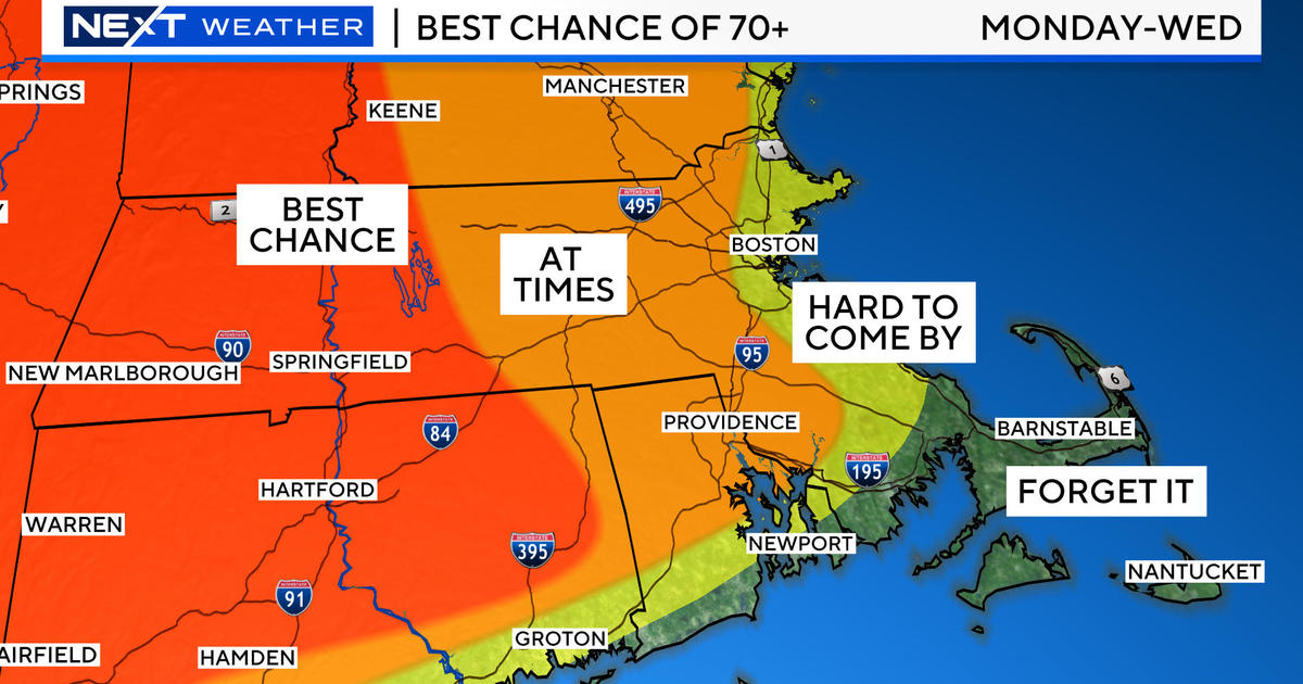
Next week becomes unsettled with some badly needed rain on the menu. A strengthening upper level high pressure system over the Plains States is going to create a heat wave there after a cooler than average summer so far. Short waves will travel around the periphery of that high pressure system. Interestingly, most of them will be emanating over the Pacific Ocean south of California. They will track northward then northeastward into the northwestern Rockies then eastward over the upper Mississippi Valley then east-southeastward over the Great Lakes and NY and southeastward into New England! The first wave is destined to produce mostly variable cloudiness here on Monday. Its parcel of showers will probably bypass most of the region except perhaps southwestern New England later Monday. The second system is projected to be steered closer to us resulting in showers and some thunderstorms on Tuesday. The 3rd and most vigorous wave will become more energized as it digs into New England so heavier rain and embedded thunderstorms are possible next Wednesday afternoon and night. While deepening, the surface storm will transit southeastward across central New England then off Cape Cod where it may intensify sufficiently to ramp up the wind early Thursday as the shield of rain shifts offshore after dawn.
Looking ahead, after those waves exit, the upper air flow will become more westerly and that will propel a piece of the Plains heat eastward through the Great Lakes perhaps into New England over the Labor Day Weekend. It is too premature to be highly confident of this scenario but, presently, many signals suggest that this is quite plausible. If that verifies, there could be one or two hot days of 90-95 as August ends and September starts. Hopefully, more cool air from Canada will come to the rescue as the new school year begins.
Todd Gutner will post his blog early this evening and Joe Joyce returns to duty tomorrow. Beginning Monday, Todd Gutner will be working the weekday morning shift, I will be working the weekend morning shift, Joe will handle the weekend evening shift and the new member of the WBZ Weather Team, Eric Fisher, will be the weekday evening meteorologist.
Have a happy and safe final full weekend of August.


