Awesome August
This month of August has been one of the best summer months that we've had in a long time in my opinion. Do you agree? There have been many very enjoyable sunny warm summer days without high humidity and excessive heat. The last time the temperature reached 90 degrees was on July 20 which was the 7th day of a heat wave! It will nudge 90 in many locations today except close to the coastline where beach temperatures will be restricted to the lower 80s by a gentle sea breeze blowing at 6-12 mph by late morning through the afternoon. Boston's official weather observing station at Logan Airport will probably not strike 90 unless the wind shifts to a southwesterly direction around 4-5 pm and that cannot be completely ruled out. The good news is that the humidity will remain relatively comfortable with dewpoints rising slightly into the lower 60s only and that is classified as moderate humidity. It will be a superb beach and boating day with the high tide happening at noon. Ocean temperatures are in the range of 65 to 72 and the waves are cresting at 1 up to 3 feet. The wind will blow near or slightly over 10 knots from the west-southwest to southeast. Apply the sunscreen!
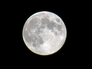 It's a real treat to have a stunning full moon on a warm summer evening and last night was the perfect example of that. Temperatures were dropping though the 70s and the sky was clear and moonlit. It cooled off nicely to make for a comfortable night for sleeping. We have another opportunity to see the moon tonight but it will be just past the full phase known as a waning gibbous moon now. It will rise at 7:40 pm. The sky will become partly cloudy and the humidity will rise a bit but not into the real tropical category. It will cool off to 73 in Boston to as low as 63 in some of the suburbs by dawn tomorrow.
As a weak upper level disturbance lifts out of the Ohio Valley today and runs into southern New England tomorrow, the stage is set for some scattered showers and boomers especially over CT and RI by late morning or midday. There might be an absence of that activity mainly north of the MA Pike into the afternoon. Meantime, a stronger cold front will be shifting east-southeastward from the eastern Great Lakes and NY. It will likely fire up a band or 2 of showers and storms entering VT, western NH and western MA by late afternoon to early evening. This projected string of showers and storms will gradually shift eastward and weaken upon reaching eastern sections late tomorrow night and early Friday.
Looking ahead, there could be a few lingering showers or storms Friday morning as the cold front gradually moves offshore. There might be sufficient instability remaining post frontal passage to generate a few more scattered showers and storms Friday afternoon then the cooler and drier air will take over and provide some refreshment for the weekend. A sprawling zone of high pressure will become dominant and control the weather through the weekend. A north-northeasterly wind will be busy on Saturday then a lighter wind is due on Sunday. It will be sunny to partly cloudy on both of those days extending into the first part of next week. A mass of hot air building in the central Plains over the weekend will attempt to push eastward into the Great Lakes and Midwest. Presently, it appears, however, that a northwesterly wind aloft will prevent the hot stuff from flowing into New England next week. Over the past couple of days, it looked like the battleground between the cooler air and hotter air was going to reside close to or right over us which would have meant a round or two of showers and storms. New guidance indicates the axis of action would set up farther west of the region meaning that we would mainly only see spells of overrunning clouds with most of the showers erupting from the western half of NY southeastward into the Mid-Atlantic region. We shall see.
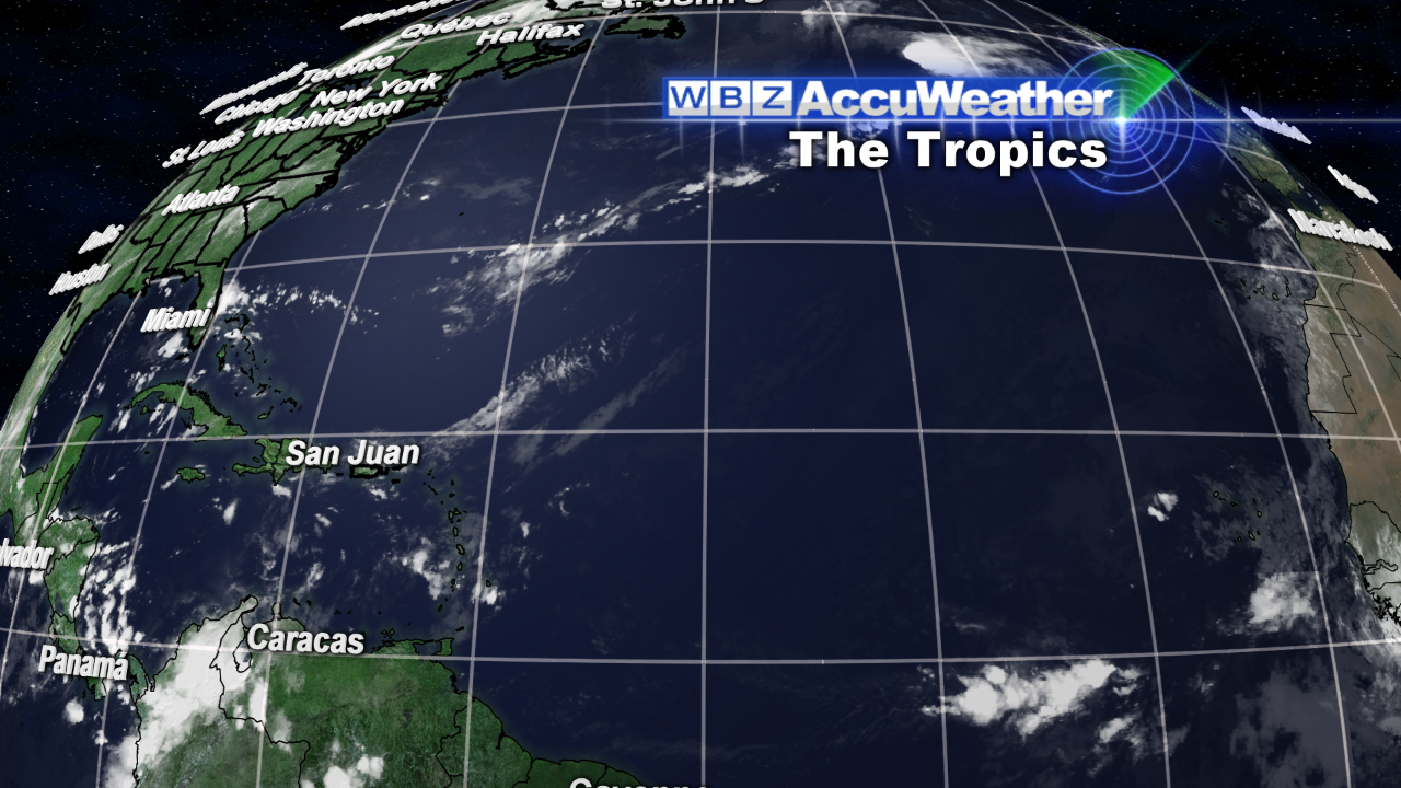 The good news is that the tropics are unusually quiet at this time of the summer when the activity is generally increasing to a peak around September 10. One of the main reasons is the existence of dry air which is squelching the waves moving off the coast of Africa.
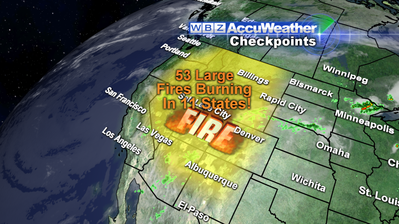
The bad news is the 53 large fires burning over 11 western states. Close to 3.5 million acres have been destroyed!
Todd Gutner posts his blog early this evening and I shall return early tomorrow morning.
Make it a great day!


