Wonderful Weather Ahead
Despite today's rain and thunderstorms, we're in the midst of a long stretch of beautiful weather that started last Saturday and should extend beyond next weekend! This is the only showery and humid day of the bunch as a wave of low pressure tracks from southeastern PA to northern NJ across the NYC area into southern CT, RI and southeastern MA. Oppressive tropical air is feeding into this weak system and some lift will generate copious amounts of rain up to 2 or more inches from Philadelphia into NYC and CT. More than 1 inch is expected in much of the Boston area southward with lower totals again under a half-inch for much of lower Cape Cod. As the wave moves into CT near or just south of Hartford, the highest risk of spotty strong to severe storms will be over mainly southern CT and southern RI. While lightning and thunder will be scattered across the rest of the region, severe weather is not anticipated at this time. Due to lack of sunshine, temperatures will only rise just a few degrees similar to what happened last Friday. Expect 73-76 in most locations as the humidity rises into the moderate to high category with the oppressive conditions confined to extreme southern New England closer to the warm sector of the storm. Once the disturbance departs early this evening, the showers will shut down abruptly and partial clearing is possible late tonight as the drier air pours in.
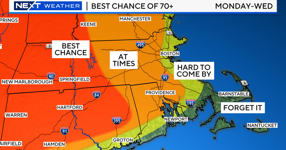
Tomorrow will be considered a transition from today's rain and the delightful weather that will resume on Thursday and linger for many days. While there will be spells of sunshine between passing patches of puffy clouds on your Wednesday, the westerly wind will be gusty at 15-30 mph. Temperatures will peak out in the middle 70s but it will actually feel a bit cooler with the much drier air and the brisk wind blowing. There could be a few spotty showers over the northern mountains. With a sprawling zone of high pressure over the upper Midwest and Great Lakes pressing eastward, the weather is shaping up to be stellar. The ridge of high pressure is predicted to become entrenched over the Northeast into the Maritimes thereby blocking any potential intruders from the south and the north. With that said, a slight turning of the steering currents could escort some high cloudiness from the Mid-Atlantic into our region from time to time but I feel that the most likely time for that to happen is later in the weekend as an impulse is transported just off the coast but most of its rain should skim just south of New England. As it exits, sunnier conditions should return next Monday. Long range guidance is revealing the high pressure system to remain locked in place well into next week although it does begin to settle south by midweek. With time, it will become gradually warmer and somewhat more humid next week as daily sea breezes keep the coast a bit cooler overall followed by a southwesterly wind late in the week. Daytime highs will gradually ramp up a degree or two for each succeeding day going forward with beach air temperatures a bit lower by a half-dozen degrees or more through that period. Speculatively, another mass of dry air could be surging out of Canada to create more refreshing air in the Northeast on the last full weekend of August.
Now I offer you some good news to make you smile today. The chance of any severe thunderstorms around most of the Boston area today is slim to none and it looks like there will be no additional boomer threats for the next 1-2 weeks. Additionally, the tropics continue quiet due in part to the dry air over much of the far eastern Atlantic and also in part to dusty air emanating from Africa. As a result, we don't have to be talking and dealing with tropical cyclones for the next 1-2 weeks at least. Tropical cyclone activity generally peaks out on September 10. Peaceful weather is our friend.
Todd Gutner post his blog early this evening and I shall return early tomorrow morning.


