Double Your Pleasure
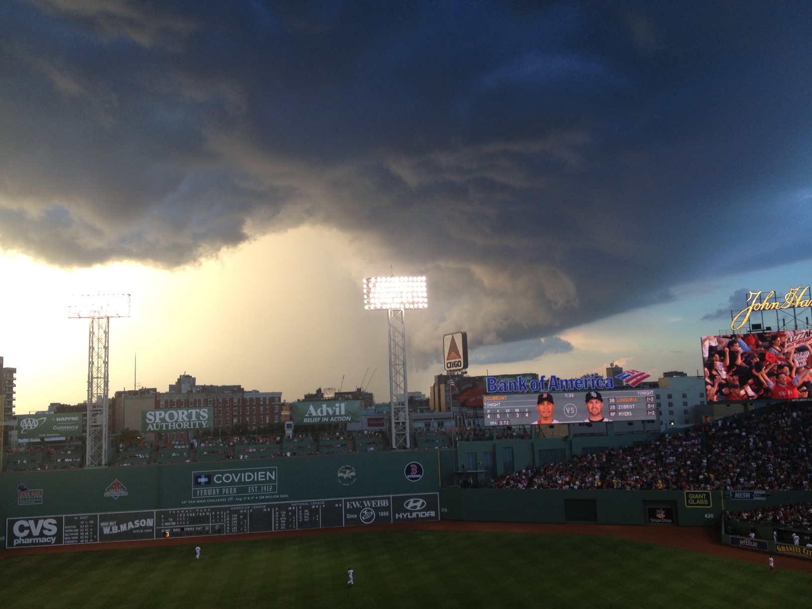 It was a truly fascinating afternoon and evening as scattered showers and thunderstorms became a bit more widespread than I had anticipated. The cloud formations, patterns and structures were stunning, very decorative and even scary in places. The WBZ Weather Team thanks everyone for taking the time to send in their great photos. One such shot was taken by Randy Smolik who was attending the Red Sox Game. His picture is somewhat alarming at first glance for many people since it has the appearance of a large tornado. Several other photos that we received also revealed tornadic-looking formations but there was very little support for any funnel clouds. There were, however, shelf clouds contained in a few of the thunderstorms. Some areas got drenched in more than an inch of rain in less than 30 minutes while a few locations also had wind gusts of 50 mph which produced mainly some tree damage. All of that action was triggered by an approaching cold front which has shifted offshore and introduced refreshing air from the Great Lakes and the Midwest.
These last two days of July will be, imo, some of the best summer weather of the entire season. It will warm up to 81-84 both days except along the coast tomorrow when a sea breeze will keep it a bit cooler in the upper 70s at the beaches. Sunshine will be prevalent but there will be some patches of small puffy clouds arriving from midday through the afternoon. The most clouds will be seen over the mountains of western and northern New England where a few spotty showers are possible. The wind will be mainly blowing from the northwest to west at 10-15 mph today. Open up the windows and let the fresh breeze scour out the stale, damp air of the past few days. With the low humidity in place, it will be very comfortable for sleeping tonight as temperatures dip into the range of 55-60 in suburbia with 61-66 more common in the larger urban centers.
The humidity will ramp up again on Thursday as cloudiness increases. An approaching frontal boundary will kick off a swath of showers and storms but it looks like the arrival time in eastern New England will not occur until late in the afternoon or early evening. Some of the rain Thursday night could be heavy with lightning and thunder. Before the boundary passes, another round of showers and storms could fire up Friday afternoon with less humid air returning amidst a brisk breeze on Saturday. Several impulses in the upper level wind field will ripple through from the weekend through much of next week. For the most part, the temperatures will be close to or slightly below the average for early August. One of the impulses, however, might deepen a bit to force a brief warmup with some higher humidity and a higher risk of a spell of showers and storms. The bottom line is that there are NO heat waves foreseen through the first half of August. Despite the chance of a stray day or two over 90 in the next 6 weeks, in conclusion, I can state with some confidence that we have survived the hottest part of summer 2013.
Joe Joyce will post his blog early this evening and I shall return early tomorrow morning.
Make it a great day!