Still Sticky After All These Days
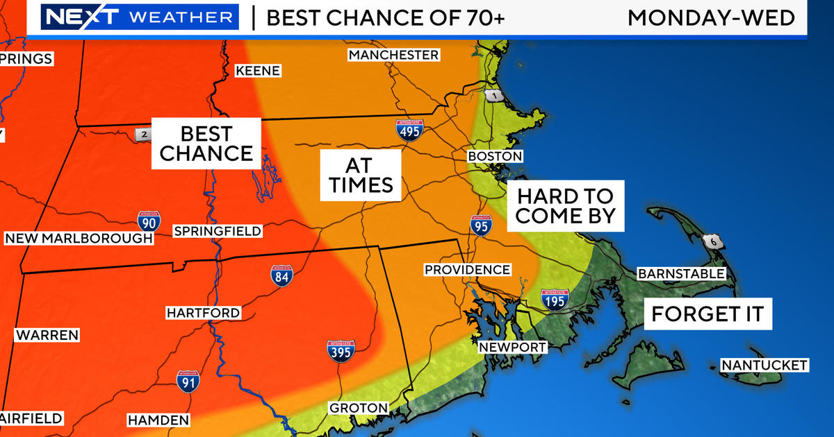
It's still sticky after all these days reminds me of one of my favorite and classic Paul Simon hits that I used in a bump shot teasing my final weathercast at Portland, Maine's NewsCenter6 in February 1978. Just after that on March 1, I commenced my career here at WBZ! And, no, it hasn't been sticky all of those days but there certainly have been a lot of crazy weather days over all those years. Anyway, as Boston's temperature reached 90 degrees at 12:20 yesterday afternoon, the city's first official heat wave of the season materialized following the 91 degrees on Sunday and the 95 degrees on Monday. It peaked at 92 degrees at 3:24 pm yesterday. While the thermostat is lowered in the next few days, it could still nudge 90 in some locations by late this morning over portions of southern New England mainly near and south of the MA Pike before building clouds lead to the development of showers and storms. An upper level disturbance will be firing some storms as the morning unfolds across northern areas so you should keep an eye on the changeable sky not only today but also for the next several days. The Storm Prediction Center has much of the region in a slight risk for severe thunderstorms today.
The scenario remains essentially unchanged from the details that I described on my blog 24 hours ago. The weather pattern is going to evolve into a deepening trough of low pressure over the Eastern States. Consequently, a very moist conduit will set up over the eastern seaboard from the eastern Gulf of Mexico northeastward into New England and Quebec. Along this route, there will be episodes of showers and thunderstorms capable of releasing tropical drenching downpours that will produce flash flooding in some areas. The soaking swath is projected along and just east of the Appalachian chain so that means mainly the region of New England west and north of the Worcester Hills. In much of this zone, lifting of the soggy air mass up over the higher elevations will enhance the rainfall leading to possible amounts of 4-8" over the next several days taking us well into next week. This certainly presents concerns to those that will be traveling, hiking, climbing and camping in these vulnerable places. You may be suddenly forced to seek higher ground quickly next week. Rather than a washout of continuous rain, I am expecting installments of rain which are very difficult to time in advance. While much of the activity tends to spike during the late afternoons to early evenings, any small perturbations in the flow can initiate showers and thunderstorms any other time of the day or night. One such short wave should crank out a spell of heavy showers and boomers later tomorrow night into early Friday. After its exit, a spell of sunnier weather may make Friday decent with a low risk of an afternoon storm and higher temperatures back into the middle 80s.
Meantime, I'll be watching a parcel of cooler and drier air over northern ME because it may be drawn southward via a backdoor cold front as a storm system blossoms a bit in NY tomorrow. The surface wind will switch into the east and freshen a bit so more low cloudiness and clammy conditions are probable. As a result, I will lower tomorrow's anticipated highs back into the middle to upper 70s. Over the weekend, lower to possibly middle 80s are possible assuming the sunshine occurs from time to time. Overall, the big 4th of July vacation week will be unsettled but a trend to less shower activity is a hope near and after the 4th if the big Bermuda high pressure heat pumper becomes more elongated on an east-west axis to our south. This would shift the steering currents to more westerly aloft thereby cutting off the moisture supply from the southeastern states. That is our one source of optimism for somewhat better weather on the 4th. We shall see.
Of interest is the weather over "The Last Frontier" which continues to be astonishingly hot. You can still call it "Baked Alaska" as interior portions of that state continue to broil. Fairbanks, which is famous for its frequent winter arctic blasts to 40 below zero, will be a whopping 93 degrees this afternoon. Yesterday morning, it had its highest overnight low temperature in 98 years! OMG!
Todd Gutner pots his blog early this evening and I shall return early tomorrow morning.
Make it a great day!


