Another Round Of Rain
Another spell of soggy weather is on the way but it will definitely not match the magnitude of last Friday's storm when most areas received 2.5 to 5". On Tuesday and early yesterday morning, it appeared that 2 to 4 " of rain could materialize from this upcoming storm. However, upon digesting fresh data later yesterday morning, it appeared that a perfect phasing of two pieces of atmospheric energy was not going to happen and that would warrant downgrading the storm. Consequently, I scrambled to revise previous thinking as I accelerated and downgraded this system and I am still sticking with that scenario this morning.
The storm will not be a miss. It will just be less potent and less productive than previously thought. Nevertheless, despite the sunshine greeting us earlier this morning, the first drops of rain will occur by noon many areas and it will become soaking wet as the afternoon progresses and the rain will be moderate to heavy later in the day and tonight before dwindling to drizzle during the am commute tomorrow. The rain will be advancing into southwestern New England this morning and that is the area that will receive the most rain in the amounts of 1.5 to 2". First the sprinkles then the steadier and heavier rain will proceed east-northeastward into eastern MA where I am predicting that 1 to 1.5" will fall by daybreak tomorrow. That would boost Boston's June rainfall closer to or just under 8" which would hoist this June from 13th wettest to 6th or 7th wettest with 16 days remaining! I am expecting that it will pretty much be a done deal by or just after daybreak tomorrow although lighter rain dwindling to drizzle or fine mist could linger a couple hours or so beyond that tomorrow morning. There will be sufficient drying in the afternoon to enable breaking clouds and some sunny spells especially north and west of Boston tomorrow afternoon. The wind will not be ferocious but a ramp up to 20-40 mph is plausible certainly on Cape Cod and probably over Plymouth County with 15-30 mph northeast to northerly winds along the coast up though Boston with less wind north and west. The wind will gradually decrease tomorrow morning and be much lighter tomorrow afternoon. Today's wind will be light at 5-15 mph from the south to southeast. Temperatures will rise to 67-70 over eastern MA before the sunshine dims out this morning and then they will retreat a solid half dozen degrees during the afternoon to fall to the middle 50s early to mid-evening when it should be really pouring at times. No excessive or torrential rain is anticipated and no severe weather is foreseen but I will not rule out some lightning and thunder especially over southwestern New England. Due to lower high tides this weekend between the phases of New Moon and Full Moon, I am expecting nothing more than a few pockets of minor coastal flooding a hour or so either side of the high tide around 3:30 tomorrow morning.
After sponsoring nasty damaging boomers and isolated twisters over the Midwest and Ohio Valley late yesterday and last night, the storm center will cross northern PA to northern NJ today then south of Long Island early tonight to south of Nantucket by 8am tomorrow. The envelope of rain will shift offshore tomorrow morning followed by a batch of pop-up showers over northwestern New England later tomorrow afternoon. Most of these will weaken and fizzle as they head southeastward toward the Boston area late in the day. As it brightens tomorrow afternoon, it could warm up to the upper 60s or so with a light breeze in the afternoon.
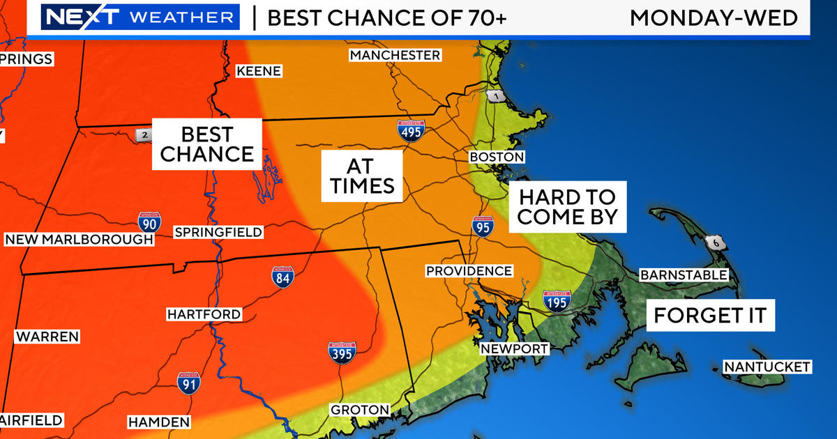
Looking ahead, high pressure building across the Great Lakes toward the Mid-Atlantic Region will provide nice dry air and pleasant temperatures in the upper 70s to lower 80s Saturday and Sunday with overnight lows mostly in the middle 40s to middle 50s except 55-60 in Boston. There will be a brisk northwest to westerly wind on Saturday with less wind from the southwest to south on Sunday. The next frontal boundaries will be on the approach but current timing doesn't introduce the spotty showers until later Sunday night into Monday. Hopefully, that feature will not speed up to spoil the late afternoon or evening of Father's Day! Overall, it should be a great weekend for all the dads out there with ideal conditions for outside activities such as golf, tennis, running, walking, biking, hiking, climbing, etc. There will be patches of clouds over the mountains with most of the showers holding off until Sunday evening. After some showers on Monday, Tuesday may stay mainly dry followed by more showers and possible boomers on Wednesday.
Todd Gutner will post his blog early this evening and I shall return early tomorrow morning.
Make it a great day!


