Temporary Drying
June 2013 is the 13th wettest on record so far. With the potential rain late Thursday and Friday, it may jump into 5th or possibly 4th place with 16 days remaining after that! Yesterday's two rounds of rain brought Boston's monthly total to 6.60". June 1982 was the wettest with 13.20" and the most recent really wet June was the 10.09" in 2006 which was the 3rd wettest June. Many people are wondering when this weather pattern will break down because summer vacation time is here for many of us and most want more typical warm and sunny weather to enjoy. I am not expecting this setup to last forever so don't despair. Don't worry, be happy. There will be plenty of good times ahead in the next couple of months. While there is more rain in the short- range forecast, I doubt that this high frequency of rain events will be repetitive in July. I do not anticipate a copy of July 2009 when 18 days contained some rain and thunderstorms. That July was the 6th wettest on record with about double the average amount of rain plus it was cool with the mean temperature 3.4 degrees below average.
Today, we're placed in the western flank of the departing storm in the Maritimes. Its circulation will continue to spin spokes of moisture cyclonically into the region. At the same time, drier air will become entrained on this western fringe so that means the sky will be changeable and patchwork leading to a risk of just a few spritzes or sprinkles or a few isolated brief heavier showers. At times, there will be ample coverage of blue sky and resultant spells of sunshine until more clouds rotate through to blot out the sun at other intervals. The wind will become busy and blow in the range of 15-30 mph from the northwest. As a ridge of high pressure builds into the region this evening, the wind will abate and the sky will be clear for a few hours until a few patches of high clouds arrive from the next weather maker tomorrow morning. After high temperatures near or slightly over 70 today, it will cool off to the lower to middle 50s tonight.
The center of a wave of low pressure emanating from the Iowa this morning will slice across northern IL today into northern Indiana tonight then to PA tomorrow, across NJ tomorrow night and south of Long Island by tomorrow night then offshore of Nantucket by Friday morning. The dynamics are present to produce a widespread outbreak of severe weather today from IA to WV. Severe thunderstorms and scattered tornadoes are likely in the steamy air which exists south of the frontal boundary draped across the area from Des Moines to just south of Chicago to north of Cincinnati. This system has the characteristics of a strong winter-like storm except, of course, the temperatures are much higher. It will crank out a blossoming plume of heavy rain that will drench the Northeast making this the wettest June ever in many locations of PA into NY. A release of 1 to 2" of rain in our region will cause renewed street and stream flooding. Additionally, some of the swollen rivers could overflow their banks in southern New England. At 10:47 am today, the National Weather Service issued a new FLOOD WATCH for tomorrow through Saturday morning but I am digesting new data that is introducing the rain much sooner tomorrow. It also departs by dawn on Friday.
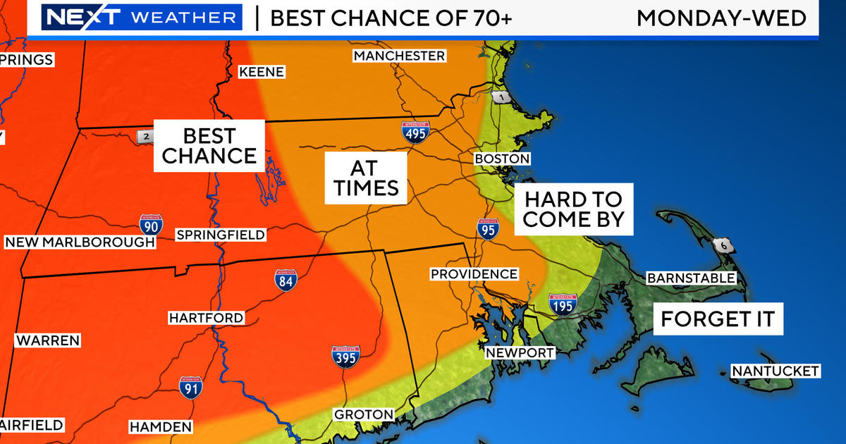
So looking ahead, I am revising the forecast to reflect the idea that the storm may accelerate so the rain could race in several hours earlier tomorrow and also exit many hours earlier on Friday. This scenario is not etched in stone just yet but more indicators are pointing in this direction. Consequently, it may turn partly sunny with a shower possible late in the day with highs in the lower 70s on Friday. Then high pressure should build in to create a splendid Saturday with plentiful sunshine and a few clouds with a busy northwesterly wind and highs in the upper 70s. Father's Day will be sunny to partly cloudy and pleasant with less wind and a rise to near 80 degrees after starting out in the lower to middle 50s first thing in the morning. It should be a superb day for outside activities like golf, tennis, running, walking and biking. If you are going to the northern mountains for hiking or climbing, there will be additional cloudiness with just a risk of an afternoon shower. Presently, it appears that the next shower threat holds off until Sunday night or Monday morning. Hopefully, there will not be any acceleration to warrant any earlier arrival. The next trough of low pressure and frontal boundaries could release another slug of an inch or more of rain Monday night onto Tuesday. After that, several days of nice summery weather may be on the menu.
Todd Gutner post his blog by early this evening ad I shall return early tomorrow morning.
Make it a great day!


