Warmup On The Way
The cool weather of the past couple of days climaxed early this morning with temperatures plunging close to the freezing point. It was definitely colder than yesterday morning as the ridge of high pressure was poised over the region resulting in a clear sky and calm conditions which is key for premium radiational cooling. In the lowlands and valley areas, the mins were in the upper 20s to lower 30s yielding a moderate frost in places while other suburban areas had just a brief touch of frost. Thanks to the WBZ WeatherBug Network and some of our regular observers, here are some morning temperatures at or below freezing: Fiskdale 28, Pepperell 29, Townsend 29, Marlborough, NH 29, Sterling 30, Westford 31, Norwood 31, Whitman 31, Medfield 31, Pembroke 31, Salem, NH 32, Concord 32, Southborough 32 and Kingston 32.
There will be a nice warmup to the range of 65-70 today as bright morning sunshine gives way to varying amounts of clouds from near noon through the evening. As the ridge shifts offshore and frontal boundaries approach, the southerly wind will increase to 15-30 mph. That will check south-facing coastal areas to 60-63 while all other areas farther away from the ocean will range up to the upper 60s to perhaps slightly over 70. A batch of scattered showers and a few thunderstorms in western NY and western PA at 7am will be transiting eastward to be entering our area later this afternoon into the evening. As the warm front pokes into the region, the first patch of showers will occur and the cold front soon after will spawn a few more showers and boomers. Some places will escape the rain completely while a few other spots will get a brief downpour. It will be a warm first half of the night with 60-65 and a brisk wind. After that, the wind decreases and the temperature falls to 50-55 by dawn.
Tomorrow will be the pick day of the week with bright sunshine and temperatures topping out in the upper 70s to slightly past 80 degrees. The only problem will be the gusty westerly wind at 15-30 mph which will be blowing around a good deal of tree pollen. The oak pollen is becoming more of an acute allergen for many people. The next cold front will be closing in on the northern mountains tomorrow evening triggering a few showers and boomers up there. That front will press southward through southern New England during tomorrow night without much fanfare as all the showers dry up. Cooler ir will advect into the area from the north so Friday will be sunny to partly cloudy with temperatures about 10 degrees lower at about 70 for a max in the afternoon. There will be less wind on Friday. Yet another weak cold front will enter the area from the north on Saturday afternoon. It will be carrying patchy clouds and just a slight risk of a brief shower in a few spots. High pressure will be building in from the Canadian Maritimes over the weekend so that means there will be a cooling and more penetrating sea breeze restricting highs to the upper 50s to near 60 or so along the coast while deeper inland, it will warm up to 65-70.
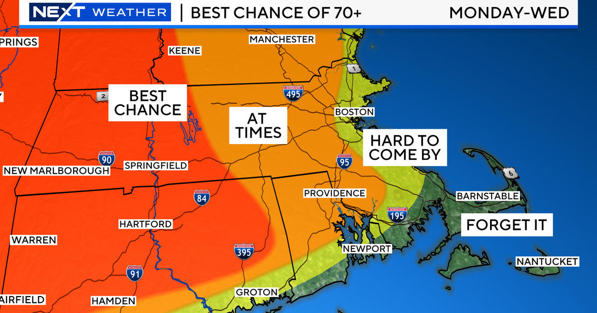
Looking ahead, that high pressure will be building southward and strengthening south of the region over the western Atlantic. Its anticyclonic or clockwise circulation will escort much warmer and more humid air into the Northeast Tuesday and perhaps Wednesday as well. If much of the cloudiness, showers and boomers associated with a cold frontal boundary remains to the north of the Boston area, the stage would be set for highs of 84-88 on those two days. Beyond that, the frontal boundary is destined to settle south of us setting up an unsettled stretch of periodic showers and mist and a northeasterly wind driving in chilly air from the ocean the second half of next week. This long range portion of the forecast is purely speculative at this time.
Dramatic weather changes have been taking place especially over the northern Plains and northern Mississippi Valley States lately. For instance, one of my fav towns, Blooming Prairie, MN, received 18" of snow on May 3 and sweltered through a high of 97 degrees yesterday! Parts of NE into IA sizzled in temperatures above 100. Sioux City, IA had a record low of 29 degrees Sunday morning then had the highest temperature ever recorded in the month of May at 106 degrees! How crazy is that? I pray that we never heat of that intensity here this summer or any summer!
Todd Gutner posts his blog early this evening and I shall return early tomorrow morning.
Make it a great day!


